Welcome to Bow Summit! At an elevation of 2,070 metres (6,790 feet) above sea level, it is the highest driveable pass in the national parks of the Canadian Rockies! This virtual cache will take you to a fantastic viewpoint overlooking Peyto Lake, one of the most picturesque glacier-fed lakes in Banff National Park. Owing to the high elevation, this cache location makes it the perfect location to study an interesting phenomenon known as treeline. To begin your adventure, park at the Bow Summit parking lot; there are public washrooms and garbage cans located there for your use.
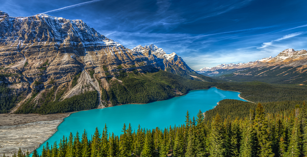
Peyto Lake from the Virtual Cache Site:
From the parking area, hike up the forested trail to the main Peyto Lake viewpoint. Continue past this viewpoint and find another trail heading southwest at a trail junction at N 51 42.963 W 116 30.424. This trail leads you directly to the virtual cache site. For individuals with reduced mobility, the trail is also accessible for drop-off via the upper parking lot.
SPECIAL NOTES:
- You will not have to leave the trail to claim a find on this virtual geocache.
- Warning: you are now in bear country. Make noise, hike in groups, carry bear spray and know how to use it, respect closures and restricted areas.
- Please pay appropriate park entry fees.
What is Treeline?
Treeline is the height on a mountain where trees can no longer grow. In the Canadian Rockies, treeline is typically at about 2,200-2,300 metres above sea level. Above the treeline is an area called the alpine zone. Up there, most trees cannot grow, survive and reproduce because of the cold temperatures, the extreme winds, and the amount of snow. The treeline elevation can also be affected by steep cliffs, glaciers, rocks, windy or shady locations and avalanche paths.
The alpine zone is a harsh environment, but some species love it up there. For example, the Whitebark pine, an endangered species, thrives at high elevations at or near treeline. Many animals such as the pika also call the alpine home! Due to its very fragile nature, human impact in alpine environments cannot be understated. It is important that visitors stay on the trail to reduce the stress on the local plants and animals. Thank you for your cooperation!
Questions
(please send answers to the cache owner via message or email)
1) What is the GC code of this virtual geocache?
2) Using your GPS, estimate the elevation at the posted coordinates. Based on your elevation reading, your observations of your surroundings and the information present on this cache page, do you think your current elevation is within 200 metres of the treeline elevation at Bow Summit?
3) Look around you: What single natural factor do you think is most responsible for the openings and reductions in treeline around Peyto Lake?
4) As proof of your visit to this virtual cache site, post a photo of yourself at the posted coordinates. NOTE: Your photo MUST be taken from the posted coordinates or your log will be deleted. Logging this cache from the lower boardwalk viewpoint is not acceptable.
Note: This virtual geocache was reviewed, edited and approved by Parks Canada.
Virtual Rewards 3.0 - 2022-2023
This Virtual Cache is part of a limited release of Virtuals created between March 1, 2022 and March 1, 2023. Only 4,000 cache owners were given the opportunity to hide a Virtual Cache. Learn more about Virtual Rewards 3.0 on the Geocaching Blog.