Te Kopahou
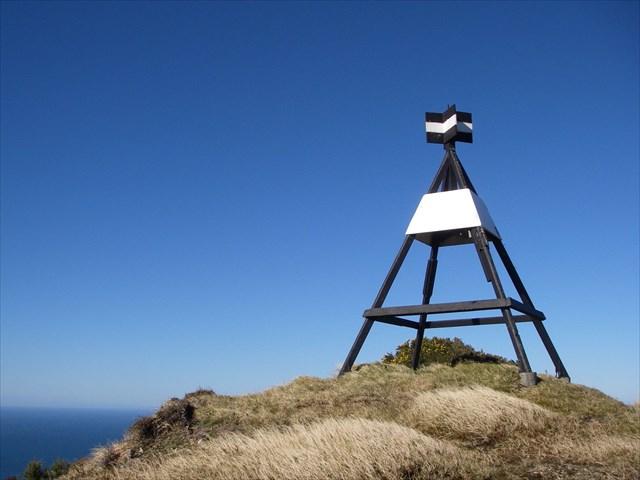
Te Kopahou, translated as “a bent or folded feather”, is the second tallest peak of Wellington’s southern hills standing at 485m high, and also the name of the ridge beginning at Highbury forming the eastern side of the Karori Wildlife Sanctuary, continuing south between the Silver Stream tributary of Karori Stream and the headwaters of Owhiro Stream, reaching Cook Strait at Sinclair Head. Te Kopahou was also a pa site of Ngati-Rangi and Ngati-Hikerata, which was burned down by Te Rauparaha circa 1850. Today it houses a 4 metre wooden trig with the geodetic code 1202, the same shape and dimensions as the one that sits atop Belmont – which you will soon be able to identify as you draw near to it.
Te Kopahou is only a 2 kilometre walk from Hawkins Hill, across a rolling gravel road along a ridge. The minimal to flat gradient makes progress quick, and it may only take you 30 minutes to reach by walking – or even quicker if you choose to bike the distance. It’s a short, easy climb to the trig site – which offers stunning views of all around Wellington, the Cook Strait & the South Island; and including but not limited to the southernmost section of the West Wind wind farm, the Karori Light, and Cape Palliser.
The trig site itself is sparse, covered in only grass with a few low lying plants sheltering in various places– a testament to the ferocious winds which can lash these hills with gusts exceeding 150km/h. The most common types of fauna now found in this region include a mosaic of coastal scrub, flax and tussock land, and scree. Dense shrub, including taupata, stunted karaka and manuka would have once dominated this area, but intensive farming, fire, quarrying and pests have destabilized the hills and many cliff faces.
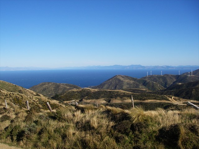 |
| Looking southwest from Te Kopahou, one can see the South Island, the southern edge of the West Wind wind farm, and Karori Light. |
Cache Details & Access Information
Once you’re standing at the trig, it’s only a short ~20m distance to the site of the cache south of the trig, which is a black 400mL Sistema containing a logbook, logbag, geocaching notice & pencil. Please be sure to rehide it exactly as you found it – and take note that the cache is NOT in or near gorse!
The easiest method to access this cache as a single entity is to park at the Brooklyn Wind Turbine, and walk/bike the 4.5 kilometre journey past Hawkins Hill – this makes for a quick and easy trip with fantastic views. The alternative is to complete…
 |
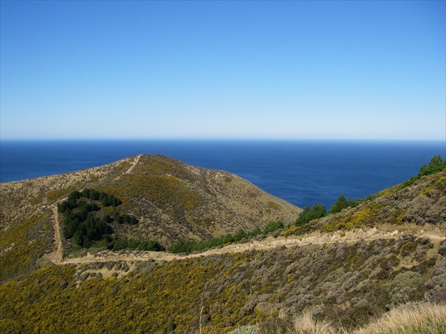 |
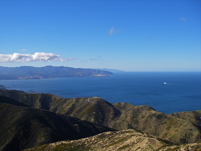
| Left: Looking ESE, towards Baring Head, Turakirae Head & Cape Palliser - and the Bluebridge ferry approaching Wellington. Right: Looking south of Te Kopahou down the Bunker Track - over the hill lies the Sinclair Head Observation Post. |
The Te Kopahou Loop
The Te Kopahou Loop is a demanding and strenuous half-day 17.7 kilometre loop which takes you to some spectacular sights and locations in Wellington – from peaks to the shore, and right around the edge of Te Kopahou Reserve. It reaches a maximum elevation of 495 metres, and drops right down to coast, with over 1080 metres of ascent and descent each. It reaches a maximum gradient of 55.6%, steeper than the final climb/initial drop on the West Wind Opau Loop track. We completed this track in 6 hours 31 minutes, including stops for photos cache placing, cache finding & lunch. If you intend to attempt the loop, allow for at least 6 hours worth of walking/biking. This figure is highly dependent on whether you choose to walk or bike to Hawkins Hill from the turbine or Aston Fitchett Drive. We’ve chosen what we think is a good method below:
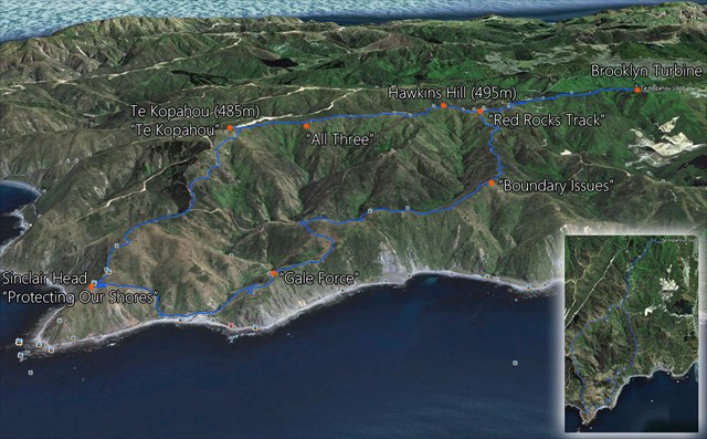
It all starts at the Brooklyn Wind Turbine – where you bike for 10 minutes along the 2.6 kilometre sealed Hawkins Hill access road until you reach the beginning of the Red Rocks Track just before the radome and past the mysterious castle house. At this point you can leave and lock the bikes (you’ll see why later), walk up to the radome, grab the Hawkins Hill cache, and progress onwards as the sealed road turns into a 2 kilometre flat dirt road known as the ‘Te Kopahou Track’ towards Te Kopahou trig, 10 metres lower in elevation in relation to Hawkins Hill. Roughly two thirds of your way along, you can the grab “All Three”, before continuing on to snag this cache also.
From Te Kopahou Trig – you start walking on what is called the ‘Bunker Track’ towards three WWII observation bunkers perched 170 metres above sea level on Sinclair Head. The track condition changes dramatically for the worse, and takes a nosedive with an average gradient of 30%, approaching 50% at times – down to an elevation of 220 metres before ascending slightly, and then again plummeting down to 140 metres with a gradient exceeding 55% - the steepest point of the trip. Remember to pick up “Protecting Our Shores” while you’re there!
Getting down off Sinclair Head to the shore is a bit of a mess – using a poorly marked route called ‘Ribs Exit’, and is probably not suited to mountain bikers, as you are walking through a small stream, mud, brushing past shrub at an angle of attack of up to 50%. From here, you can wander across the Red Rocks coastline to the coastal beginning of the Red Rocks Track, which will take you back up to your bikes. Along the way, you can pick up “Gale Force” on the ridgeline closer to the coast, and then “Boundary Issues”, and once you’re back at the bikes, you can snatch “Red Rocks Track”, if you haven’t already done so.

Be sure to bring your camera with you as there are some spectacular views, some warm/windproof clothing, as it can get quite gusty up there, along with some food and drink. There should be cellphone reception along pretty much all the ridges, although you may lose it as you descend into valleys and possibly on the coastline. Enjoy!
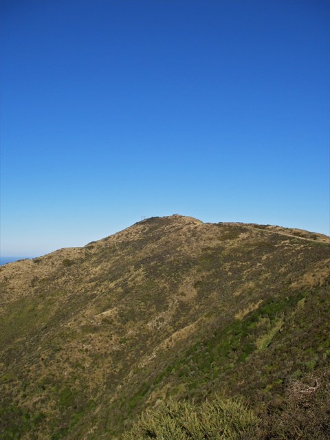 |
| Te Kopahou Trig from a distance... |