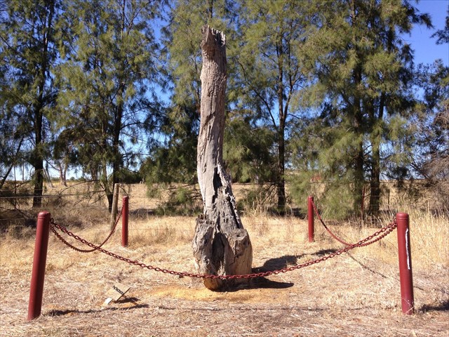
The coordinates will have you standing opposite a dead tree with some bollards and a plaque.
Jacks Road Survey Marker
That particular plaque was put in place by the Rutherglen Historical Society in conjunction with the Indigo Shire Council. This all came about because when the Natural Gas line was brought through in 1997. The Gas & Fuel workers dug out and almost destroyed the original survey marker! Whooops! (the tree) which was used to survey the town & district, so they were made to re-position the old tree and put a small fence around it then the plaque was installed. You can see the concrete they used around the base of the tree.
Survey markers were generally carved into trees as that was considered to be fairly permanent. Although often over looked and considered boring to most people we look at them as a living heritage ( in this case not living) a remaining legacies of our pioneering and settlement history.
There are thousands of such markers around Australia and where possible we will continue the series to keep this information alive.
Please cover the hide up