Located in the Beaver Dam Lake area along route 350 in the
K-3 parking lot.
This is a special earth cache dedicated to my friend Blue Gill
Fisherman(BGF). He likes earth caches like this. Thank you BGF for
being a good friend.
The Little Stayner Sandy Boils is a artesian spring located on
the bank of the Stayner Lake.
I discovered this EC with my brother Joranda when we was
visiting the Mid West Geobash.
The water appears to be boiling with the constant upwards
pressure of water coming from underneath. The sand adds more to the
visual effect of the water pressure.
This entire area is the remains of a glacial period from
thousands of years ago. The lake in front of the springs was
created by a large glacial ice block, known as a kettle.
The Little Stayner Sandy Boils Artesian Spring water is forced
upward under pressure. The water in an artesian spring flows from
an aquifer, which is a layer of very porous rock or sediment,
usually sandstone, capable of holding and transmitting large
quantities of water. The geologic conditions necessary for an
artesian spring are an inclined aquifer sandwiched between
impervious rock layers above and below that trap water in it. Water
enters the exposed edge of the aquifer at a high elevation and
percolates downward through interconnected pore spaces. The water
held in these spaces is under pressure because of the weight of
water in the portion of the aquifer above
If a well was to be drilled from the land surface through the
overlying impervious layer into the aquifer, this pressure will
cause the water to rise in the well. In areas where the slope of
the aquifer is great enough, pressure will drive the water above
ground level in a spectacular, permanent fountain. Artesian springs
can occur in similar fashion where faults or cracks in the
overlying impervious layer allow water to flow upward. Water from
an artesian well or spring is usually cold and free of organic
contaminants, making it desirable for drinking, however I do not
suggest drinking water from this spring.
This open body of water was caused by a discharge of water from
a fissure in the bedrock that had sufficient force to blow away the
overlying soil and sediment. It now maintains a conical basin
filled by the springs below.

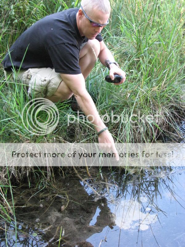
To get credit for this EC, post a photo of you with GPS and the
Sandy Boils Artesian Spring just like in the picture and answer the
following questions.
1. How many biols of sand do you see moving under the water?
2. How big is the area of the boils?
3.Estimate how wide the lake is that the spring is flowing
into.

| Cav Scout has earned GSA's highest
level |
 |
DO NOT LOG AS A FIND UNTIL YOU HAVE A PICTURE READY TO POST AT
THE TIME OF LOGGING A FIND FOR THIS EC! Logs with no photo of the
actual cacher logging the find or failure to answer questions will
result in a log deletion. Exceptions will be considered if you
contact me first (I realize sometimes we forget our cameras or the
batteries die). Logs with no photos will be deleted in seven days
of posting.
I have used sources available to me by using google search to
get information for this earth cache. I am by no means a geologist.
I use books, internet, and asking questions about geology just like
99.9 percent of the geocachers who create these great Earth Caches.
I enjoy Earth Caches and want people to get out and see what I see
everytime I go and explore this great place we live in.