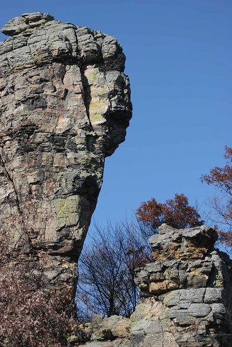
Castellated Mounds
The term "mound" in Wisconsin refers to any isolated hill. Some,
like Necedah Mound or Hamilton Mound, are monadnocks of Precambrian
rock. Others, like Blue Mounds or the Platte Mounds, are capped by
Silurian outliers. But the term is most commonly applied to the
castellated mounds, isolated hills of Cambrian sandstone rising
steeply above the central lowlands, and occasionally capped by
Ordovician dolomite. Usually, they simply consist of sandstone, and
are often steep-sided pinnacles. They are far too delicate to have
survived glaciation, and many owe their steepness to wave erosion
by Glacial Lake Wisconsin. They are ephemeral features and will be
gone in a few tens to hundreds of thousands of years.
It's interesting to note that nowadays we tend to think of
Wisconsin as an eastern state, or at least midwestern, and don't
call these features mesas or buttes, because those are Western
landforms. We would not think twice about calling them mesas and
buttes if they were in Wyoming. Lawrence Martin, the author of The
Physical Geology of Wisconsin, unhesitatingly refers to them as
mesas and buttes, and regards them as "the very frontier of the
true West." (P. 317) *
In order to log this Earthcache, please provide the following
information:
Upload a photo of you at the site.
Email us and tell us approximately how long the contiguous outcrop
of sandstone is.