Devil's Gate EarthCache
-
Difficulty:
-

-
Terrain:
-

Size:  (not chosen)
Please note Use of geocaching.com services is subject to the terms and conditions
in our disclaimer.
A place of my childhood, and also a great summer job in while I was in college, it's one of the best state parks in WI.
Cache is located on the Doughboys' Trail in Copper Falls State Park northeast of Mellen, WI.

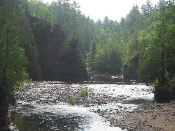
Shifts in the earth’s crust result in cracks or fractures called faults. Faults are natural lines of weakness which increase the down-cutting power of rivers. The gorge at Copper Falls State Park was formed as the Bad River flows along one of these faults. The rocks you see at Copper Falls were thrust upward to their present upright position after being formed in layer-cake fashion.
The formation of Devil’s Gate formed as the Bad River eroded through this band of coarsely textured conglomerate rock. On both sides of the river, you can also see vertical bands of shale and sandstone. The conglomerate rock formed after lava flows stopped and streams laden with rocks and sediment poured of the layers of basalt. Just like the basalt, conglomerate was initially deposited in layer-cake layers which were then tilted by tremendous pressure from within the earth to their present upright position.
In order to log this cache as a find, you MUST email me the following two measurement estimations and answer the question:
1. The distance in feet across the opening at the BASE of Devil's Gate (where the water can flow).
2. Height in feet from river level to the top of Devil's Gate.
3. Name the three types of rock listed on the sign at the bridge.
Please remember to remain only on maintained trails, and that inside the gorge is a closed area. This cache can been be completed from the bridge.
Additional Hints
(No hints available.)