Marchmündung Traditional Cache
-
Difficulty:
-

-
Terrain:
-

Size:  (large)
Please note Use of geocaching.com services is subject to the terms and conditions
in our disclaimer.
 |
Marchmündung
Die March (tschechisch und slowakisch Morava) ist ein Nebenfluss der Donau. Sie ist der Hauptfluss Mährens, das nach ihr benannt ist, und von dem sie etwa drei Viertel entwässert. Die wichtigsten Nebenflüsse sind links die Betschwa (Becva) und rechts die Thaya (Dyje).
In ihrem Unterlauf ist die March der Grenzfluss zwischen Tschechien und der Slowakei (50 km) bzw. zwischen Österreich und der Slowakei (91 km). In Luftlinie sind diese Strecken wegen der vielen Mäander des Flusses nur 37 bzw. 50 km.
Die March entspringt im Nordwesten Mährens im Glatzer Schneegebirge (Kralicky Sneznik), an der Grenze Polens zu Tschechien auf einer Seehöhe von 380 m. Nach 354 Kilometern mündet sie an der Thebener Pforte bei Hainburg an der Donau und Theben (Devin) in die Donau.
Der Cache
Der Cache liegt bei der Mündung der March in die Donau, im Auwald. Ein höherer Wasserstand sollte dem Cache zwar nicht schaden, allerdings ist er nicht ganzjährlich zugänglich (wasserstandbedingt), deshalb ist die Geländeschwierigkeit auf 3 eingesetzt.
Der Cache ist eine Lock-and-Lock Dose.
|
Bitte den Cachebehälter gut schließen, und auf die selbe Stelle zurücklegen!
|

Estuary of the Morava River
The Morava is a tributary of the Danube. It is the major river of Moravia, which derives its name therefrom. Morava drains almost three quarters of the Moravian region. Its major tributaries are the Becva on the left and the Thaya on the right.
The lower part of the river's course forms the border between the Czech Republic and Slovakia (50 km) and then between Austria and Slovakia (91 km). Because of the many meanders of the river, the linear distance is just 37 km and 50 km respectively.
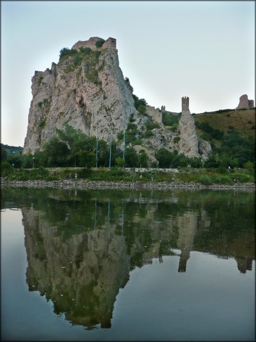
The Morava originates on the Kralicky Sneznik mountain in the northwestern corner of Moravia, near the border between the Czech Republic and Poland at a height of 1 380 meters above sea level. After approximately 354 km, the Morava flows into the Danube under the Devin Gate near Hainburg an der Donau and Devin.
Cache
The cache lies near Morava's estuary, in the alluvial forest. Higher water level shouldn't harm the cache, but because of this it may not be accessible throughout the year. This is why the terrain rating is 3.
The cache is a Lock-and-Lock box.
|
Please close the box well and put it on the same place!
|
|
Additional Hints
(Decrypt)
gbgre Onhz / RA: qrnq gerr