Kehoe Beach EarthCache
-
Difficulty:
-

-
Terrain:
-

Size:  (other)
Please note Use of geocaching.com services is subject to the terms and conditions
in our disclaimer.
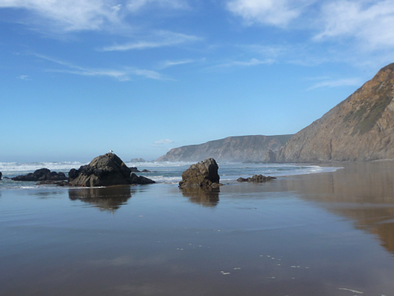
Pierce Point contains many treasures. A day trip will reward you with stunning views, historical sites, and a chance to see Tulle Elk and other wildlife. Kehoe Beach in particular has dramatic cliffs that will show you the forces that have changed our planet. This cache has no physical container, but invites you to learn more about the geology of this special place.
The beach is part of the Salinian Block on the Pacific Plate, the land west of the San Andreas Fault that is moving northward about one to two inches a year. The cliffs along the beach allow you to trace the powerful forces of the earth's movement. Granitic rocks are at the base of the block and are overlaid with Laird Sandstone and the Monterey Formation. Each segment has its unique story to tell.
The coordinates take you to the trailhead. From there, it is about a half-mile walk to the beach. It is one of the few trails in the park where dogs are allowed – please note that once you get to the beach, dogs must stay north of the trail to protect nesting areas.
The Monterey Formation
As you arrive at the beach, look for the light colored shale and steeply dipping cliffs of the Monterey Formation. These rocks underlie the pasture lands and coastal dunes that extend south to Abbots Lagoon. The white color is due to weathering, the fresh rock is black and smells of oil when broken.
The Monterey Formation is primarily made up of diatoms, planktonic organisms composed of silica. This formation provides clues to geological events that began in the Cenozoic Era, about 65 million years ago. At that time, the ocean covered the land. The type of organisms in evidence here suggest that the sediments were formed in very deep water where little oxygen was available to support animal life. Extensive faulting broke up the ocean trenches and the sediments were redeposited in basins. When the ocean subsided (or the land rose) during the middle to late Miocene period, the deposits hardened into the rocks found here. The similarity of these rocks with those found in the Monterey area suggest that Point Reyes was much further south.
The Formation is both the source rock and the reservoir rock for most of the oil in California. Although oil seeps were noted near Bolinas, the offshore areas were thought to have the greatest potential for development. Wells were drilled in the 1960s, but no significant oil was found and the wells were plugged and abandoned. The entire region is now protected and no further drilling will be done.
Laird Sandstone
Kehoe Beach is the best place to see in Point Reyes to see Laird Sandstone, which was formed about 16 million years ago as the oceans rose and fell. Walk north along the beach, note the sandstone's gently dipping layers. Look at how the pattern of the sandstone has changed with the movement of the earth. Do you see an area where the sandstone is offset by a high angle reverse fault?
The Monterey Formation is above the sandstone, and the sandstone in turn rests on granitic rock. Large cracks between the formations suggests geological forces. In addition to the rocks you find here, the area is notable for what you do not see. The older Point Reyes Conglomerate might be expected underneath the sandstone. Unless the rocks were not formed in this area, the uncoformity suggests the conglomerate was eroded away as the land and sea moved.
Sierra Rocks?
Continue to walk north. Laird Standstone gives way to dramatic granitic cliffs. You will also notice granite sea stacks covered with mussels along the beach.
These basement rocks along Kehoe Beach are from the Late Cretaceous age, 80-100 million years old. They are part of the plutonic continental rocks that were formed when magma cooled beneath the surface. There are also fragments of darker rocks and minerals (xenoliths) that are far more ancient, engulfed as the magma erupted around them.
The rocks are similar in composition to the granite in the Sierra Nevada. Some geologists believe that they were an extension of the southern Sierra, separated by the San Andreas fault, and moved north along the Pacific Plate. Others look to the area around Monterey for their origin, perhaps formed under an island or as part of a chain of volcanoes.
The rocks are highly faulted (fractures along which movement occurs). They are cut by prominent white quartz veins and dikes. Note the pattern of the quartz and consider the forces that brought these rocks here.
The fractured nature of the rocks also result in debris chutes that channel falling material to the shore, which are eroded away by high waves.
Logging Requirements
Please email me through my profile rather than use the message center.
Email the owner with the answer to these questions:
- Why do you think the granitic rocks here have a different shape than the granite found in the Sierras?
- Find a quartz vein, mark the coordinates (include them with your answer) and identify the approximate degree of its uplift (if any). What is its approximate length and width?
- Of the three types of rock formations, which is the hardest and which is the softest?
- Photo Requirement: Post a picture of the quartz vein with your log. Under the June 2019 guidelines you need not be in the picture but it should otherwise include your gpsr or a personal item.
Please submit your answers before logging this as a "find." Logs that have not fulfilled the logging requirements will be deleted.
Make sure you leave the area as you found it and take out anything you carry to the beach.
Resources
- Doris Sloan, Geology of the San Fancisco Bay Region, University of California Press, 2006.
- Doris Sloan, Geology of the San Francisco Bay Area, Cal Day Talk, 2007
- Philip W. Stoffer, Geology at Point Reyes National Seashore, National Park Service, 2005
- Richard Cardwell, Geology of the Point Reyes Area, September 2003 NCGS Field Trip.
- Darren Bocksnick, The Anomaly of Point Reyes Geology, American Chronicle, June 22, 2007
- Jim Locke, The Geology of the Point Reyes Peninsula, College of Marin, 1994-2008
- Field Trip Guide to the Geology of the Marin Headlands and Point Reyes National Seashore, Geology of the National Parks, San Francisco State University, 2002
Additional Hints
(No hints available.)