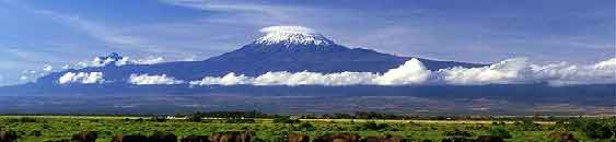
Formation
Mount Kilimanjaro was formed about 3 million years ago during the
formation if the Great Rift Valley. Then nearly a million years ago
volcanic activities centered on a few specific points. Kilimanjaro
is not one single mountain peak but rather three volcanoes lying
practically on top of one another. The lowest summit, Shira, at
12,995 feet last erupted half a million years ago and is now
considered extinct. The other two peaks are dormant and have not
erupted for centuries. Mawenzi, at 16,896 feet is linked to the
highest summit, Kibo, by a broad ridge which gives the summit of
Kilimanjaro a “saddle” shape.
Climate Zones
Because of its height, there are five climate zones to
Kilimanjaro:
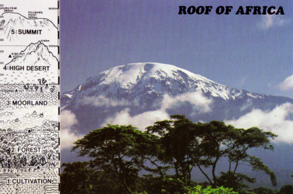
The Lower Slopes/Culitvation - Between 2,600 feet and
5,900 feet, this are experiences tropical conditions. An average of
45 inches of rain falls there each year. The lowlands are now
densely cultivated with coffee and banana plantations.
Rain Forest - The zone between 5,900 and 9,200 feet
receives the highest amount of rainfall, up to 78 inches per year.
The moisture results in a belt of dense rain forest and mist.
Brightly colored butterflies, toucans, and colobus monkeys can be
found here.
Mooreland - The moorland zone is between 9,200 feet and
13,100 feet and is covered with heather and bright flowers. Above
the heath is a black moorland where plants such as lobelias and
groundels grow. Antelopes, vultures and elephants can be found
here.
High Desert - Harsh conditions prevail in the alpine
desert between 13,100 and 16,400 feet. The semi-desert region
receives less than 10 inches of rain annually. Temperatures range
from the mid 80s to below freezing at night. Some plans such as
moss or lichens can survive here.
Arctic Zone/Summit - The summit zone above 16,400 feet is
an icy wasteland, baked by fierce sunshine during the day and
frozen at night. The thin air here contains half as much oxygen as
at sea level. Here is where the glaciers can be found. It has been
widely documented that the glaciers of Kilimanjaro have been
melting due to rising temperatures.
Assignment
1. Take one photo in each of the five zones of the terrain, geology
and rocks that make up that zone.
2. Include a picture of you with a GPS in any one of the five
zones
3. For each rock send me an e-mail describe how you think it was
formed (e.g. glacial movement, volcanic activity, pressure)
Note that the posted coords are for the center of the crater. You
DO NOT need to go there