[CZ] Bystricka / Bystrice je pravostrannym pritokem Vsetinske Becvy. Prameni na severnim svahu vrchu Beskyd (891 m n. m.) v pohori Vsetinske Vrchy. Proteka obci Valasska Bystrice a pod soutokem s potokem Mala Bystricka a silnicnim mostem u pohostinstvi U Busu se vleva do prehrady Vodni nadrz Bystricka. Pod prehradni nadrzi ricka nese jmeno Bystricka (Bystrice), proteka obci Bystricka, kde se vleva do Vsetinske Becvy. Delka toku cini cca 16,5 km. Nejvyznamnejsi pritoky jsou pravostranne potoky Mala Bystricka a Ruzdka. Pramen je v blizkosti cervene znacene turisticke znacky, ktera vede po hrebeni Vsackych vrchu.
Délka toku ~16,5 km
Plocha povodí 64 km²
Prumerný prutok 0,864 m³/s
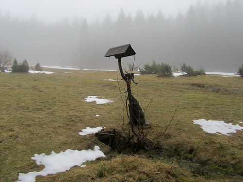
[EN] Bystricka / Bystrice is right tributary of Vsetinska Becva. It rises on the northern slope of the hill Beskyd (891 m) in the mountains Vsetinske Vrchy. It flows through the town Valasska Bystrice. The length of the flow is about 16.5 km. The most important tributaries are the rivers of the right hand Mala Bystricka and Ruzdka. The spring is near the red tourist mark that runs along the ridge Vsacke vrchy.
The length of the flow of ~ 16.5 km
Catchment area 64 km²
The average flow of 0.864 m³ / s
