 Clarkston, Glasgow to Pembrokeshire. UK (2021)
| Trackable Options |
 Found this item? Log in.
 |
 Printable information sheet to attach to Clarkston, Glasgow to Pembrokeshire. UK (2021)
Print Info Sheet
Printable information sheet to attach to Clarkston, Glasgow to Pembrokeshire. UK (2021)
Print Info Sheet |
|
-
Owner:
-
WalksTheSurf
Message this owner
-
Released:
-
Sunday, March 5, 2017
-
Origin:
-
South Wales, United Kingdom
-
Recently Spotted:
-
Unknown Location
This is not collectible.
Use TB4EY2W to reference this item.
First time logging a Trackable? Click here.
1 - To travel the world's geocaches telling tales of the amazing Pembrokeshire coast.
2 - Collect photos of exotic (and mundane) places visited.
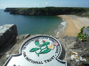
Pembrokeshire is the sort of place that many who visit get stuck and end up living here. The weather is warmer and drier than Glasgow. The days are at least 2 hours longer in winter, but at least 2 hours shorter than in Glasgow in summer. The tidal range is very great; up to 7.5m.
The coast is truly spectacular with over 50 beaches to swim and surf at providing a range of experience from family paddling to powerful surf that is almost too adventurous.
The Pembrokeshire Coast National Park was designated because the Pembrokeshire coast has fine examples of every marine landform to be found in Britain with the exception of those associated with chalk. In addition over 2/3 of the coast is covered by further conservation designations including Sites of Special Scientific Interest, Special Protection Areas, Special Areas of Conservation and a Marine Nature Reserve.
On the historical/cultural side there are over 50 Iron Age Settlement Sites, half a dozen Medieval Castles, and a chain of c1850s (Palmerstone) Forts and WWII airfields and battery sites.
The Daugleddau or Milford Haven Waterway is a ria (drowned river system) that provides a first class deep water port and many marinas.
(Some of our family came from London, one from Glasgow, the rest were born in Pembrokeshire. These 3 trackables are released to celebrate that fact.)
Gallery Images related to Clarkston, Glasgow to Pembrokeshire. UK (2021)
View All 16 Gallery Images
Tracking History (7725.1mi) View Map