Event is on
Easter
Friday
 Goal: To hike the next 32.1km of the Iroquoia
section of the Bruce Trail. The Iroquoia
section is a total of 121.7km in length.
Goal: To hike the next 32.1km of the Iroquoia
section of the Bruce Trail. The Iroquoia
section is a total of 121.7km in length.
This is the 9th Bruce Trail hike in this series of BT events. We
plan to continue with the Iroquoia section. The total distance of
the Iroquoia section is 121.7km long and we will be hiking the next
32.1km of it to continue with this section of the Bruce Trail.
For future hikes, see the schedule listed at the end of the
event listing. We plan on doing about 2 to 4 hikes a year in order
to complete my goal of finishing the entire Bruce Trail on my 50th
birthday.
I estimate that the entire hike will take about 10 hours to
complete, so we should be done around 7:00pm. This is at a moderate
3km\h pace.
If you can't make the entire hike, maybe join us for part of it
atleast. You can always drop out along the way if you feel it's too
difficult or too long.
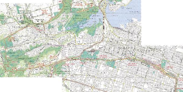
 Meet at 9:00am at the posted coordinates, which is
the 28.6km mark of the Iroquoia section of the Bruce Trail which is
at the top of the Greenhill Avenue Access Trail. We plan to start
hiking around 9:15am.
Meet at 9:00am at the posted coordinates, which is
the 28.6km mark of the Iroquoia section of the Bruce Trail which is
at the top of the Greenhill Avenue Access Trail. We plan to start
hiking around 9:15am.
 Destination is the 64.5km mark (Edition 25 of Bruce Trail
guide) of the Iroquoia section of the Bruce Trail which is by a
parking lot at Rock Chapel Road (N43° 17.447 W79° 56.215).
Destination is the 64.5km mark (Edition 25 of Bruce Trail
guide) of the Iroquoia section of the Bruce Trail which is by a
parking lot at Rock Chapel Road (N43° 17.447 W79° 56.215).
 Parking: Beginning:
West end of Greenhill Avenue at Cortina Crescent has room for about
10 cars. End: Parking lot at Rock Chapel Nature
Sanctuary off Rock Chapel Road has room for about 30 cars.
Parking: Beginning:
West end of Greenhill Avenue at Cortina Crescent has room for about
10 cars. End: Parking lot at Rock Chapel Nature
Sanctuary off Rock Chapel Road has room for about 30 cars.
Hopefully some people will park at the end and carpool back to the
starting point both before and after the hike.
 What
you should bring: Water and other drinks. Food for lunch,
dinner and snacks. GPS. Maps. Camera. Cell Phone. First Aid Kit.
Advil/Tylenol.
What
you should bring: Water and other drinks. Food for lunch,
dinner and snacks. GPS. Maps. Camera. Cell Phone. First Aid Kit.
Advil/Tylenol.
It might be wise to stash some supplies at certain locations of
your choice along the trail so that you don't have to carry
everything with you.
 Track our progress as we hike the trail. Don't feel up for the
hike, then join us by watching our progress as we go along. Screen
will update couple of minutes, but our progress will be updated
every hour or so. Thanks to northerpenguin for setting this
up.
Track our progress as we hike the trail. Don't feel up for the
hike, then join us by watching our progress as we go along. Screen
will update couple of minutes, but our progress will be updated
every hour or so. Thanks to northerpenguin for setting this
up.
Google Maps - http://www.torontogeocaching.com/bthike/
Latitude - bthike@gmail.com
<--add this email as a 'friend'
 Badges: Those of us that complete this hike along with the
other 3 hikes in the Iroquoia section (Hikes will be scheduled to
finish before Nov 21, 2010) will qualify for the Iroquoia End To
End badge for hiking the entire Iroquoia Section of the Bruce
Trail. For more information and to obtain a badge, see this Iroquoia Bruce Trail
Club link.
Badges: Those of us that complete this hike along with the
other 3 hikes in the Iroquoia section (Hikes will be scheduled to
finish before Nov 21, 2010) will qualify for the Iroquoia End To
End badge for hiking the entire Iroquoia Section of the Bruce
Trail. For more information and to obtain a badge, see this Iroquoia Bruce Trail
Club link.
Here is the Badge information from http://www.iroquoia.on.ca/hikes.html
under the Badges section.
|
To receive a badge, you have to be a Bruce Trail member to
get one.
You are required to hike the entire Iroquoia Section from Forty
Mile Creek in Grimsby to the bottom of Kelso Conservation Area In
Milton within a period of one year. Keep a record of the days you
hiked, the start and end points, and any other details you wish to
add.
Send $5 for each badge you require, and a self
stamped and addressed envelope, and your log book to the
following.
Iroquoia Bruce Trail
Club
P.O. Box 71057
Burlington, ON L7T 4J8
You will receive your badges
back in the envelope you supplied.
|
|
List of people who
hiked
(41 Total)
|
|
res2100
bggy
Buttons and Beaux
Cayuga Crew
dora's explorers
ElectroQTed
Fababoo
Galloping Gourmet
GuelphHiker
jeff-trex
Nozzletime
nucleophilic-steve
TochiHunt
TuF_RyDa (4x)
Team Goju (2x)
geocite (3x)
akela_31
Amazon Annie
Brook22
cache4pat
Dr. House
FreeSpirited1
GeoTrailGuy (2x)
Ham-sters (2x)
hellnite_jp
hubcap33
Katemijohn
Katemijohn
MaddieP
Micd
northernpenguin
RockHarder
rucache
|
Previous Bruce Trail hike events:
4/6/2007
BT Hike Event - Toronto Section (52.3km)
11/24/2007
BT Hike Event - Caledon Hills Section: Part 1
(38.8km)
4/26/2008
BT Hike Event - Caledon Hills Section: Part 2
(31.8km)
10/25/2008
BT Hike Event - Dufferin Hi-Land Section (53.8km)
4/10/2009
BT Hike Event - Niagara Section: Part 1 (22.8km)
5/2/2009
BT Hike Event - Niagara Section: Part 2 (22km)
10/24/2009
BT Hike Event - Niagara Section: Part 3 (34.7km)
11/21/2009
BT Hike Event - Iroquoia Section: Part 1 (28.6km)
Total distance hiked to
date: 284.8km
Total distance remaining to hike: 610.3km
% of trail completed: 31.8%
Proposed Bruce Trail Hike Schedule and
Information - Dates and Distances may change
|
Hike # |
Date |
Section |
Part |
Distance
km |
Notes |
Time |
Pace
km\h |
Started |
Made it
to End |
|
1 |
Friday, April 06, 2007 |
Toronto |
Full |
52.3 |
Easter Friday |
13.48 |
3.789855 |
24 |
8 |
|
2 |
Saturday, November 24, 2007 |
Caledon Hills |
Part 1 of 2 |
38.8 |
|
11:36 |
3.344828 |
13 |
10 |
|
3 |
Saturday, April 26, 2008 |
Caledon Hills |
Part 2 of 2 |
31.8 |
|
10:41 |
2.976599 |
17 |
15 |
|
4 |
Saturday, October 25, 2008 |
Dufferin Hi-Land |
Full |
53.8 |
|
16:21 |
3.29052 |
17 |
5 |
|
5 |
Friday, April 10, 2009 |
Niagara |
Part 1 of 3 |
22.8 |
Easter Friday |
7:11 |
3.174014 |
65 |
59 |
|
6 |
Saturday, May 02, 2009 |
Niagara |
Part 2 of 3 |
22 |
|
7:47 |
2.826552 |
48 |
46 |
|
7 |
Saturday, October 24, 2009 |
Niagara |
Part 3 of 3 |
34.7 |
|
10:15 |
3.385366 |
37 |
15 |
|
8 |
Saturday, November 21, 2009 |
Iroquoia |
Part 1 of 4 |
28.6 |
|
7:38 |
3.746725 |
24 |
16 |
|
9 |
Friday, April 02, 2010 |
Iroquoia |
Part 2 of 4 |
32.1 |
Easter Friday |
11:50 |
2.712676 |
41 |
19 |
|
10 |
Saturday, October 02, 2010 |
Iroquoia |
Part 3 of 4 |
37.9 |
|
|
|
|
|
|
11 |
Saturday, October 23, 2010 |
Iroquoia |
Part 4 of 4 |
21.8 |
|
|
|
|
|
|
12 |
Friday, April 22, 2011 |
Blue Mountains |
Part 1 of 2 |
36.5 |
|
|
|
|
|
|
13 |
Saturday, October 08, 2011 |
Blue Mountains |
Part 2 of 2 |
30.7 |
Thanksgiving Weekend |
|
|
|
|
|
14 |
Saturday, April 28, 2012 |
Beaver Valley |
Part 1 of 3 |
41.7 |
|
|
|
|
|
|
15 |
Saturday, September 23, 2012 |
Beaver Valley |
Part 2 of 3 |
38.7 |
|
|
|
|
|
|
16 |
Saturday, October 13, 2012 |
Beaver Valley |
Part 3 of 3 |
32.7 |
|
|
|
|
|
|
17 |
Saturday, April 27, 2013 |
Sydenham |
Part 1 of 5 |
29.7 |
|
|
|
|
|
|
18 |
Saturday, October 12, 2013 |
Sydenham |
Part 2 of 5 |
39.5 |
Thanksgiving Weekend |
|
|
|
|
|
19 |
Friday, April 18, 2014 |
Sydenham |
Part 3 of 5 |
34.4 |
Easter Friday |
|
|
|
|
|
20 |
Saturday, October 11, 2014 |
Sydenham |
Part 4 of 5 |
32.6 |
Thanksgiving Weekend |
|
|
|
|
|
21 |
Saturday, April 25, 2015 |
Sydenham |
Part 5 of 5 |
35.1 |
|
|
|
|
|
|
22 |
Saturday, October 10, 2015 |
Peninsula |
Part 1 of 5 |
25.9 |
Thanksgiving Weekend |
|
|
|
|
|
23 |
Saturday, April 30, 2016 |
Peninsula |
Part 2 of 5 |
33.2 |
|
|
|
|
|
|
24 |
Saturday, September 24, 2016 |
Peninsula |
Part 3 of 5 |
28.6 |
|
|
|
|
|
|
25 |
Saturday, May 06, 2017 |
Peninsula |
Part 4 of 5 |
41.4 |
|
|
|
|
|
|
26 |
Thursday, August 24, 2017 |
Peninsula |
Part 5 of 5 |
36.5 |
50th Birthday |
|
|
|
|
|
|
|
Total distance hiked so far: |
316.9 |
km |
|
|
|
|
|
|
|
Total expected distance: |
893.8 |
km |
|
|
|
|
|
|
|
Total distance left to hike: |
576.9 |
km |
|
|
|
|
|
|
|
% completed |
|
35.5 |
% |
|
|
|
|