This was one of 12 caches placed in the CSI series. When it began, prizes could be won for finding the whole series.
There is no final stage anymore but any cache left counts as an individual find.
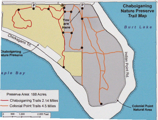
A 2-stage Multi Cache that begins in the Colonial Point Memorial Forest. This beautiful piece of property is owned by the University of Michigan Biological Station. There are many trails winding through this natural area that the public is encouraged to use for hiking or snowshoeing. However, in so far as GeoCaching is concerned, they do not wish to have cache containers on their property. Therefore, the 1st stage of this cache is virtual in nature only. There are no containers placed upon the U of M property, and the pursuit of the final stage will take you outside of these boundaries.
This natural area consists of 2 adjoining properties. There are 291 acres under the ownership of the Biological Station, and 175 acres are owned by the Little Traverse Conservancy. The crown jewel of the U of M property is the large stand of Red Oaks dating back to 1840. This forest is considered to be one of the finest stands of such trees in the Midwest. In 1985 these lands were purchased by a sawmill and slated for heavy logging. As you can imagine, much bru-ha-ha was raised by various conservation groups in the area, as well as by all of the local property owners. Through the cooperative efforts and donations of several environmental groups and local citizens, these lands were eventually purchased and saved. In addition to the Red Oaks, you will see some huge Hemlock trees. Other trees of noteworthy size that you will see include Beech, Maple, White Pine, and Birch. More information about these lands and the cultural history of the area can be found at the following web site. Colonial Point Memorial Forest
PRINT THIS MAP
Now – to get to the cache. At the posted coords you will find a plaque “dedicated in loving memory”. What was the age of this person? The 2nd stage coords of: N 45 29.224 W 084 41.467 are bogus. To fine-tune those coords, add the age of the person on the plaque to the last 2 digits of the latitude, and subtract the age from the last 2 digits of the longitude. The terrain rating of 2 is about right if you plan your route carefully. You can make it harder than that if you plan poorly. There is a trail map posted near the 1st stage to help you plan your route, and there are others posted at various places on the trails. There is also one attached as a jpeg on this cache page that you may wish to print and take with you.

Here is the complete cache series;