|
Sudoeste
Alentejano e Costa Vicentina
O Parque Natural do Sudoeste Alentejano e Costa
Vicentina abrange o litoral sudoeste de Portugal Continental, no
sul do litoral alentejano e no barlavento algarvio em redor do Cabo
de São Vicente. Inclui territórios de freguesias dos
seguintes concelhos:
- Sines (freguesias de Porto Covo e
Sines);
- Odemira (freguesias de Longueira / Almograve,
Santa Maria, São Luís, São Salvador, São
Teotónio, Vila Nova de Milfontes e Zambujeira do
Mar);
- Aljezur (freguesias de Aljezur, Bordeira,
Odeceixe e Rogil);
- Vila do Bispo (freguesias de Budens, Raposeira,
Sagres e Vila do Bispo).
Para além da faixa costeira e da zona
submarina de 2 km a partir da costa, o parque inclui o vale do rio
Mira desde a foz até à vila de Odemira.
Na área do parque encontram-se diversos
tipos de paisagens e habitats naturais e semi-naturais, tais como
arribas e falésias abruptas e recortadas, praias, várias
ilhotas e recifes (incluindo a ilha do Pessegueiro e um invulgar
recife de coral na Carrapateira), o estuário do Mira, o cabo
Sardão, o promontório de Sagres e Cabo de São
Vicente, sistemas dunares, charnecas, sapais, estepes salgadas,
lagoas temporárias, barrancos (vales encaixados com densa
cobertura vegetal), etc. As altitudes máximas são: 324 m,
no interior (em São Domingos, Odemira); e 156 m, no litoral
(em Torre de Aspa, Vila do Bispo). A profundidade máxima
é 32 m, 2 km ao largo do Pontal da Carrapateira
(Aljezur).

|
Southwest Alentejo and
Vicentine Coast Natural Park
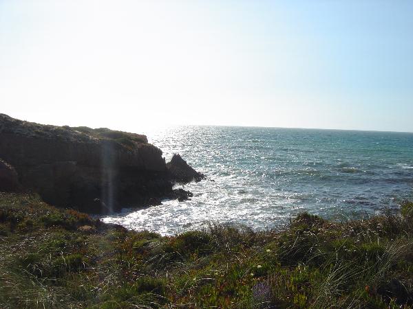
This natural park has spectacular views over
the seashore with cliffs hiding wonderful sandy beaches and
estuaries.
The Southwest Alentejo and Vicentine Coast
Natural Park covers the coastline in the municipalities of Sines,
Odemira, Aljezur and Vila do Bispo.
This is an area of outstanding natural
beauty, important for its landscape, geology, flora and fauna,
architecture, history, traditional and archaeological
heritage.
Some of its most impressive features are the
reefs and small islands such as Pessegueiro and Carrapateira
together with the Mira estuary, Cape Sardao and the Sagres
promontory. The rocks of Arrifana and Odeceixe and the soil area at
Sagres contrast with the sand dunes in Vila Nova de Milfontes and
Sardao.
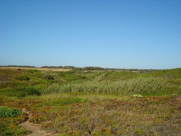
The vegetation varies depending on the soil
and the wind and salt exposure. There are many well preserved areas
in the sand dunes and some areas of cork and Medronheiro trees. The
vegetation is abundant around Sagres – Sao Vicente and
Carrapateira.
On the cliffs it is common to find the great
cormorant and storks which are often observed building their nests
in rocks by the sea. There are also a few otters and amphibians
such as toads and frogs. The coastline in this area is a very
important migration corridor particularly for birds of prey and sea
birds.
There are many historical remains of the
presence of Phoenicians, Arabs and Romans as well as more recent
defensive constructions.

|
|
A CACHE
Esta cache foi colocada para
possibilitar um passeio. Podem deixar o carro a cerca de 1300
metros, no estacionamento da praia e seguir pelas arribas até
à cache ou deixá-lo a 200 metros e andar um pouco a
pé, há para todos os gostos.
Atenção redobrada
às crianças e ao oceano. No último troço
há que passar por uma "praia" onde, no caso de maré alta
a rebentação pode surpreender os mais desatentos.
Não arrisquem a vossa segurança.
O acesso recomendado é pelo
acesso à Praia das Furnas. Se tentarem outro acesso mais a Sul
estão por vossa conta nos areais...
Se
não conseguir fazer o Found, quer seja por não encontrar
a cache quer seja por não a poder procurar, terá que
cumprir estes requisitos para ser autorizado a fazer o log na cache
final do Projecto Alentejo:
- terá que registar o Not
Found, notes não valem.
-terá que provar que esteve mesmo lá. Uma fotografia sua
junto das arribas servirá.
|
THE CACHE
This cache was
placed to allow you a little walk. You can leave the car 1300
meters away, in the beach parking and follow the cliffs to the
cache, or you can drive up to 200 meters and walk a bit, it's your
choice.
Doble your
attention to the children and the ocean. In the last track, you'll
have to pass by a "beach" where, in High tide the waves can catch
you. Don't risk your safety.
The recomended
access is trhough the access named Praia das Furnas. If you try
another one to the South, you're on your own in the
sand...
If you cannot
make the Found, no matter it's because you can't find it or you
cannot look for it, you'll have to fill this requirements be
authorized to log the found in the final cache of the ALentejo
Project:
- You'll have to register your Not Found, notes aren't
allowed.
-you'll have to prove that you've been there. A picture of you
close to the cliffs will do.
|