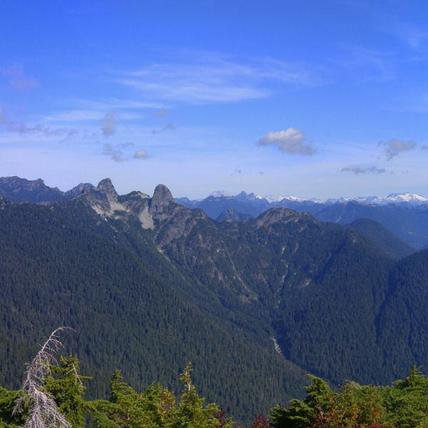
 The Lions from Mt. Strachan
(click for whole panorama)
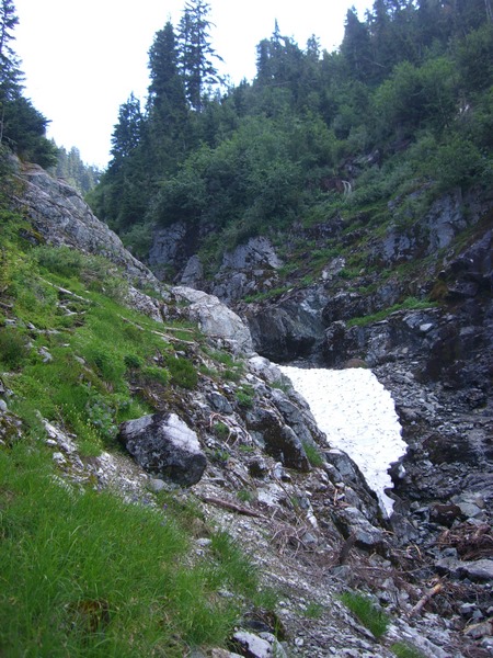 Expect to find snow in the ravine, even at the end of
summer
Expect to find snow in the ravine, even at the end of
summerThis multi will guide you to the peak of Mt. Strachan. This is
not a walk in the park; the summit is almost 500m above the start
and many sections of the trail exceed a 1:1 grade. It's a moderate
hike, with the return trip clocking in at about 5 hours.
This cache should not be attempted when there
is still snow on the peak (November - May) and all the
caches and waypoints will be buried beneath several metres of snow
in the winter.
Trail description
The hike up Mt. Strachan starts at the Cypress Bowl parking lot
and picks its way through the bottom of the chair lifts. Keep an
eye out for the signs pointing the way to the Howe Sound Crest
Trail. This trail runs from the parking lot (elevation 980 m) up
and down the shoulders of several mountains all the way to Lions
Bay.
About an hour into the hike, you will come to two small foot
bridges. The trail to Mt. Strachan is to the north between these
two bridges (which themselves are only separated by about 4 feet).
The trail is often overgrown, but quickly leads you to the base of
the ravine that comes down from Mt. Strachan.
Be careful when ascending the ravine. The trail sticks to the
north side of the ravine and doesn't fully enter the ravine until
the top third, but the path is quite steep, slick, and
unsteady.
When you come to the top of the ravine, you will be in a saddle
between the north and south peaks. The north peak is higher than
the south and offers full 360° views. The trail up to the north
peak is marked with red painted dots.
After spending some time at the north peak, retrace your way
back to the saddle. The trail to the south peak is on the west side
of the clearing, not via the more inviting trail on the east side.
The trail wends its way up the south peak, and along it following
some cairns. About halfway across the clearing on the top, the
trail veers east, coming out on the east side of the chairlift.
The trail goes back into the forest at the south side of the
clearing, just east of the chairs. From there, it picks its way
through rocks and roots down into the forest.
About one third of the way down, you will encounter the wreckage
of a RCAF T-33 trainer that crashed in 1963, killing the two
pilots. Out of respect for the dead, do not
disturb any of the wreckage.
The trail continues down the mountain until it emerges from the
forest and intersects the Collins ski run. From there, it's a
tedious slog down the road back to the parking lot.
Cache info
All the caches are small Lock'N'Lock containers with the
exception of the final. All the caches are accessible without
leaving the trail except for the final and waypoint 2. The waypoint
2 cache is a little off trail but requires no bushwacking. The
final requires stepping through some low brush.
The starting cache is near the "start" of the trail, but that
start point has been badly affected by the continued development of
Cypress Mountain. At the time of placement, there was a trail
marker pointing to the Howe Sound Crest Trail where the trail split
off from the trail to the Yew Lake Trail. The in-forest stretch of
the trail here, however, is quite short.
There are 5 caches in total, including the start.
Other caches on this hike
There are several other caches that can be found while following
this trail:
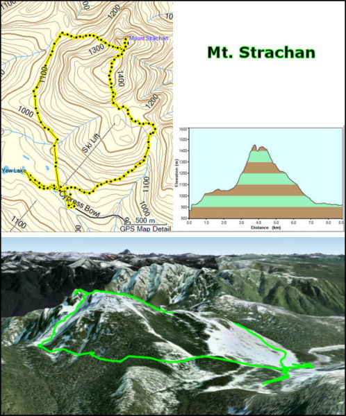 The Mt. Strachan Trail