The
Leura Maar is an extensive volcanic complex sited around the town
of Camperdown. The summit of Mt Leura can be reached directly by
car, or you can take a walking trail from the base if you're
feeling energetic.
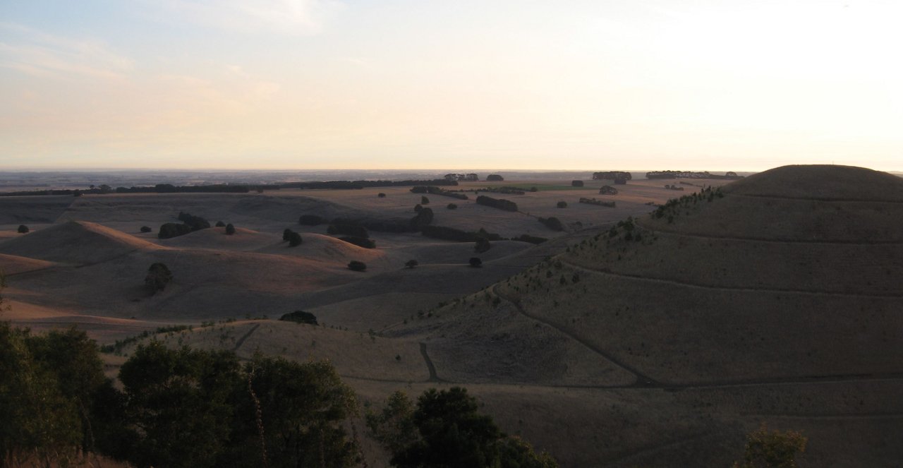
The Leura Maar is approximately 2.5km long, 1.7km wide and up to
50m deep in places. The two most prominent features of this
volcanic complex are the scoria cones Mt Sugarloaf and Mt Leura,
which you are standing on at the given coordinates.
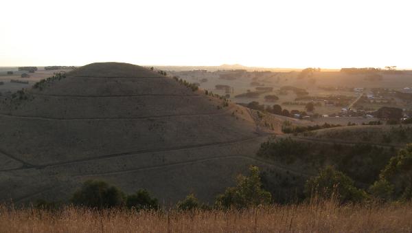
Originating from a series of major volcanic eruptions over
20,000 years ago, the 100m deep crater in the southerly direction
is one of many craters visible from this outlook, and was created
by gases and steam exploding from the ground ahead of a rising
column of lava. Initially forming a 'vent' through the earth's
surface, continued eruptions widened the vent into the craters you
can see all around.
Following the formation of the craters, explosive bursts of lava
were ejected from fissures on the floor of the crater. Gases
escaping through the lava broke into fragments of scoria which were
thrown high into the air, accumulating large formations over a
period of several months. The many hills you can see from this
point, including the symmetric cone Mt Sugarloaf and Mt Leura, are
the result of this activity.
At GZ, situated at the summit of Mt Leura, you will find a
number of information boards relating to the volcanic activity and
to the district in general.
To log a find on this earthcache, you must provide the
following information via email (no info in logs, please):
1. What is the deposit forming the rim of the maar known
as?
2. How long may it have taken for the Leura Maar to form?
3. What do the cuttings on the road to the Mt Leura summit expose
clear examples of?
4. How long may it have taken for Mt Leura to 'build'?
5. True or False? These features are some of the oldest in
Victoria.
Finally, upload a photo with your log showing you standing in
front of this picturesque feature with your GPSr. Feel free to log
as a find when you send your email, but logs not meeting the above
criteria will be deleted in accordance with Earthcache
guidelines.