The cache is NOT at the posted coordinates.
You will need to solve a simple puzzle to obtain the final coordinates.
Do you like challenge caches and live in, or want to spend significant time in, the Lancaster area? Would you like to complete a challenge with some of the flavor of a Delorme challenge, without having to drive thousands of miles? Do you spend hours staring at maps? Are you ready for a systematic exploration of Lancaster county? If so, you are ready for...
The Lancaster County
Quadrangle Challenge
FULL SIZE MAP
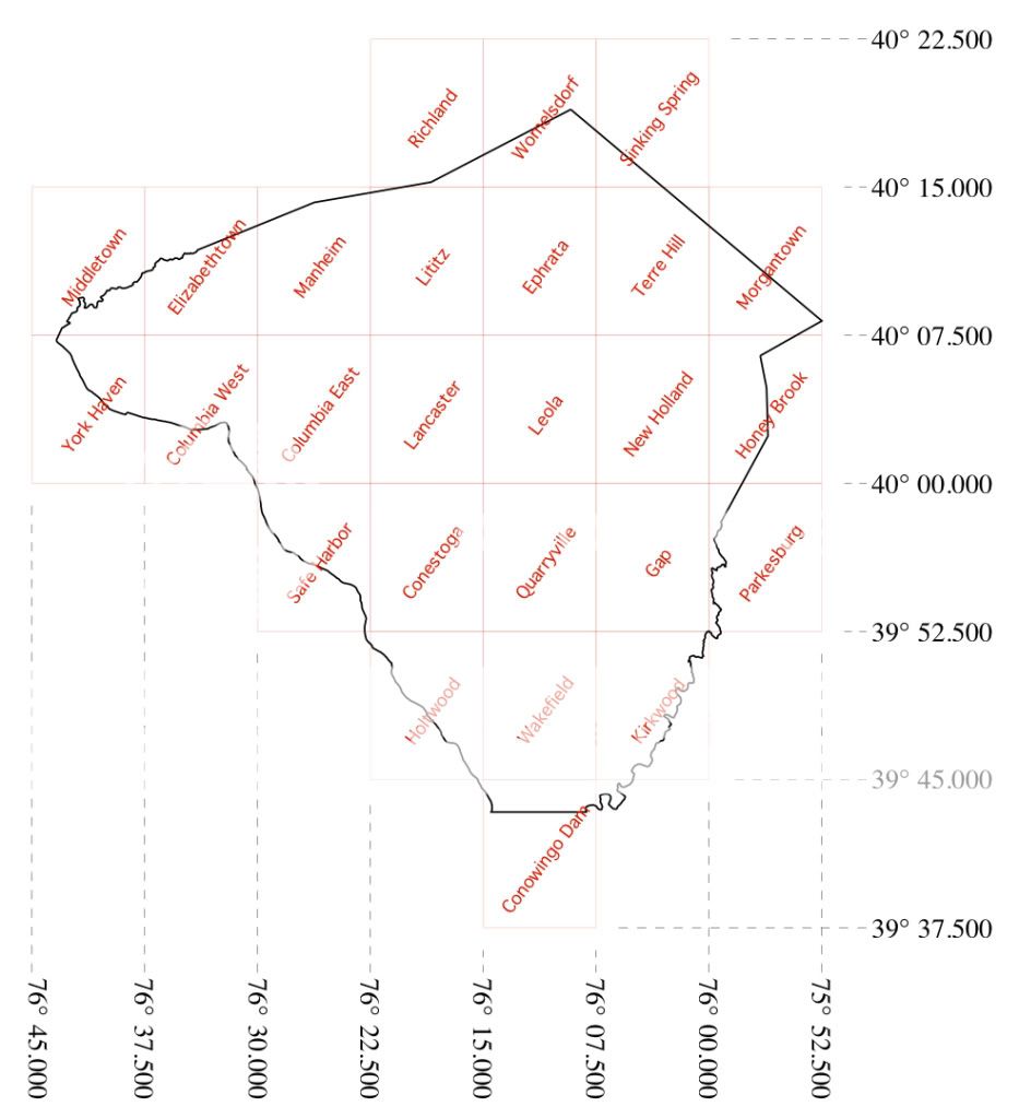
The objective of this challenge is to find a geocache in each of the 26 USGS 7.5 minute topographical map quadrangles that cover Lancaster County.
This challenge is a modification of the original Bay Area Quadrangle Challenge, which has produced several spin offs... Los Angeles County, Sacramento Valley, North Valley, Spokane County and Deschutes County. As far as I know, this is the first Quadrangle Challenge east of the Mississippi.
Counties are a little smaller in this area and sometimes oddly shaped, not always fitting nicely within the 7.5 minute quadrangles. The borders of Lancaster county actually reach into 32 7.5 minute quadrangles. However, I thought it would be best to save the Red Lion, Airville, Delta, Rising Sun, Oxford and Elverson quadrangles for another challenge. When this cache was placed there were no caches hidden in the tiny corners of Lancaster county that fall in those 6 quadrangles. This challenge CAN be (but does not have to be) completed without leaving Lancaster county. Just for fun, a map with all 32 quadrangles can be found here.
The Challenge:
In order to complete this challenge you must:
1. Find at least one geocache on each of the 26 USGS 7.5 minute topographical map quadrangles that cover Lancaster County.
2. Create a bookmark list or post a note of the caches you've found in each quadrangle listed alphabetically by quadrangle name using the format:
Quadrangle Name - Cache Name - GC##### - Date Found (EXAMPLE BOOKMARK LIST).
You may delete your bookmark list 2 weeks after logging your find since geocaching.com currently only allows a maximum of 40 lists.
3. Find the final cache using the coordinates verified by GeoCheck.
4. Log the cache online after the physical container is found and the logbook inside is signed.
5. I will review and verify the list. If I discover an issue, I will ask you to edit your online log until the situation is corrected.
The Details:
1. All cache types listed on geocaching.com qualify as finds with the exception of Events, CITOs and Locationless caches.
2. Posted coordinates for a cache (including multicaches and puzzles) will be used to determine in which quadrangle a given cache falls.
3. If the posted coordinates for a geocache are for a quadrangle border or corner you may use a find on that geocache to qualify for any ONE of the quadrangles it touches.
Example: GC2J23V qualifies as a find in either the Gap or Parkesburg quadrangle but not both.
4. It is possible to complete the challenge without leaving Lancaster county. However, geocaches found outside of Lancaster county DO qualify as finds for the particular quadrangle in which they are located.
Example: GC1AY26 qualifies as a find in the Conowingo Dam quadrangle even though it is in Maryland.
5. Previous finds DO qualify.
6. Geocaches hidden under your personal geocaching.com account DO NOT qualify.
7. While you may have others with you when you find the final cache, only those who have fulfilled ALL criteria for this cache will be allowed to sign the log book and log it as a find online.
8. Remember that is is a GAME and it is supposed to be FUN!
The Puzzle:
The cache you seek is hidden here:
NORTH
Conowingo Dam Kirkwood° Kirkwood Columbia East . Conowingo Conowingo Elizabethtown
WEST
Gap Ephrata° Columbia East Gap . Ephrata Conowingo Dam Columbia West

The Cache:
The difficulty and terrain rating reflect the cache location and are not an attempt to judge the difficulty of completing the challenge (which may be very different depending on where you live and when you started geocaching). The cache is hidden in the Lancaster County Central Park. A trail guide with a map can be found here. Park hours are dawn to dusk. NO NIGHTTIME GEOCACHING! Trailhead information provided by the geocheck. You are looking for a well stocked 50 caliber ammo can. Bring some items along for trade and remember to trade up or trade equal.
There are TWO unactivated geocoins in the geocache. FTF gets their choice of ONE of the two coins. The second coin is reserved for the first geocacher to complete this challenge with ALL NEW finds (no finds before February 5, 2012). Who will that be?
Finishers:
Cacher
|
Quads Completed Date
|
Cache Logged Date
|
Sammydogs
FTF |
Feb. 5, 2012
|
Feb. 5, 2012
|
| ratjam |
Nov. 17, 2011
|
Feb. 5, 2012
|
| horselady9 |
Feb. 6, 2012
|
Feb. 6, 2012
|
| kathleenjo |
Feb. 7, 2012
|
Feb. 7, 2012
|
polecat42
ALL LANCASTER FINDS |
Feb. 4, 2012
|
Feb. 8, 2012
|
| levidan |
Feb. 9, 2012
|
Feb. 10, 2012
|
st!tch
FTF ALL NEW FINDS |
Feb. 26, 2012
|
Feb. 26, 2012
|
| albsjudge |
Oct. 23, 2011
|
Mar. 4, 2012
|
| suzymjb2 |
???
|
Mar. 6, 2012
|
| geojo1 |
Mar. 8, 2012
|
Mar. 8, 2012
|
| BelieveMore |
Feb. 23, 2012
|
Mar. 8, 2012
|
| Kirsten2usa |
Mar. 8, 2012
|
Mar. 11, 2012
|
| philflyboy |
Nov. 17, 2011
|
Mar. 24, 2012
|
| mortonfox |
???
|
Mar. 25, 2012
|
| Your Name Here |
???
|
???
|
* The "completed" date will be the most recent date listed on your bookmark list. If you change your list to include all older caches, email me if you want the date in the table changed. Same deal with the ALL LANCASTER FINDS... if I missed it, let me know. *
Resources:
These files might be helpful in keeping track of your progress.
* If one of the links doesn't work send me an email. *
Alert: You are about to download a file in order to obtain further details that may be helpful to find this geocache. As the cache owner, I represent that this file is safe to download although the files have not been checked by Groundspeak or by the Geocache Reviewer for possible malicious content. As a result, you are downloading this file
at your own risk. |
Clicking on a file link below will take you to the File Dropper website. Select the GREY "Download This File" and enter the character code you will see to download the file.
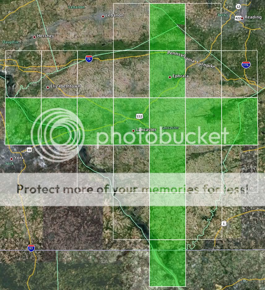
• Google Earth .KML file with polygons for each quadrangle which can be turned ON and OFF
* PICTURED ABOVE *
• Google Earth .KML file with quadrangle corners (C01 - C40)
• .GPX file with quadrangle corners (C01 - C40)
• .GPX file with quadrangle boundaries as tracks converted by GPSBabel
I have found that the easiest way to construct a list and keep track of your progress is simply to search the geoaching.com map near center of each quadrangle and look for a cache you have found. View the cache page and check to make sure the coordinates fall within the correct quadrangle. This bookmark list shows that I have completed this challenge myself and was put together in about 15 minutes. Let me know if you need help.
GOOD LUCK!