GEOCACHE “DE COKSE HEI”
“De Cokse Hei” zoals deze mooie plek in de volksmond in Afferden wordt genoemd, is een bos en heide gebied met enkele vennen in de omgeving zoals “De Es” en “De Zeuvenbeum”. Het hoogste punt wordt gevormd door een paraboolduin die “Dun Hopberg” genoemd wordt.
Het Bergerbos is een onderdeel van het 5323 hectare grote Nationaal Park “De Maasduinen”. Dit park dankt zijn naam aan de opvallende stuifzandruggen die paraboolduinen worden genoemd. Deze paraboolduinen zijn ontstaan tegen het einde van de laatste ijstijd. Grote delen van Noord- en Midden-Limburg waren toen bedekt met een laag dekzand. Door de wind werd dit zand opgeblazen tot zandruggen en hoefijzervormige duinen. Staatsbosbeheer heeft in het Bergerbos - de Afferdense bossen en de Duvelskuul - zo'n 30 hectare bos gekapt om de 3 heide-eilandjes met elkaar te verbinden: "Het Quin" (oftewel “De Kwen”) in het noorden, "De Cokse heide" in het midden en "De Duvelskuul" in het zuiden van de Afferdense bossen. Aan hei en open zand zijn diverse plant- en diersoorten gebonden. Vogels als nachtzwaluw en boomleeuwerik, amfibieën als hagedis, knoflookpad, heikikker en rugstreeppad, insecten als blauwvleugelsprinkhaan, diverse heidevlinders en -libellen doen er hun voordeel mee. De deelpopulaties ervan kunnen zich dan door het hele gebied verspreiden. Uiteindelijk zal een nieuwe ecologische verbindingsstrook ontstaan, bestaande uit een bosheidelandschap. Er is nog 10 à 25 procent bos over. Tegenwoordig maakt het onderdeel uit van een 110 hectare groot heidegebied waarin runderen en geiten meehelpen dit gebied open te houden.
Deze cache kun je bereiken over bospaden en kan het beste te voet bezocht worden en ligt in een gebied met loslopende geiten en runderen. Deze dieren kunnen onvoorspelbaar reageren als je te dicht in de buurt komt. Houd hier rekening mee! Verder is er geen toegang met loslopende honden en na zonsondergang. Parkeren is mogelijk bij de parkeerplaats vlakbij het “Zevenboomsven” (“De Zeuvenbeum”) met vogelkijkhut. Na het bezoeken van de cache kan het mooi gelegen S-vormige “Esven” (“De Es”) nog bezocht worden; dit ligt slechts op 5 minuten wandelen vanaf de cache. Hier ligt een wandelpad omheen. Vandaaruit kun je eenvoudig via boswegen de parkeerplaats weer bereiken.
Als je alle 3 de caches (De Kwen, De Duvelskuul & De Cokse Hei) hebt bezocht, dan mag je onderstaande banner aan je profiel toevoegen.
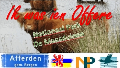
Bannercode:
<p><a href="http://coord.info/GC6JJPP"><img src="https://s3.amazonaws.com/gs-geo-images/6dd1ccae-b1a2-40e5-b0ac-86279550e05b.jpg"></a></p>
Deze cache is mede mogelijk gemaakt door StaatsBosbeheer.
GEOCACHE “DE COKSE HEI”
“De Cokse Hei”, as called by the local inhabitans, is a forest and heathlands area surrounded by some fens exists like the “De Es” and “De Zeuvenbeum”. The highest point is formed by a river dune of the Meuse river called “Dun Hopberg”.
The "Bergerbos is part of the national park "Maasduinen", founded in 1996 and covering approximately 5300 ha. The landscape consists of forests and heathlands on a sandy plateau along the river Meuse close to the German border. The present characteristics of the park are strongly influenced by an intense interplay of wind, water and humans through the course of time, resulting in a unique pattern of drifting sand ridges or parabolic dunes which date from the last glaciation. Besides heathlands and forests, there are several fens in the park.
Staatsbosbeheer has cut down about 30 ha. trees to connect 3 islands of heathlands. These islands are called "Het Quin" (or “De Kwen”) in the north, "Cokse heide" in the middle and "De Duvelskuul" in the south of the Afferden forest. The natural rejuvenation of this forest lead to new flora and fauna like some reptiles and amphibians species. Among the flora we find several oak species, birch, pine, alder and beech. In these days this place is a part of a 110 ha. sized heathland area in which Galloways and goats are helping to keep this area open.
This geocache uses small sandy forest trails and can be done mainly by foot. To visit the cache you have to enter an area with Galloways and goats. These animals can response unpredictable if you come too close. So keep this in mind. Furthermore there is no access to this area for unattached dogs and after sunset.
You can park your cache vehicle at the parking near the “Zeuvenbeum” fen. There’s also a bird spot hut located near the parking. After visiting the cache you can walk to the nearby S-shaped fen called “Esven”; This is only a 5 minute walk from ground zero. This beautiful fen is surrounded by a walking trail. Afterwards you can easily return to the parking by forest roads.
If you have visited all 3 geocaches (De Kwen, De Duvelskuul & De Cokse Hei) you may add the banner below to your profile.
Bannercode:
<p><a href="http://coord.info/GC6JJPP"><img src="https://s3.amazonaws.com/gs-geo-images/6dd1ccae-b1a2-40e5-b0ac-86279550e05b.jpg"></a></p>
This geocache has been made partly possible by "Staatsbosbeheer".