Irene Concentration Camp Cemetery and Garden of Remembrance.
This Heritage Site was chosen as the location for this cache to share historical information about the location with the geocaching community.
The location of this Virtual Cache is within the boundaries of Irene Secure Village.
Points of access into the village can be gained from various entrances:
East from Main Road through the boom gates in Stopford Road.
The Stopford Road access is the closest to the cache location.
Or from
South: Nellmapius Road through the boom gates in King Street.
North: Alexandra Road through the boom gates in King Street.
If the Security personnel ask why you are entering the village, inform them that you are going to the Irene Concentration Camp Cemetery and Garden of Remembrance.
The formal ‘Gate Times’ for access to the Garden of Remembrance are 06H00 to 18H00. There is a pedestrian gate to the right of the main gate that is always open.

The information that has been included in the description compiled for this listing is based on what we learned at the location and on numerous websites on the Internet. We thank the authors of the articles and owners of the websites for making the information available to the general public and us.
The Irene Concentration Camp Cemetery is a national heritage site.
During the Anglo-Boer war concentration camps were set up to house Boer women and children. The Irene Concentration Camp was opened on the 2nd November 1900 and was a Boer War prison camp for women and children. They were driven from their homes by the British troops and transported by train and often just dumped in Irene. They had very few possessions, often only the clothes they wore.
The population in the camp increased dramatically and the inhabitants were housed in tents in extremely poor conditions. There was tremendous overcrowding and in some cases as many as 20 people were housed in 6-sleeper tents.The weekly food rations were insufficient, often not sufficient to feed all the prisoners. Blankets, milk, fresh fruit and vegetables, soap, candles and toiletry were scarce and were only provided when the camp doctor prescribed items as a ‘medical comfort’.
The prisoners and particularly the children were malnourished and as a result became ill quickly. They were the first to succumb to their illness as a result. The doctor could only treat 500 patients and as a result very few prisoners received any medical care at all.
The winters is Irene are generally much colder than the surrounding areas, resulting in deaths being recorded daily. They usually died as a result of disease and malnourishment. The children succumbed first.
A second camp was opened on the Southern side of the Hennops River. By 1902 there were more than 5000 inhabitants living in the camps.
The camp Cemetery
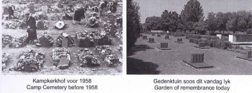
Piles of rock indicated the original graves. There were a few tombstones lying around and they were later removed. As a result the graves could not be identified. The British authorities numbered the graves with metal plates and one of these found was a plate number 2156. It is thought that the actual deaths could be much higher than the 1149 number generally accepted. Nearly a thousand of the deceased were children under the age of 15.
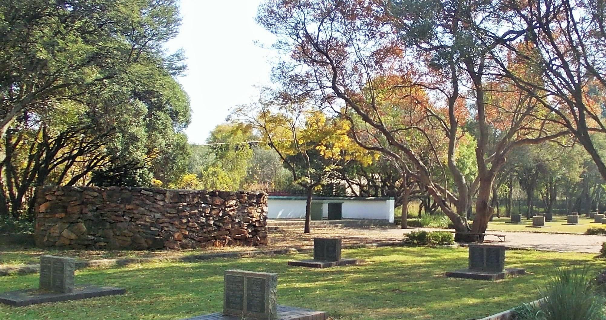
In 1958, at the request of the Women’s Federation, the SA Council on War Graves turned the cemetery into a garden of remembrance. Some of the original hand-engraved tombstones on slate, were mounted on murals. Symbolic tombstones were then erected alphabetically with the names of those that died in the camp. The container located in the designated Parking area houses a number of the slate tombstones to protect them from the environment.
The original rocks that were removed from the graves were used to build a memorial wall and paving in the centre of the graveyard. In 1968 the 35 children who were buried in a second cemetery during the camp years, were reburied in a sarcophagus above ground level. The cemetery today is a national heritage site, under the protection of the South African Heritage Resources Agency (SAHRA).
The Memorial Wall
The sarcophagus with the ‘wall of names’ in the background

Another view of the sarcophagus

Towards the end of the war, the oval was used to provide space for sports and recreation for the prisoners.
Irene Oval
One of the Camp Commandants (Lieutenant Alexander Bruce) established a sports field in the centre of the camp as part of his plan to improve conditions in the camp and raise the morale of the residents.
This sports field, which is located about 200 metres from the Concentration Camp Cemetery site, is still used today as a very popular sports field and recreation site.
A plaque describing the establishment of the sports field is located on the edge of the field.

If you would like to visit the field and read the information on the plaque that describes the background regarding the field, it can be found at S 25° 52.139’ E 028° 13.201’ (Reference Point 5)
Irene Primary School
Before the Concentration Camp was vacated and shut down, a school was established in the Concentration Camp to teach and educate the children in the camp. After the camp had been vacated and shut down, the school continued to teach and educate children in the area. Adjoining the Garden of Remembrance on the East and South East side is Irene Primary School which has grown to be a well-attended and well known school.
In order to qualify to log this cache as ‘Found’ you need to complete the following tasks:-
1. Take a photo of either you with your GPS, or just your GPS unit, at the listed coordinates. (Located at the wall on which the names of people who died in Irene during the war, have been engraved.) You can choose what features you include in the background of the image. The photograph must be attached to your log.
Answer the following questions and submit the answers to us by e-mail or utilising the Message system on our profile.
2. When was the building nearest the main gate opened?
3. What is the title of the poem at this location, and who was it written by?
4. What do you believe you are seeing in the concrete adjacent to the coordinates at this location?
References:
If you would like to find out more about the location and the relevant history, the links provided below can be accessed and will provide more detailed information about the location and relevant historical information.
The websites that can be accessed using links provided below have not been checked by geocaching.com HQ or by the reviewer for possible malicious content and access to the relevant sites is at your own risk. We, as the cache owners, believe that the pages are safe to visit.
http://www.theheritageportal.co.za/article/short-history-irene-concentration-camp-cemetery
http://www.southafricaexplorer.co.za/attractions/irene-concentration-camp/irene-concentration-camp.html
http://allatsea.co.za/musings/irene-concentration-camp/
http://regionalgeography.org/101blog/?p=2455
https://www2.lib.uct.ac.za/mss/bccd/Histories/Irene/
Virtual Reward - 2017/2018
This Virtual Cache is part of a limited release of Virtuals created between August 24, 2017 and August 24, 2018. Only 4,000 cache owners were given the opportunity to hide a Virtual Cache. Learn more about Virtual Rewards on the Geocaching Blog.