
At 12,800 feet, Engineer Pass (along the Alpine Loop Scenic and Historic Byway) is located in the San Jaun Mountains of south-west Colorado. Although not as well known as other passes in state; the Engineer Pass Virtual Cache will reward you with scenic views of pristine Alpine environments, offer interesting facts about the area, add a nicely rated cache to your profile all while offering an Alpine Adventure you will remember for years. Additional areas of interest are abundant along the Alpine Loop, but beyond the scope of this cache description. In order to maximize your preparedness, enjoyment, and safety; the cache description is divided into the following sections:
1. Logging requirements
2. Planning Your Trip
3. Engineer Pass Description
Logging Requirements
Within twenty feet of the posted coordinates you find a interpretive and Engineer Pass sign. In order to successfully log the cache, you must complete two tasks:
1. Send the CO the answer to following question: Please name the seven significant mountains and peaks visible from Engineer Pass, as listed on the interpretive sign. In your message, please include a reference to “GC7B8DP Engineer Pass,” your geocaching name, and the correct answers.
2. With the Engineer Pass sign visible in the photo (see picture at the top of the cache description), take a picture of you, your GPS, and / or your vehicle and post it in your log entry to prove you were physically at the posted coordinates. Unlike other cache types, the new generation of virtual caches are authorized to include a photographic requirement. This task is not optional.
Any log entry that fails to follow these instructions or meet both logging requirements will be deleted.
Planning Your Trip
The 5 Terrain rating for this cache is based upon vehicle requirements, terrain, weather, and distance challenges that all cachers will have to overcome to reach the posted coordinates at this remote location.
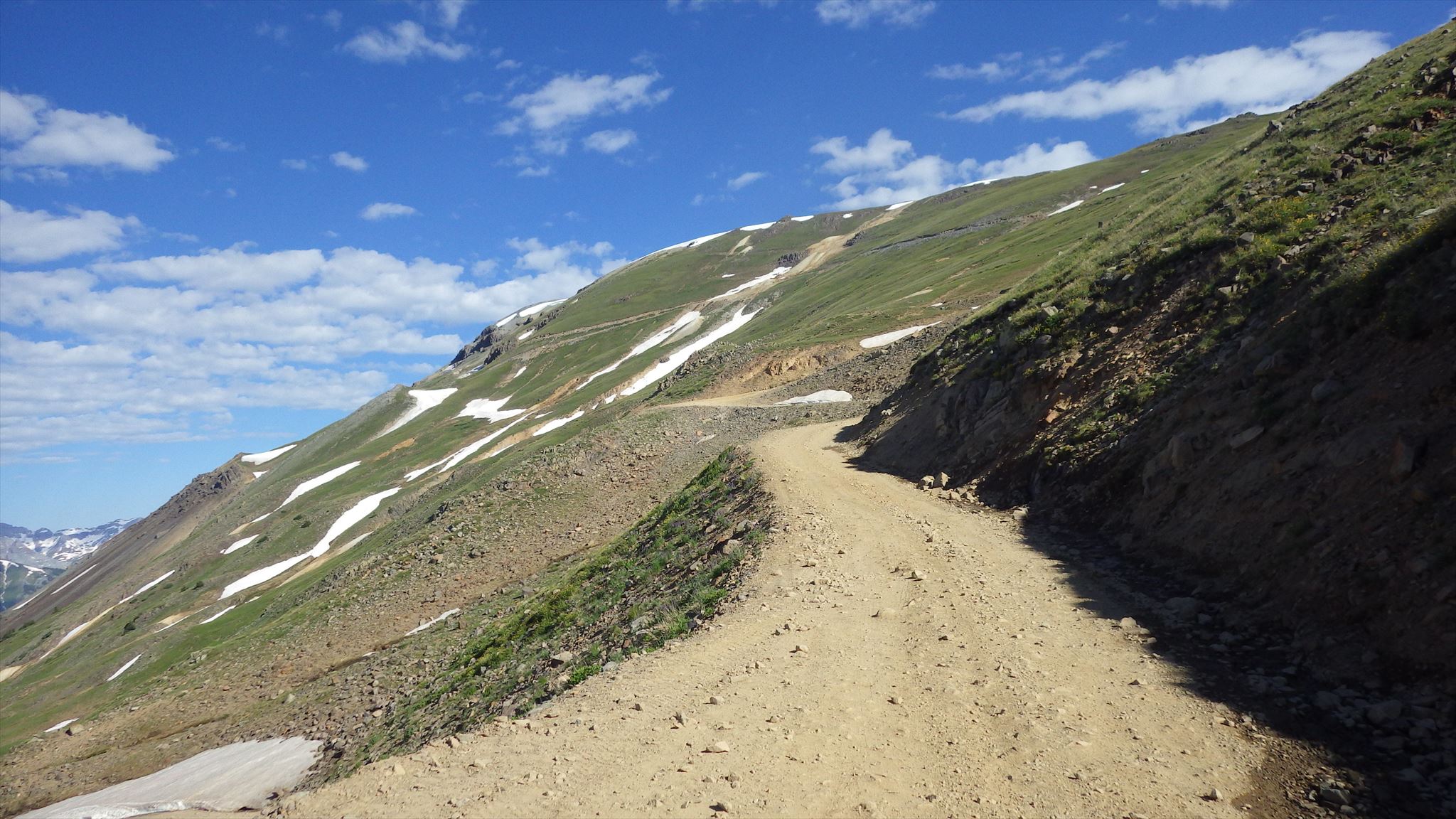
Assuming weather conditions permit; you will need a four-wheel drive, high clearance vehicle to reach Engineer Pass and drive the Alpine Loop (your “special tool”). The road is rated as moderate, but could be safely driven even by novice drivers who are careful. The most significant challenges will be narrow roads with steep drop offs and tight turns on switchbacks. Difficulty will be increased during certain weather conditions. If desired, there are a number of videos online that show a “drive though” of the route to the pass so you can personally assess the difficulty prior to departure.
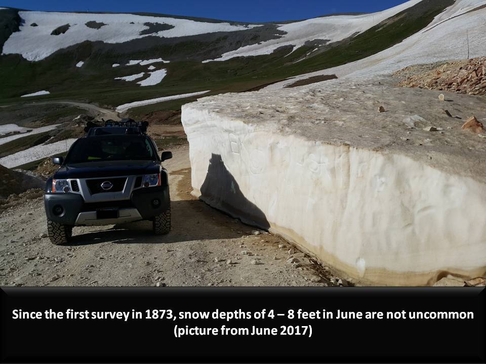
The normal open season for the Alpine Loop is May through October. Prior to departure check the weather and road conditions, and if the road is open. For those unfamiliar with Colorado Alpine terrain, weather can dramatically change in a short period of time and with little warning. Hail or snow may be possible even in the summer months. Referencing climatology data can help you prepare for possible extremes. There are various sources to obtain this information, but some links are included below if you wish to use them. Due to its remote location, you may have to rely on data from the nearest location available.
1. Forest Service Road Status
2. Lake City Local Trail and Road Conditions
3. Climate Data (Silverton)
4. National Weather Service Current Weather (Red Mountain Pass)
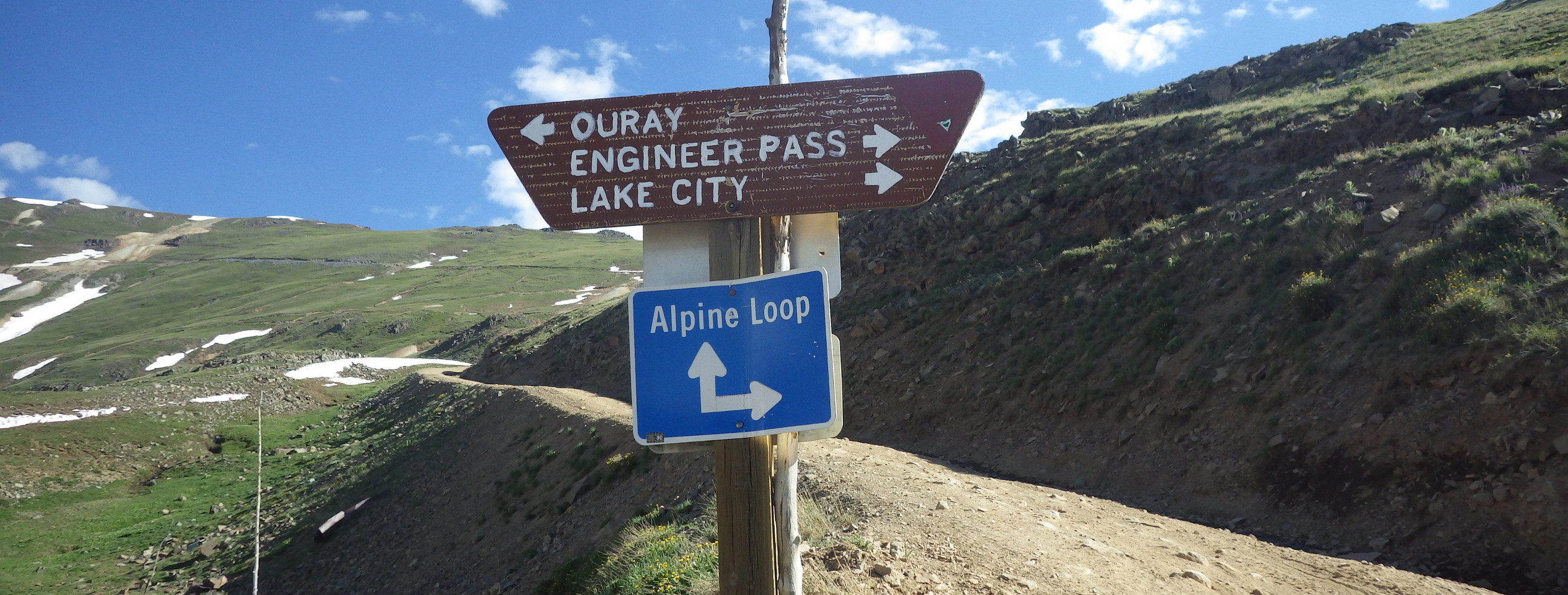
Begin your journey to Engineer Pass by staging from one of the three closest towns: Lake City, Ouray, or Silverton. Each town has refueling options for your vehicle. Anticipate at least a 4 – 6 hour (round trip) drive depending upon your driving skill, route, and weather conditions. This time does not include meeting the cache logging requirements or any sightseeing / side trips you may want to do while in the area. The Forest Service has made a pamphlet that contains a map with safety, regulatory, and travel tips for the Alpine Loop.
Alpine Loop Motor Vehicle Summer Travel Routes
Engineer Pass Description
During the Pleistocene era (approximately 2.6 million to 11,700 years ago) repeated glaciations took place along the Animas River Valley. The glaciers shaped the topography as it is today. Despite ice layers over two thousand feet thick, Engineer Mountain still protruded and became what geologist call a nunatak.
Sometime between 1300 – 1500 A.D., the Ute people migrated to the Four Corners region and pressed on to enter the Rocky Mountains, Engineer Pass and beyond. The Ute that settled this region was the Weeminuche Band. They eventually became the modern Ute Mountain Ute Tribe, one of three federally recognized tribes of the Ute Nation. The Ute did not permanently settle near Engineer Pass, but migrated seasonally between the mountains and lowlands to hunt and gather. In 1765, Juan Antonio María de Rivera was the first European to make contact with the Ute during his exploration of the region for Spain. With the acquisition of Horses from the Spanish, the Ute were able to penetrate farther into the mountains and better establish many of the trails that become modern roads in the area. By the early 1800s, fur trappers and traders from the east began to enter Ute territory. A succession of treaties with the United States reduced Ute territory and forced greater numbers onto reservations. The area containing Engineer Pass was acquired in the 1873 Brunot Agreement, with the first US Army survey team arriving that same year.
Engineer Pass and Engineer Mountain received its name from this 1873 survey team. The survey was sponsored by the Army Corps of Engineers, headed by Lieutenant E.H. Ruffner. Topographic assistant H.G. Prout was the first person to ascend the nearby 12,968-foot summit. Prout originally wanted to name the peak "Mount Ruffner," but LT Ruffner declined and decided to name the mountain in honor of the entire Army Corps of Engineers. In 1877, engineer Otto Mears (who also built the nearby Million Dollar Highway) built Engineer Pass and connecting roads. This toll road was a major route connecting Silverton, Animas Forks, Ouray and Lake City. During the mining boom of the late 1800's, Engineer Pass provided a easier route for miners, supplies and materials to be transported. The Pass was critical for the economy and livelihood of hundreds of people, and still is with the tourism brought into the area by the Alpine Loop.
Virtual Reward - 2017/2018
This Virtual Cache is part of a limited release of Virtuals created between August 24, 2017 and August 24, 2018. Only 4,000 cache owners were given the opportunity to hide a Virtual Cache. Learn more about Virtual Rewards on the Geocaching Blog.