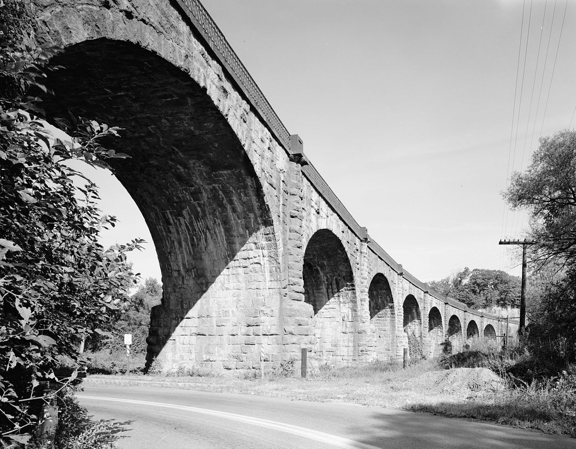
 Thomas Viaduct in 1970
Built in 1833-1835 and still in active use today, the Thomas Viaduct is the oldest multiple-arched stone railroad bridge in the world. It spans the Patapsco River, linking the towns of Relay and Elkridge, MD. It was designed by Benjamin Henry Latrobe II, built by John McCartney of Ohio, and named for the Baltimore & Ohio (B&O) Railroad's first president. It is made up of 8 spans totaling 612 feet in length, and is approximately 26 feet wide and 59 feet high. It is built on a 4 degree curve.
Design and Construction
At the time it was designed, many doubted that the bridge would be able to support its own weight, let alone heavy train traffic. Hence, the nickname "Latrobe's Folly". The bridge has long since proved its detractors wrong, having been in continuous service for over 175 years. It routinely carries 200-ton diesel locomotives towing heavy freight traffic, as well as commuter trains traveling between Baltimore and Washington on the MARC Camden Line. It has survived several major floods, including Hurricane Agnes in 1972.
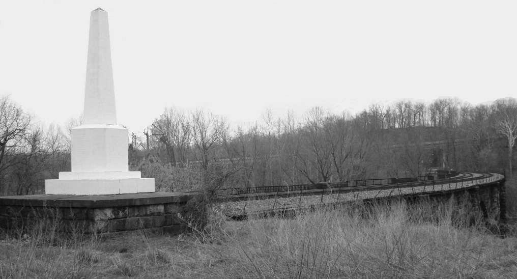 Thomas Viaduct Builders Monument
Construction of the bridge began on July 4, 1833, and was completed exactly two years later, on July 4, 1835, at a cost of approximately $200,000USD (roughly $5 million in 2017 dollars). During construction, over 600 workers set up a camp on the Patapsco flats just downstream of the bridge site. The bridge was constructed from locally-mined Woodstock Granite. When construction was complete, the builders erected a 15-foot obelisk monument at the north end of the bridge, to commemorate the people involved with designing and building the bridge. I've provided a waypoint for anyone interested in seeing the monument up close. Be aware that it is a steep climb from street level, and is close to active train tracks. You do not need to visit the monument to get credit for this cache.
Here is a very well-done computer-generated animation, produced in 2010, which shows how the bridge was built.
Civil War
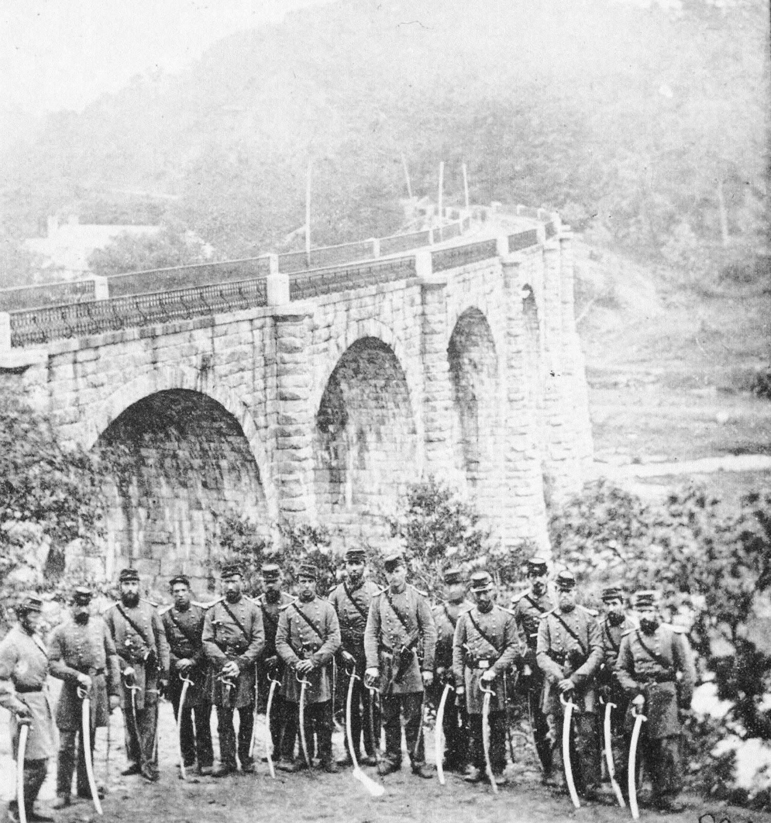 Cook's Boston Light Artillery, 1861
During the Civil War, the Thomas Viaduct and the railroad junction at Relay were strategic points along the B&O Railroad. They provided Washington D.C. with its only direct rail connection to the north, and a main link to Harpers Ferry and the west. Relay was also a gateway to the Patapsco Valley, which contained many mills that were manufacturing equipment and textiles vital to the Union war effort. If the Confederates had destroyed the Thomas Viaduct, rail traffic to the nation’s capital from the north would have been cut off. Recognizing this, the Union placed occupying forces in the area around the viaduct for the duration of the war. The Sixth and Eighth Massachusetts regiments, as well as Cook's Boston Artillery Battery, took control of the railroad junction, Relay House train station, and the Thomas Viaduct on May 5th, 1861.
In addition to guarding the area from attack, the Union forces also guarded against smuggling. Southbound trains were stopped at Relay and searched for arms and supplies destined for Confederate forces in southern states. Many items were discovered and confiscated over the course of the war.
Viaduct Hotel and Station
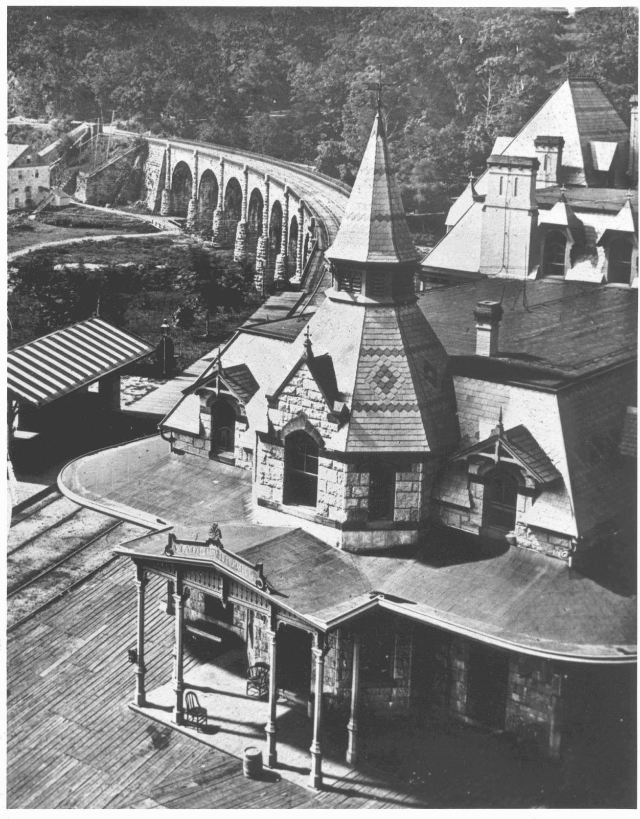 Viaduct Hotel, c.1873-1883
In 1873, the B&O Railroad opened a hotel overlooking the viaduct, on the Relay (Baltimore County) side of the river adjacent to the viaduct builder's monument. The hotel was designed by E. Francis Baldwin, and featured an elaborate Victorian design. It was built from the same Woodstock Granite as the bridge, with accents made from red Seneca Sandstone, and gingerbread woodwork around the windows, gables, porches, and eaves. The roof was made from multicolored slate tile. The hotel served both as a rail station, and a sleepover point for passengers needing to change trains, or wanting a break from their travels. In its heyday, the hotel became popular with vacationers, some of whom spent entire summers there. Sadly, as stopover train traffic declined in Relay towards the turn of the century, the hotel fell into disuse and eventually closed in 1938. It was torn down in 1950.
Although the Viaduct Hotel is gone, many examples of Baldwin's architecture survive. The closest examples are the B&O Railroad Museum central roundhouse, and the B&O Warehouse at Camden Yards, both in Baltimore City.
At the posted coordinates, there is an interpretive sign with additional information about the hotel.
Further Reading
Directions
Driving and parking instructions are taken from Maryland DNR's Patapsco Avalon Area web site.
Enter the Avalon Area of Patapsco Valley State Park off U.S. 1 at South Street, just north of Elkridge (see waypoint). Proceed on Park Entrance Road to the posted coordinates. The Thomas Viaduct is in view behind the ranger station. Park near the posted coordinates, in the driveway/turnaround in front of the ranger station. Note the interpretive signs, and if desired, carefully walk the road to examine the bridge, keeping in mind the danger of the blind curve on the roadway.
Note: Park hours are 9:00am to sunset. If there is a ranger on duty, let them know you are just looking at the viaduct. You should not need to pay a day-use fee. Also, the park sometimes fills to capacity on summer weekends and holidays. If in doubt, check status on the Maryland State Parks Twitter feed (look for tweets referencing "Patapsco Avalon Area"). If you're unable to enter the park to reach the posted coordinates, you may also view the bridge at N 39° 13.251 W 076° 42.825. Be aware that during the warmer months, tree cover can obstruct the view of the bridge from this location.
To claim this virtual cache as a find:
- Send me an email or message through my profile, with the answers to the following questions. Both answers can be found on the interpretive signs at the posted coordinates.
- What is the full name of the person for whom this historic bridge is named?
- What was the date of the quote from the Baltimore Sun by John Randolph Stidman? (month, date, and year)
- Take a photo of yourself and/or your GPSr with the Thomas Viaduct in the background, and include the photo with your log. The photo need not include your face.
You must physically visit the site to claim a find! Please upload your photo(s) and send your email or message within a reasonable amount of time. Logs that do not comply with the requirements may be deleted!
I hope you enjoy your visit to this historic landmark!
Virtual Reward - 2017/2018
This Virtual Cache is part of a limited release of Virtuals created between August 24, 2017 and August 24, 2018. Only 4,000 cache owners were given the opportunity to hide a Virtual Cache. Learn more about Virtual Rewards on the Geocaching Blog.