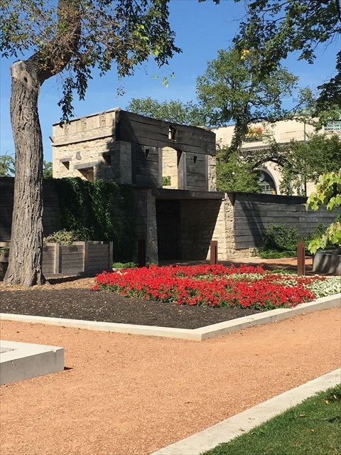
The Fort, built between 1834 and 1837, was the centre of trade for an area that was larger than Eastern Europe and was the administrative and judicial body of the Red River Settlement, which was governed by the Hudson’s Bay Company (HBC). It was also the place where Louis Riel formed the Provisional Government which led to Manitoba entering Confederation as a province.
When the Fort was no longer of economic or military use it was gradually demolished between 1881 and 1888. Only the Governor’s Gate survived. In the 1890’s the HBC responded to a public campaign by agreeing to give the Gate and the small parcel of land surrounding it to the city “as a public park forever.”
Upper Fort Garry Gate has been surrounded by hustle and bustle for over 150 years. Today, as part of an urban park, it stands a stone’s throw from several of Winnipeg’s busiest streets. One hundred and fifty years ago, it watched over the growing Red River Settlement and represented the Hudson’s Bay Company’s political power.
Explore this Amazing Park
We really hope that you will visit this site, discover its many features, learn about our history and more reasons Winnipeg is special. Discover Upper Fort Garry
Download the free App so you can plan your visit and optimize your visit to this wonderful place.
To Claim This Find
Please complete BOTH of the following tasks:
1. Stand at the posted coordinates facing South (which is near the reconstructed gate), take a selfie with the gate behind you and post the photo with your log. For privacy reasons, you are NOT required to include your face if you prefer not. Instead, you may include a sign with your geocaching name OR a GPS OR anything else you wish to substitute.
Move West to the Manitoba Liquor and Lotteries Heritage Wall We encourage you to take in the show that runs every 15 minutes during park hours. More than 400 feet of steel and light, the Wall marks the height, depth and location of Upper Fort Garry’s west wall, which was demolished in the 1880s. Its layers scribe three continuous lines tracing the history of western Canada and of Upper Fort Garry.
2. Include in your log your favourite feature of the Heritage Wall.
You are not required to message the CO in order to log your visit as a find. Please ensure the above two requirements are included in your log.
Virtual Reward - 2017/2018
This Virtual Cache is part of a limited release of Virtuals created between August 24, 2017 and August 24, 2018. Only 4,000 cache owners were given the opportunity to hide a Virtual Cache. Learn more about Virtual Rewards on the Geocaching Blog.
This geocache is located on Treaty 1 territory and the land on which you are visiting is the traditional territory of Anishinaabeg, Cree, Oji-Cree, Dakota, and Dene Peoples, and the homeland of the Métis Nation.