Whites Creek Wetland
 The constructed wetlands beside Whites Creek are designed to remove nitrogen and phosphorus from polluted stormwater.
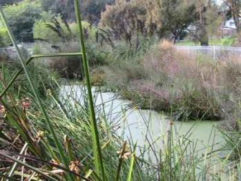
Biodiversity is increased by the creation of a dynamic aquatic ecosystem and the aesthetic features of a popular park are improved. The wetlands are now an excellent field centre for the demonstration of water sensitive urban design.
How it works
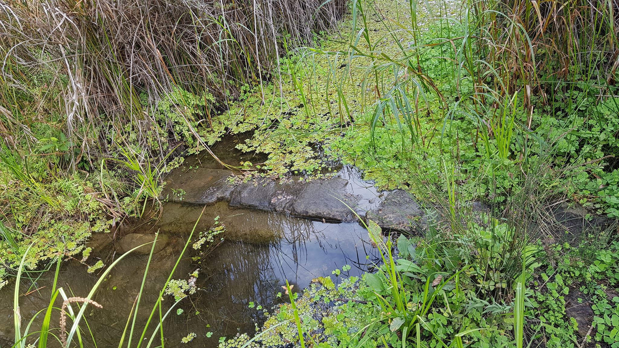
The Whites Creek Wetland system consists of a series of sedimentation ponds. Each has a surface area of approximately 130m² with gradual slopes and a maximum water depth of 0.5m.

Contaminated water and sediments from the Whites Creek channel are pumped up to the wetland by a pump-out system. Water and sediment first enters the wetland system at the southern end of the wetland. Here the sediment in the water is allowed to settle out and the water continues to travel slowly through the remaining ponds in a clockwise direction.
Each time the water passes through a pond the water quality is improved since the nutrients and chemicals contained within the water are absorbed by the plants and soil’s structure within each pond. As the water is slowed down, a natural process of settling also takes place.
Native plants growing in the ponds absorb nitrogen and phosphorous from water and provide shelter and food for insects. The depth of each pond is different, from one third to one half a metre allowing a variety of plant species to survive and add to the biodiversity. The plants thrive best when the water they grow in is well oxygenated.
Frogs and native fish are now breeding successfully. Striped Marsh Frog, Common Eastern Froglet and Perons Tree Frog all add to a loud cacophony of croaking frogs on warm spring nights.
But what came as a real surprise, a true pleasure to all that worked on this project, were the turtles. Not planned, they just appeared soon after the wetlands were first filled, and they have stayed and thrived ever since. Can you spot one?

The Story of Whites Creek Wetlands
Originally the idea of a local resident and Friends of the Earth member, Mr Ted Floyd, the concept of a wetland in Whites Creek had been in the planning stages for many years.
While researching how to restore urban waterways in 1994, he identified a site for the construction of a wetland alongside Whites creek.
Construction of Whites Creek Wetlands took the co-operation of Leichhardt Council, the NSW Government and Environmental Organisations.

Completion of construction was celebrated with an Open Day on Sunday 20th October 2002. Council also initiated a successful community education program which won an Environmental Education award.
Wetlands improve water quality in the harbour by filtering out pollutants and nutrients. Water from the creek is pumped into a first pond where sand, silt and lead fall to the bottom. And proceeds through each pond until the water returns to the creek to continue its journey.
The Earthcache
Sadly, Ted was tragically killed exactly one year ago, in May 2017. Ted was my uncle. His life's work was as a Soil Scientist - a Geologist, a real one. The one time I spoke to him about Geocaching before his passing he was a little underwhelmed by the idea ... until I talked about Earthcaches. He reckoned Earthcaches were good things.
|

Ted Floyd
|
I am honoured to have been one of his nephews, and to now bring people here to this amazing spot and be witness to the fruits of his many years of labour. Maybe we will inspire someone, maybe you, to replicate this amazing inner urban wetland somewhere else.
At the posted coordinates you can easily see the rock weir below that seperates one pond from the next. This allows the water in the ponds to take their time, to settle back and unload their sediments.
To log this geocache send to me via message centre, or email, answers to the following:
1. How many Ponds are there, and why do you think there are that many? (Note: If you are researching this online the counts are all wrong from what I can find. You will need to visit this place and work it out yourself).
2. What shows that the water quality is good?
3. Other than just seperating one pond from the next, these rock weirs do something to the water. What? And why is this such an important help to the function of these wetlands?
Once you have sent your answers, feel free to log your visit online. I will contact you if there are any issues.