ANTOINE PEAK CONSERVATION AREA
Welcome to Antoine Peak! This area has miles & miles of scenic trails to explore! Come check it out. There are LOTS of geocaches to find! There are no motorized vehicles allowed, but you will see hikers, bikers, horseback riders, and in the winter time, snowshoers. Have fun!
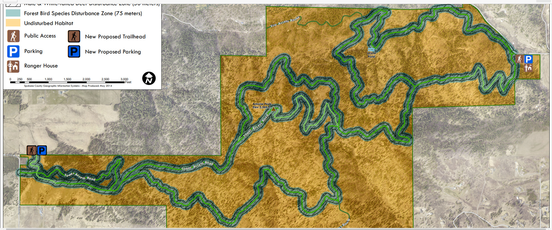
Antoine Peak consists of 1,296 acres of mountainous terrain on the northern edge of Spokane Valley. This conservation area was acquired in four phases between 2007 and 2019, with 50% of phases 1-3 of the acquisition being funded through Washington State Recreation and Conservation Office (RCO) grants.
With 360-degree views from its 3,373-foot summit, Antoine Peak Conservation Area provides unique recreational opportunities, protects critical habitat for the region’s large mammals, and preserves a critical wildlife corridor that connects the Spokane River Valley with Mount Spokane State Park.
INFO:
WEST TRAILHEAD
There is a large parking lot with a large ADA porta potty on the west side trailhead at 15501 E Brevier Road. It has 11 paved passenger vehicle parking stalls, and room for four trucks with trailers. It has more car parking on the gravel, also. There is NON-POTABLE water here. This parking lot has a security camera. I would still be careful about leaving valuables in your car.
EAST TRAILHEAD
The East Trailhead provides limited parking on the east side of Antoine Peak at 19516 E Lincoln Rd and includes some room for passenger vehicles and several horse trailers. Not sure about toilets. Will check on this lot soon and update the page.
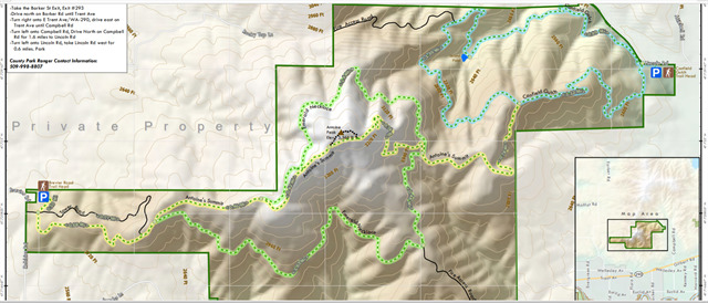
TRAIL MARKER COORDS (from west to east, more or less):
Road Up (fire access road that I like, cool, shaded & gentle, adds.3 mi): N 43.249 W 117 11.705
Road Down (same road, top junction): N 43.198 W 117 11.211
Summit Rd4: N 43.233 W 117 11.739
Summit Trail: N 43.163 W 117 11.232
Summit Rd: N 43.254 W 117 11.113
South Emerald Loop WEST: N 47 43.229 W 117 11.117
North Emerald Loop WEST: N 47 43.295 W 117 10.572
Summit Rd2: N 43.276 W 117 10.562
Summit Rd3 (at top/towers): N 43.530 W 117 10.188
Trail From Summit Rd to Major Intersection: N 47 43.510 W 117 10.087
Very STEEP Cutoff (NO caches): N 47 43.497 W 117 10.114
North Emerald Loop2 EAST: N 47 43.491 W 117 09.765
Trail to Summit Rd/Towers: N 47 43.467 W 117 09.790
South Emerald Loop4 (N Connector): N 47 43.458 W 117 09.797
Connector Trail to East Loops/East Trailhead: N 47 43.432 W 117 09.753
South Emerald Loop3 (S Connector): N 47 43.166 W 117 09.777
South Emerald Loop2 EAST: N 47 43.138 W 117 09.796
Steep Cutoff Trail to Summit (NO caches): N 47 43.169 W 117 09.819
Fire Access Rd (not part of trail system): N 47 43.103 W 117 09.768
Connector Trail to West Trails/West Trailhead: N 47 43.608 W 117 09.295
Trail to West Side: N 47 43.668 W 117 08.649
MY OTHER HIKING CACHES:
Priest Lake
Priest Lake2
English Point
Hawk Hill
Farragut State Park
Missile Site
Liberty Lake
Pend Oreille County Park
Dishman Hills
Iller Creek/Rocks of Sharon
McKenzie
Palisades Park
Round Lake
Slavin
Wolf Trails
Rathdrum Mountain
Peewee Mountain