North Landing Field / Morningstar Field (Y76), Des Moines, IA
This cache is hidden at the location where Morningstar Field was located. You do not need to enter the mine and the cache is easily accessible.
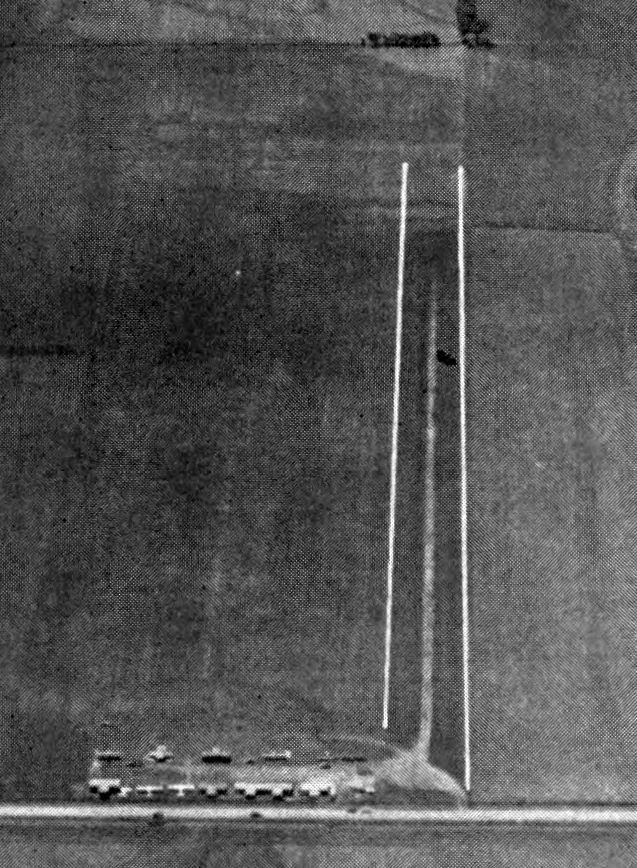
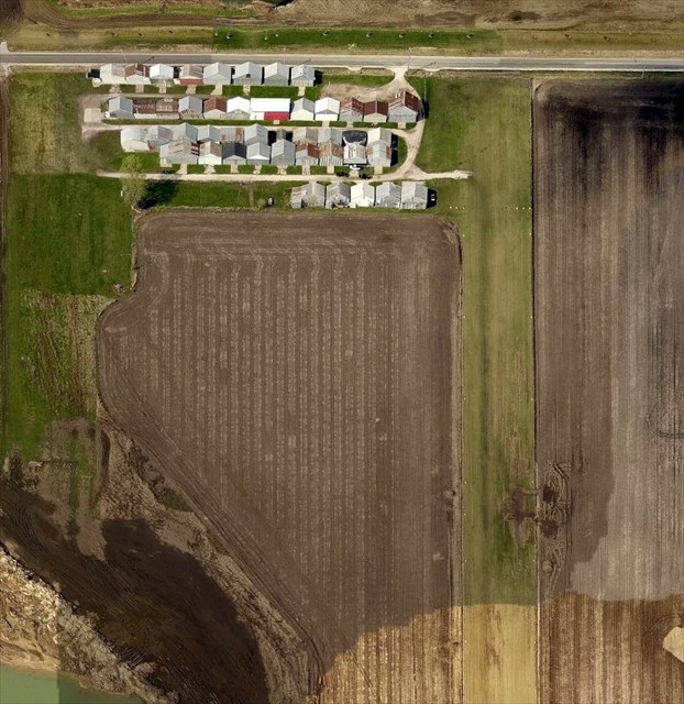
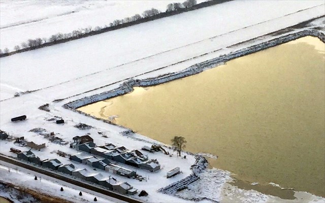
An undated aerial view looking south at North Landing Field from the 1952 IA Airport Directory (courtesy of Lee Corbin).
This small general aviation airport was not yet depicted on a 1938 aerial photo nor on the May 1950 Des Moines Sectional Chart. According to its FAA Airport/Facility Directory data, North Landing Field was established in January 1952.
The earliest depiction which has been located of North Landing Field was a 1955 aerial photo. It depicted North Landing Field as having a single unpaved north/south runway, with a number of small buildings on the northeast side.
The earliest photo which is available of North Landing Field was an undated aerial view looking south from the 1952 IA Airport Directory (courtesy of Lee Corbin). It depicted North Landing Field as having a single unpaved north/south runway, with a number of small T-hangars & light aircraft on the northeast side.

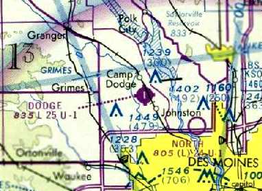
The earliest aeronautical chart depiction which has been locate of North Landing Field was on the May 1955 Des Moines Sectional Chart. It depicted North as a private airfield with a 2,000' unpaved runway.
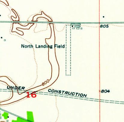
The 1956 USGS topo map depicted North Landing Field as having a single unpaved north/south runway, with 6 small buildings on the northeast side.
The 1962 Des Moines Sectional Chart depicted North as having a 2,000' unpaved runway.
The September 1975 Des Moines Sectional Chart (courtesy of Chris Kennedy) depicted North as having a 2,400' unpaved runway.
Keven Grove recalled, “I took my first flight off this field in a Aeronca Champ at a early age as my mother sat & knitted nervously during my flight lesson nearly 35 years ago”, circa 1980.
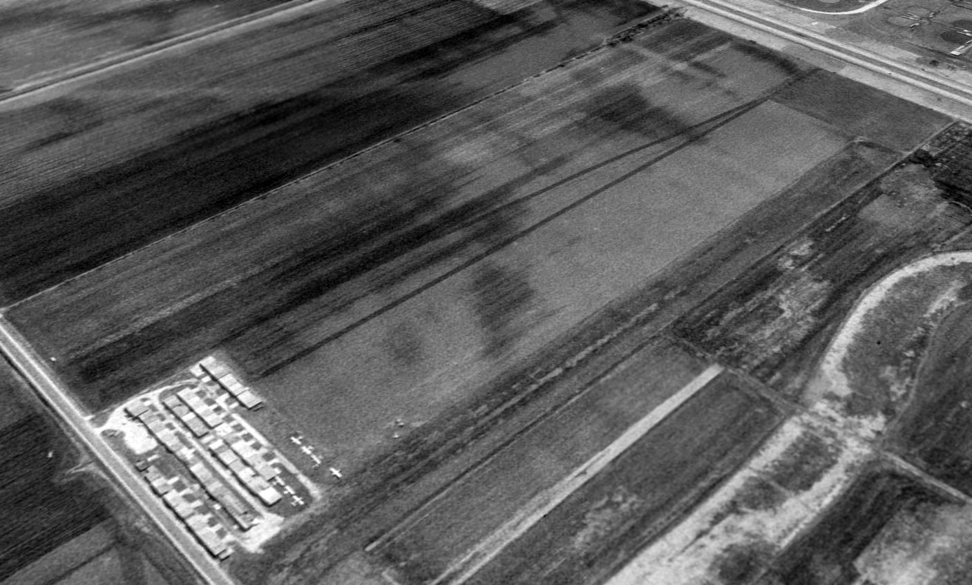
A 1990 aerial view looking southeast depicted North as having a singe unpaved north/south runway, with a large number of individual hangars to the northwest. Seven light single-engine aircraft were visible parked outside as well.
A 2000 aerial view showed the adjacent land use which would eventually spell the end for this small airport - a gravel mining pond had been constructed adjacent to the west side of the airfield.
A 2009 aerial photo showed the gravel mining pond had extended to the western edge of the runway.
At some point between 1975-2009, North Landing Field had been renamed Morningstar Field, as that is how it was labeled on the 2009 Omaha Sectional Chart.
According to Keven Grove, “The Morningstar family owned the land & I think the airfield was on the north portion of it.”
A 2010 aerial photo showed that the runway had been relocated to the eastern side of the property, away from the expanding gravel mining operations to the west.
Keven Grove observed, “The mine was nice enough to allow the airfield to remain a few more years by relocating the runway until they were on its threshold as well.”
A circa 2010 aerial view looking north depicted the large number of individual hangars at Morningstar Field, along with the runway which had been relocated to the east side of the property. There were no aircraft visible outside.
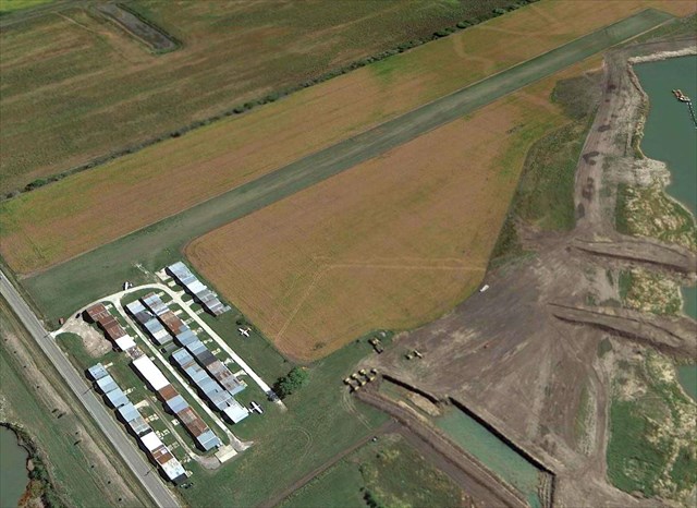
The last photo which has been located showing aircraft at Morningstar Field was a 9/14/12 aerial view looking southeast. Three light single-engine aircraft were visible parked outside the hangars.
The land use which would eventually spell the end for this small airport was visible on the right side - a gravel mining pond.
A 2013 photo of Morningstar Field.
In 2013, the FAA Airport/Facility Directory described Morningstar Field as having a single 2,333' turf Runway 18/36, listed the owner as Martin Benskin, and the manager as Dave Kalwishky. It was said to have a total of 56 based aircraft, and to conduct an average of 54 takeoffs or landings per day.
A 2013 news item reported on the closing of Morningstar Field:
“Morningstar Field has operated north of Interstate-35/80 & east of the Des Moines River for about 60 years. The owner has leased the land to a nearby gravel company, which plans to use the land for mining. The airport will be closed at the end of this month. Morningstar Field is a grass strip with hangars where private pilots kept small aircraft. It had about 40 airplanes housed at the field until pilots learned of the upcoming closure & began relocating to other airports.”

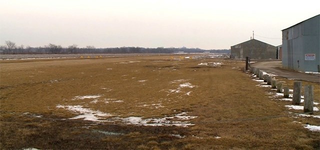
A 10/15/14 aerial view looking southeast shows the gravel mining pond further encroaching on the site of Morningstar Field, but the runway & most of the hangars remained intact.
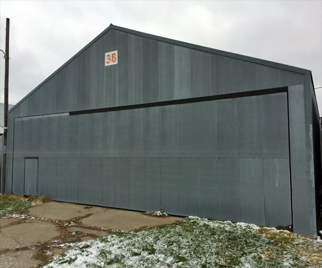
An 11/11/14 photo by Keven Grove at the site of Morningstar Field, showing “the only hangar salvaged for reconstruction. It took us one month to remove, just barely staying ahead of the wrecking crew.”
An 11/28/14 aerial view by Keven Grove looking southeast at the site of Morningstar Field, showing the hangars & runway.
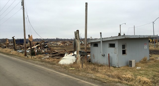
A 12/21/14 photo by Keven Grove of the remains of Morningstar Field, showing “the club house where members gathered for coffee every Saturday morning for over 60 years.”
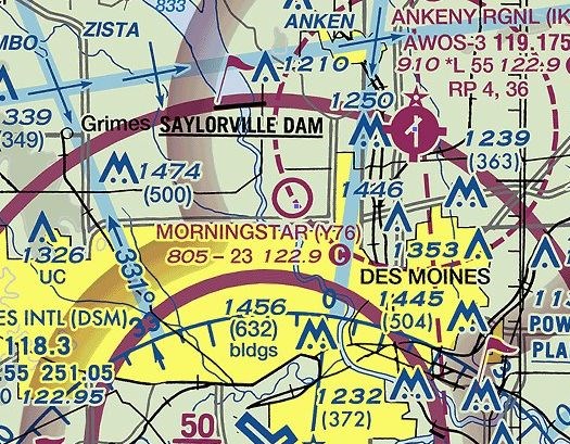
Showing that you can't always trust aeronautical charts, Morningstar Field was still depicted on the 2015 Sectional Chart, more than 2 years after its closure.
Keven Grove reported in 2016, “Morningstar may still be on the charts but is officially closed as a mining company has literally 'undermined the operation'. I bought the nicest hangar of nearly 50 from the field & was the last out. Very sad to the area aviation community.”
The site of Morningstar Field is located northwest of the intersection of Northwest 6th Drive & Interstate 80.

Aviation Caches
Aviation Cache: A-7D Corsair II 71-0213
Aviation Cache: A-7D Corsair II 71-0334
Aviation Cache: A-7D Corsair II 71-0254
Aviation Cache: And Then There Were Three
Aviation Cache: AH-1 Cobra
Aviation Cache: Ames Municipal / Wearth Airport
Aviation Cache: B-17F 42-30535
Aviation Cache: B-17G 42-97224
Aviation Cache: B-24 41-29052 Crash Site
Aviation Cache: The Cyclone Post
Aviation Cache: F-86L Sabre 53-0750
Aviation Cache: Aviation Cache: F-80 Midair Collision 10/22/1954
Aviation Cache: Hap Westbrook
Aviation Cache: Hunter Field
Aviation Cache: I Hear The Choppers Coming
Aviation Cache: Lamotte Air Defense Radar Station
Aviation Cache: MERLE
Aviation Cache: Morningstar Field / North Field
Aviation Cache: NAS Ottumwa
Aviation Cache: NAS Ottumwa Auxiliary Airfield #10
Aviation Cache: The Parakeet Casualty
Aviation Cache: Phantom
Aviation Cache: Scorpion Down - December 9, 1968
Aviation Cache: The Silent Knights
Aviation Cache: T-33 Shooting Star 51-4406
Aviation Cache: T-33 Shooting Star 53-5916
Aviation Cache: T-33 Shooting Star 58-0579
Aviation Cache: Thunderflash
Aviation Cache: Thunderstreak
Aviation Cache: The Vantage