Geocaching.com Caption Contest 31 – Win a Barely Coveted Prize

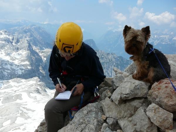
WINNING CAPTION: I pass here every day, but I never noticed this spot. - Irisvo

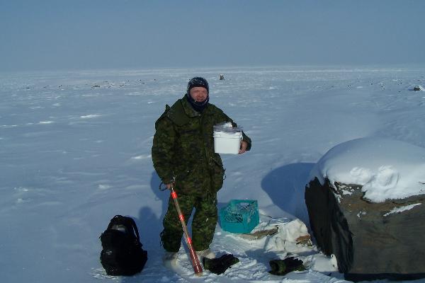
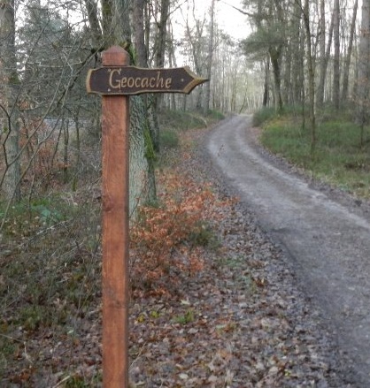
Geocaching can often be journey that involves extreme persistence and potentially a few dozen layers of clothing. The cache you see pictured above is one of the northern most geocaches in the world. It’s located where winter reigns most of the year.

Share your gift for clever captions in the 30th installment of our Geocaching.com Caption Contest. What caption would you write for the picture above? “The geocacher was disappointed to find the only swag in the cache was an ice maker.” The winning caption earns you a barely coveted prize.

A coveted, "barely coveted prize"

Submit your caption by clicking on “Comments” below. Please include your geocaching username in all entries. Then, explore the captions other geocachers have posted.

You’re encouraged to try to ‘influence’ the voting process (*nudge*nudge*). “Like” the caption that you think should win. If you think your caption should win, convince your fellow geocachers, your friends, and family to “like” your caption. Lackeys vote from the top finalists to decide the winner of the contest.

The winner receives this coveted, ‘barely coveted prize’ you see to the left. It’s a rare unicorn-rainbow Trackable.
Click on the image to see the winning caption from this contest

More than a twenty Lackeys voted to award the winner of the 30th Geocaching.com Caption Contest a barely coveted prize. Click on the image at right to discover the winning caption from the last Geocaching.com Caption Contest.

Explore all the past winning captions by checking out all the Geocaching.com Caption Contests. If you have suggestions for Geocaching.com Caption Contest photos, send a message and the image to pr@groundspeak.com.

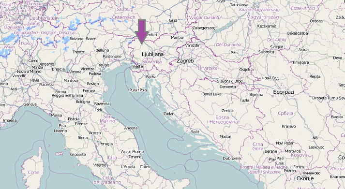
“Triglav 2864” GC14N3H GEOCACHE OF THE WEEK – February 27, 2012

Logging Triglav 2864

Learning some quick Slovenian may smooth your long hike to reach this Geocache of the Week. The cache page for “Triglav 2864” (GC14N3H) shares a couple Slovenian phrases to offer other your fellow hikers as a courtesy. It reads, “When you meet or pass somebody say ‘dober dan’ (good day) or ‘zdravo or zivjo’ (hello).”

Geocachers may also need the phrase, “How far to the top?” The  difficulty 1.5, terrain 4.5 geocache sits high atop a Mt. Triglav. The hike to the geocache and back can take two days.

The peak of Mt. Triglav reaches 2864m (9390 ft) into the cool central European air. The mountain is highest in all of Slovenia and graces the country’s flag.

Geocachers are advised to bring safety gear for the aggressive terrain and extra clothing to adapt to the shifting weather on the mountain. The cache page offers this warning, “Never underestimate the extremes of mountain weather. Check the weather forecast before you go and plan and equip accordingly.”

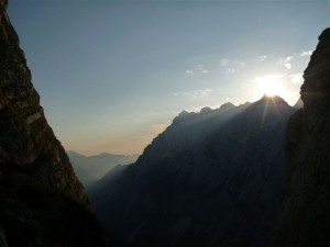
View from near the cache location

Hikers plan their trips  months in advance. The best time to climb begins in July. More than two hundred geocachers have taken the challenge to find “Triglav 2864” since TeMpL Team hide the traditional cache in 2007.

Some geocachers say they overcame fears to find this cache, “So far the hardest cache. I am very glad that I finally decided to [go] up. I do not like heights too, so for me it was a really powerful experience. We had nice weather and it was a very nice view. Thanks for a nice, big cache.”

Continue to explore some of the most engaging geocaches around the globe. Check out all the Geocaches of the Week on the Latitude 47 blog or view the Bookmark List on Geocaching.com.

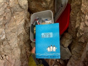
Cache container

If you’ d like to nominate a Geocache of the Week, send an email with your name, comments, the name of the geocache, and the GC code to pr@groundspeak.com.


Groundspeak Weekly Newsletter – February 15, 2012

Here’s a multiple choice geocaching question: The adventure of geocaching goes well with…?

A) Extreme Biking
B) Swimming
C) Zip Lining
D) All of the Above (and more)

If you chose D, you’re right. And you can find geocaching along with these activities at Wild Canyon Games.

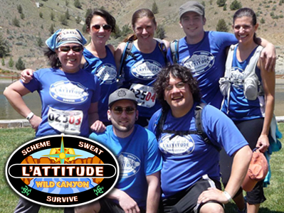
Wild Canyon Games is the ultimate team-based adventure race competition. This weekend event pushes adults to challenge themselves physically, mentally, and emotionally. Teams of adventurers compete in various events, including a triathlon (biking, swimming, and running), adrenaline activities like zip lines and a ropes course, and an intensive geocaching course. The geocaching course at Wild Canyon Games has teams competing to find the highest “point total” worth of geocaches in a limited amount of time. You better train hard and plan your course well if you want to win this geocaching competition – it includes 350 geocaches hidden over 170 square miles.

The Wild Canyon games adventure race gives teams the opportunity to strive for a common goal. Our team of Groundspeak Lackeys had so much fun at last year’s race that we are sending two teams this year. Join us at this amazing event in Oregon, USA. Registration is almost full, check it out at www.WildCanyonGames.org!

Groundspeak Weekly Newsletter – February 22, 2012

Leap Day Geocaching

There’s one thing money cannot buy and all geocachers want – more time to go geocaching. On Leap Day (this February 29), geocachers’ wishes come true; there’s a whole extra day on the calendar to go geocaching! And Geocaching.com is providing an additional incentive to get outside on the 29th – a Leap Day souvenir for all accounts logging a “Found it” or “Attended” that day. You’ll receive the colorful Leap Day Souvenir on your Geocaching.com profile.

You’ll also help in a record-breaking attempt. Last Leap Day, way back in 2008, some 36,696 distinct accounts logged an “Attended” or “Found it” on a cache. We’re aiming to double that number this year with at least 73,392 distinct accounts logging a cache on February 29. In order to count toward the goal, people only have to log a single cache.

More than 900 Event Caches are already planned for Leap Day. If the 25,000 adventurers expected to attend these events log their attendance on the 29th, we’ll be more than 30% of the way toward our goal. But we still need your help in order to reach 73,392! So talk to your fellow geocachers, your friends, and your co-workers; tell them about going geocaching (and logging their find) on February 29. We will be reporting our progress toward the goal on the Latitude 47 blog and the Geocaching.com Facebook page.

As an extra bonus, Premium Members who love to look at their “finds by date” statistics have a rare opportunity to fill in the February 29 square – the 366th day of geocaching!

New Geocaching.com Maps

We are the .35%

A few months ago, Google announced a change to its Maps API licensing structure that requires third-party websites with over 25,000 map loads per day to pay for use of the API. (Visit Google for more details on their pricing structure.) According to Google the new limits should affect only around .35% of maps consumers. Geocaching.com averages about 2,000,000 map loads per day, placing us firmly within that small percentage of affected consumers.

After discussing available options, we made the difficult decision to reduce our reliance on Google Maps and take steps to better integrate Leaflet and OpenStreetMap. This decision was based, in large part, on our ability to bear the very significant cost of licensing Google maps given our high rate of consumption. It was also based on the advantage we gain in many ways using new tools that allow us to grow our technology and the service we provide.

OpenStreetMap Benefits – Enter the Rainbows

and Unicorns

Creative Commons, Community Driven, Constantly Updated

OpenStreetMap is freely and publicly editable in a similar way as Wikipedia. Anyone can change or add to the maps and thousands of people worldwide contribute on a regular basis. As a result, the maps are constantly improving, and as a community we can grow the map database while we geocache.

What happens when a large number of passionate people pull in the same direction? Well, geocaching, for one. Our passionate community grew this hobby from one geocache to more than 1.6 million.

OSM Maps are Good

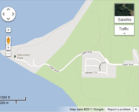
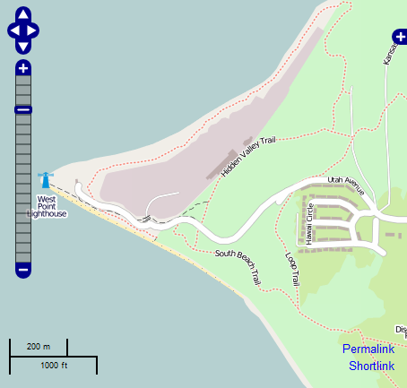
While OpenStreetMap is known widely in Europe, much of the rest of the world is unfamiliar with the mapping software. OSM maps accurately represent location, not only at the street level but also at the level of buildings and infrastructure. Even walking paths in many parks are included. Here is one comparison showing the level of detail provided.

Google Map of Discovery Park
OpenStreetMap of Discovery Park

*Note the dotted-line trails depicted in the OpenStreetMap example. These are hiking trails contributed by Open Street Maps users and are refined on a continuous basis.

New features

Leaflet, the lightweight JavaScript library for tile-based interactive maps, is replacing our current Google implementation. It provides us with more flexibility to offer features that previously had not been possible.  Including:

  • Support for tablets like the iPad and other mobile devices
  • Display of only the caches in a Pocket Query instead of all caches at once
  • Faster tooltips, at any zoom level

We also intend to build out our own tile server in the future which will speed up the loading of map tiles enormously.

Moving Forward

We remain committed to providing great mapping resources to our customers and believe that both the global geocaching community and our website benefit from this change. With ongoing innovation and new technologies being developed every day, geocaching will continue to evolve.

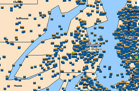
We have certainly come along way. Here is a glimpse of our old maps (circa 2005):

Oh the horror!

You can check out the new maps here.