New country souvenir, Jamaica, with Geocache of the Week: Oyster Bay Jamaica!


- EarthCache
- GC5KZW6
- by Team Mollymap
- Location:
- Jamaica
- N 18° 29.326 W 077° 38.964
Today, we released a new country/regional souvenir for Jamaica. If you have found a geocache in Jamaica, you automatically receive the souvenir on your profile.
Jamaica, an island located in the Caribbean Sea, delights all five of the senses. Reggae, folk, and dancehall music provide an unforgettable soundtrack as the smell of spices and taste of fresh tropical fruits highlight Jamaica’s incredible musical and culinary traditions. The warm blue waters and famous beaches contrast with the Blue Mountains to the east. From the distance, a blue haze lingers over these mountains well-known for the coffee beans that grow there and the highest peak in Jamaica, Blue Mountain Peak.
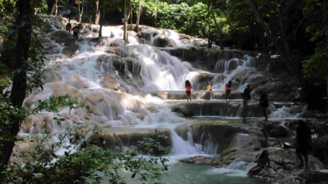
Jamaica offers a wealth of options, and geocachers will be certain to find something that piques their curiosity. Geocachers can see the Blue Mountains and the Caribbean Sea from the top of the oldest lighthouse in Jamaica at GC5YV79. For those arriving by sea from a cruise ship, GC3E27R is a quick find close to the port in Montego Bay.
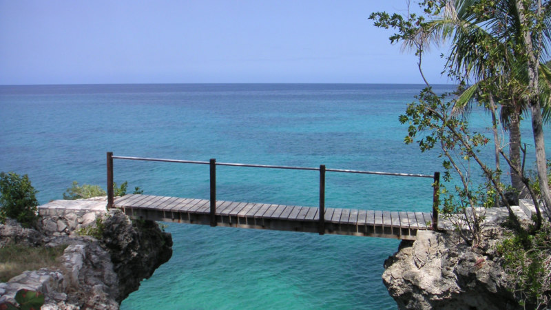
Geology lovers are interested in going to the areas where different geological forces that have shaped the island can be observed. One of these interesting places is the subject of our Geocache of the Week, Oyster Bay Jamaica! (GC5KZW6). This EarthCache focuses on tombolos. A tombolo is a spit, a ridge of sand, that connects an island to the mainland.
Geoachers also travel to Oyster Bay on the north side of Jamaica to observe this geological phenomena. The northern boundary of Oyster Bay is a tombolo. Before the formation of the Bay, Bush Cay was just an island to the north of the shoreline. The EarthCache’s page explains that the current in this area is responsible for bringing sediment from the west and depositing it here to connect Bush Cay to the mainland. This formed the northern boundary of Oyster Bay.
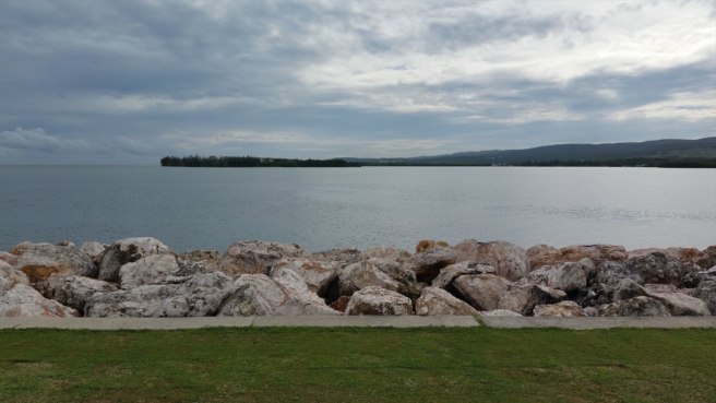
The cache page explains in depth about the currents and the sediments that create tombolos. After reading it, geocachers need to estimate the distance between the western boundary of the Bay and the tip of Bush Cay. Given the science, geocachers will then speculate about how the area will look 200 years from now and which force will be the biggest factor in its appearance. For now, the cache page has over 200 photos from geocachers who have marveled at the glittering water, expansive views, and the new knowledge about this captivating island.
We know geocachers love country and regional souvenirs and we do too! We are releasing at least one new country/regional souvenir per month starting in January 2019. These new souvenirs will be featured alongside Geocaches of the Week in each region and shared on the third Wednesday of each month. Check out all of the Geocaching souvenirs here.
Continue to explore some of the most amazing geocaches around the world. Check out all of the Geocaches of the Week on the Geocaching blog. If you would like to nominate a Geocache of the Week, fill out this form.
