While the bright blue tiled image has the potential to disorient a geocacher, the photo in the center column and the color of the text tie the whole thing together.
Bright blue looks good on Phil Harris…and this cache page.
How do you transform your cache page from blah to rah?
Can you say “Hypertext Markup Language” five times fast?
Check out GC57KW3…it literally sparkles.
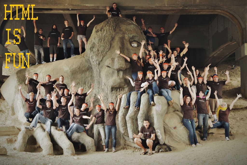
That’s right, we’re talking about HTML, baby.
And we’re talking about it with as much spice as possible, because we know some of you are about to fall of your chairs at the sheer boringness of it all.
Even the HQ’ers think so.
HTML 101
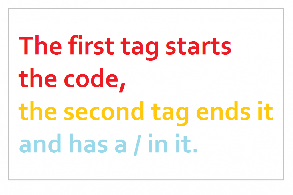
HTML code is created using tags framed by the greater-than and less-than signs: < and > . A piece of code usually uses two of these tags to change the text between them.
You can have colors too. Keep reading.
To make a paragraph break
Enter <p> and </p> on either side of the text in your paragraph.
Give your eyes a rest. Take a (paragraph) break.
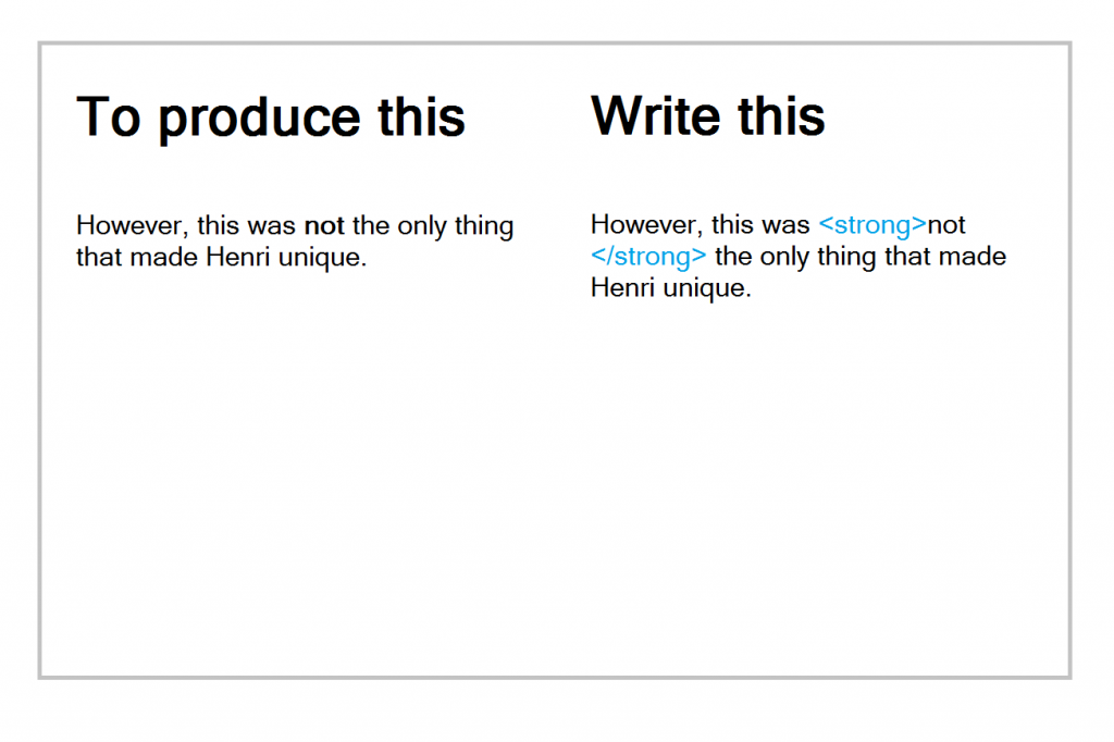
To make something bold
Enter <strong> and </strong> on either side of the text you want to emphasize.
Be bold. Is there any other way?
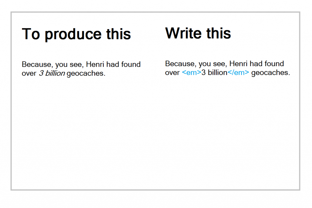
To add italics to your text
Do basically the same thing as with bold text, only use the <em> and </em> tags.
Italics add a little spice, I think we can all agree.
To add both italics and bold
Use both the <em> and the <strong> tags, with their closing tags: </em> and </strong>
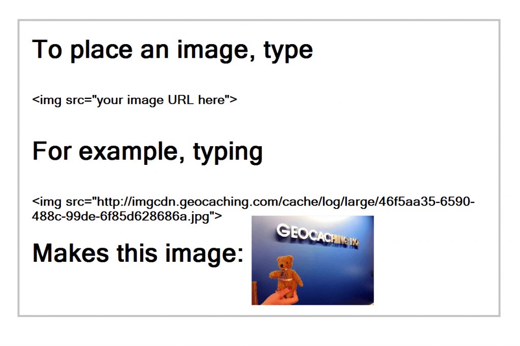
To add an image to your page
Make sure your image is saved to your cache page gallery or is available on the internet somewhere. Find the URL of the image.
To find the URL, open the image in your browser, and right-click to get the URL.
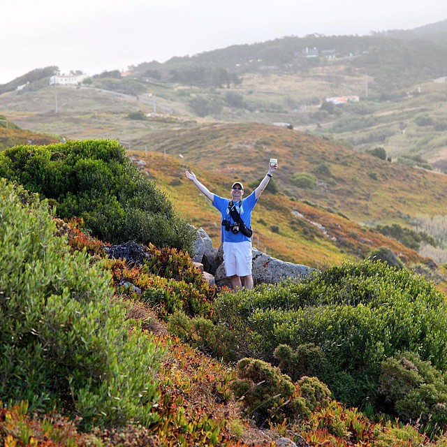
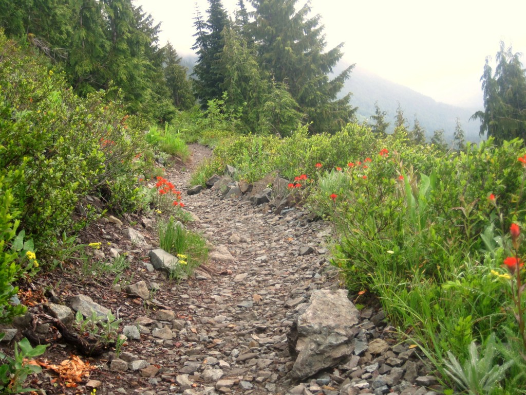
Unless you live on the moon, you’ve probably gone geocaching in some sort of natural area—food garden, arboretum, provincial park, nature reserve, etc. Most areas have designated walking or hiking paths, but it can be sorely tempting to march straight off into the bush looking like Kipling’s Mowgli.
Here are three reasons not to release your inner Tarzan unless you’re in your own jungle oasis (or…potted plant patio).
1) You are a big, strong human, and you will crush the plants.
Are you in the new King Kong remake? If not, then there’s no reason to blunder around crushing things. Your wanderings off the path are likely to leave a trail, one that another geocacher might follow thinking it leads to a cache. By the time the next person finds out your trail doesn’t lead anywhere, they’ve made it look even more like a trail that leads somewhere. You see where this is going. Big strong human, please keep all arms and feet inside the designated trails…
2) Stingy, bite-y, slimy things.
What’s red and green and stings all over? Poison oak, poison ivy, and stinging nettles. And they can really ruin a geocaching party. Keeping to the designated paths (and wearing your cargo pants) is key to avoiding these antagonists of the plant world. Nettles, like human children, are best seen and not heard disturbed.
3) Every step you take…the land manager is watching you.
Alright, so that may be unnecessarily creepy. But it’s the land manager’s job to make sure activities like geocaching are done in harmony with the environmental goals of the area. It’s the geocacher’s job to know what that means for geocaching. It’s true that geocaching in public natural areas is a privilege, not a right. Is this patch of hillside closed-off to protect sensitive species? Don’t go there human! No find is worth being kicked out of a park.
Tell us (and share some pics)…what’s your favorite natural area in which to geocaching?
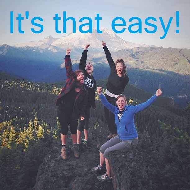
Sometimes, expectations don’t match reality. Sometimes, geocachers are absolutely fine with that.
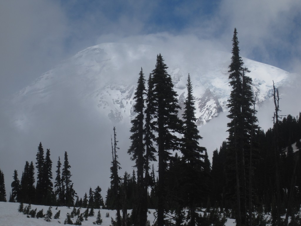
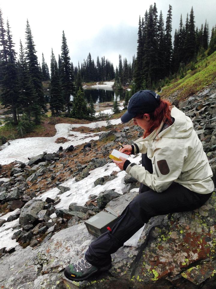
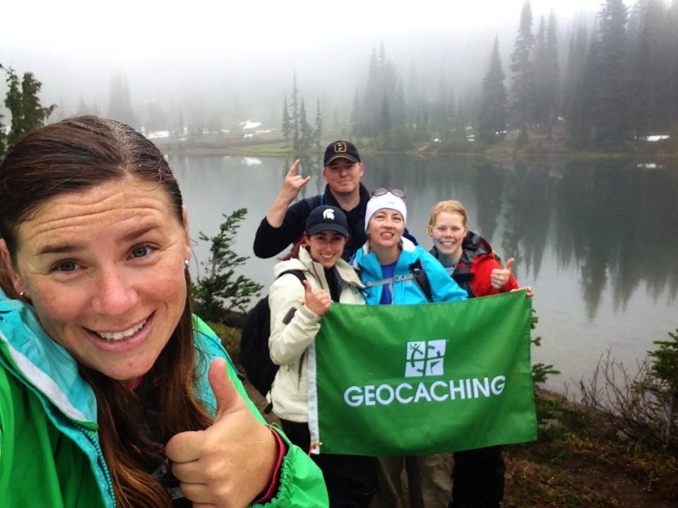
The team of intrepid Geocaching HQ’ers who left Seattle on Friday, June 27th were expecting their weekend culminate in a hike halfway up Mount Rainier. At 10,080 feet in elevation, the Camp Muir hike wasn’t one to scoff at. For five hours, the team would slog straight up rock, ice, and snow. Virtual caches GCA69 and GC1192 would be waiting for them at the top (hopefully holding a sign, flowers, and hand warmers). Logging these, one very old T5 and another very old T4.5, would be the ultimate payoff.
Alas, despite fervent pleas and several bouts of sun-dancing, the team of geocachers was not able to ward off the mantle of clouds that hung over the mountain. When the big day came, Mt. Rainier was to reveal itself for only a few seconds before vanishing shyly again.
At that point, the team found itself on the cusp of failure.
A triple DNF hung across their shoulders—two for the caches, one for the mountain itself. They had no back-up plan, for the hike up to Camp Muir had consumer their very beings. It was the only ascent they’d considered, the only slope they’d trained for. The team was inconsolable.
Inspiration hit them like a bison charging down a mountain. What do geocachers do when they DNF? They break into song of course.
Explorers, sleuths, adventurers,
finders, keepers, hey!
We the brave, the geocachers,
three dozen finds per day!
The song, which was sung to the tune of “Ronda Alla Turca”, rallied the team immensely. They realized what they had to do to cancel out their DNF: find some more geocaches! Unsurprisingly, the surrounding cliffs, valleys, trails, rivers, and lakes were dotted with geocaches of every type. In little time, the team was hiking merrily along a thin, winding trail rimmed with wildflowers. The prospect of two more caches at the end of the trail lifted their spirits immensely.
The team thought about all the reasons they loved geocaching, and added one more to the pile: A DNF isn’t synonymous with failure. Lots of things can get in the way of a find. Weather turns south. Batteries die. The dog eats all the snacks. Does that mean the adventure is over? Nope!
Three tips to DNF a DNF
1) Bring a friend. Someone with Pollyanna-style enthusiasm will do nicely.
2) Look around. Are there other caches nearby? Go find ’em.
3) Plan for a return trip. A DNF isn’t a permanent status.
4) Try singing the song mentioned above. Try singing anything to the tune of Ronda Alla Turca. It will cheer you up, we promise.
Remember that time we wrote about an FTF after 12 years? Maybe we weren’t being specific enough. That was a FTF after 4,337 days.
Geocachers are born to break records, to test limits, to push boundaries. So when four guys set out in a boat on a journey to an obscure island to find a geocache with impossible odds, we were excited, enthralled, even impressed. But we were not surprised. No, never surprised. The need to seek adventure is in a geocacher’s very DNA.
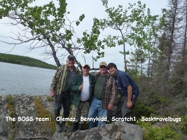
First rule of geocaching as a team: find a good team name.
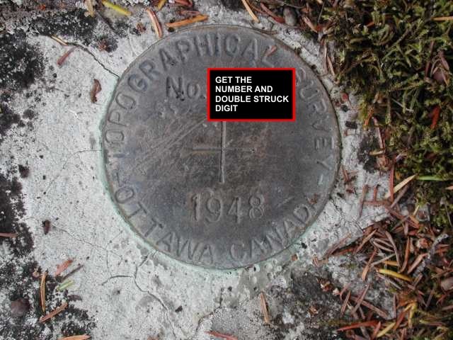
SK Extreme 01 is a virtual geocache on an uninhabited and unnamed island in Brabant Lake, in northern Saskatchewan. Note that Saskatchewan is just about twice the size of Germany—making the island a needle in a big Canadian haystack.
The geocache was published on Geocaching.com in 2002 by geocacher KenJamin, who was staying on the island during a guided canoeing trip. He found a topographical survey benchmark and, realizing that Canadian benchmarks weren’t published online like American benchmarks, thought it would make a good virtual cache.That’s the type of geocache for which one gathers information at a site, rather than finding a physical hidden container.
KenJamin says the virtual would be the start of a series of extreme geocaches. “The kind of caches that drew me to geocaching in the first place.”
Twelve years and zero finds later…
Team BOSS, a group of geocachers consisting of bennykidd, olemaz, scratch1, and sasktravelbugs, planned a trip. Snow and ice would force them to delay their adventure until spring. Their journey would begin with a drive from Saskatoon to Brabant Lake, a route so long and remote even Google Maps doesn’t dare plot it. And they knew the drive itself wouldn’t be a picnic. Says Olemaz, “We had heavy rains in Southern/Central Saskatchewan and if we had the same rain that far North, roads could have been treacherous. ”
Once at the lake, which is shaped more like a trailing globule of drool than a water feature, they’d cross the water in a rented boat to the island—the site of the cache. Rain, fog, and wind were of primary concern on this stretch of the journey.
Of course, these things don’t usually go as planned.
Team BOSS had, “perfect weather, perfect roads, and a perfect landing.” And the benchmark itself? It was “a fairly quick find.”
The real challenge came when the team was forced to wait to return to an area with cell service before making the phone call to KenJamin. The reward, however, was spectacular. “The phone call to the Cache Owner, KenJamin, for his required answers made our day as we knew we’d catch him off-guard and he would be stunned.”
Benchmark Island, SK
And he was. “I vividly remember receiving the call from Team BOSS. I think olemaz said the digits from the benchmark followed by the key digit, and words to the effect of ‘does that mean anything to you?’ I admit I was stunned and didn’t make the connection at first. I paused and thought; then it suddenly stuck me and I blurted out ‘No Way!'”
Gold, guts, and glory?
Not quite. Despite this, olemaz says there was great deal of excitement and adventure for sure. “The best moment of the trip was seeing the beauty of nature in this world and the camaraderie among geocaching friends having fun.”
What’s next for Team BOSS?
Among other things on a long, long bucket list…
Olemaz wants to complete the Jasmer Challenge—to find one geocache hidden in each month since May 2000. He is only four finds away.
Scratch1 plans to find a geocache in every province and territory in Canada. When that’s done, he’ll find a geocache in every state in the U.S.
Bennykidd is just going to go out and find more geocaches, all over, from one coastline to the other!
Sasktravelbugs has the last “APE” geocache in Brazil in his sights. He also needs to find caches on only one more continent to complete the 7-continent challenge.
And KenJamin?
“As I reflect on this, the first cache in the series, I recall and appreciate all the great logs and pictures I have received as a result. The three caches and the cachers that have visited them have made the distance, hikes and effort to place them repaid ten fold. As far as my future geocaching adventures go I have ambitions for areas in and around Arches and Grand Canyon National Parks. Cache recommendations would be appreciated.”
You might think this is an ordinary pier in Blaine, but GC2VW16 is nearby.
You’ve read about geocaching in far off lands, on ships and mountains…even in space. Wild, exotic geocaching stories make the news so often, that sometimes they seem more common than, well, the commonplace.
But for once I’m tired of palaces and underground tunnels! I’m even tired of spaceships! We’re going geocaching in the most exciting place of all—this geocacher’s home coordinates.
The small town of Blaine is packed so tightly into the northwestern corner of Washington state that it looks like it’s hiding from the rest of the country. The town itself feels that way too—which is odd, considering a population of around 5,000 and the presence of two international border crossings. It doesn’t seem like the type of town where anything terribly exciting is likely to happen. I grew up in Blaine, so you’d think I would know.
Turns out, all it took was a weekend of geocaching in Blaine to completely derail my perspective.
Over the course of two days, my mom, dad, sister, and I made 15 finds and 4 DNFs. (For all you hard-core geocachers out there, stop your scoffing! These are impressive numbers. My 16-year-old sister had recently come into possession of her learner’s permit and was driving us for the very first time. For once I was appreciative of my town’s severely conservative speed limits.)
Those 15 finds were accompanied by three realizations about why my hometown was the best place I could possibly go geocaching—and why the same is probably true for you.
1) Learning new things about old places
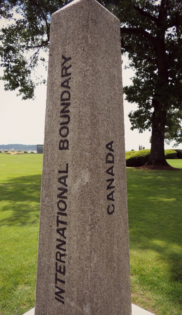
GCD65A, Canada, and the United States of America all share this area of land.
The Peace Arch (yes, there’s an actual arch) that stands on the international boundary between Blaine, Washington and Douglas, British Columbia, is supposedly one of the first earthquake-proof structures in North America. Had I not gone geocaching at the Peace Arch, it’s likely I would have continued to lose sleep over the fate of unsuspecting border-crossers in the event of an earthquake.
2) Writing logs with a personal touch
It turns out writing a log for a geocache in a place you know is very different to writing a log for a geocache in a place that’s new to you. When caches take me to new places I find myself writing with much the same sentiment: “Beautiful spot! Never been here before, but now that I know it’s here…” And so on. In Blaine, I found myself adding my own memories of places to my logs. I wanted the CO’s to know that I too really loved this spot, because of that one time we jumped off this pier in the middle of winter…
3) Revisiting old memories
Blaine is a small town. Spend fifteen years there and you’re bound to have a memory tied to every lamppost, street corner, and homeland security office. One geocache took me to the forest where I first met one of my best friends on a field trip. Another took me to the sewage treatment plant they built to replace the one near my house. Both good memories, happily re-lived in the name of geocaching.
So what’s the take-away here?
Blaine really is a lovely town, worth more than a drive through on your way to Vancouver or Seattle. Geocaching at home can be as rewarding an experience as something more fanciful and exotic. And, whoever decided that learning to drive at 16 makes sense clearly never met my sister.
What’s your geocaching at home story?
This is right between a sewage treatment center and GC3A175,