“Hey, I can see my house from up here.” Photo by geocacher devilmanrocco.
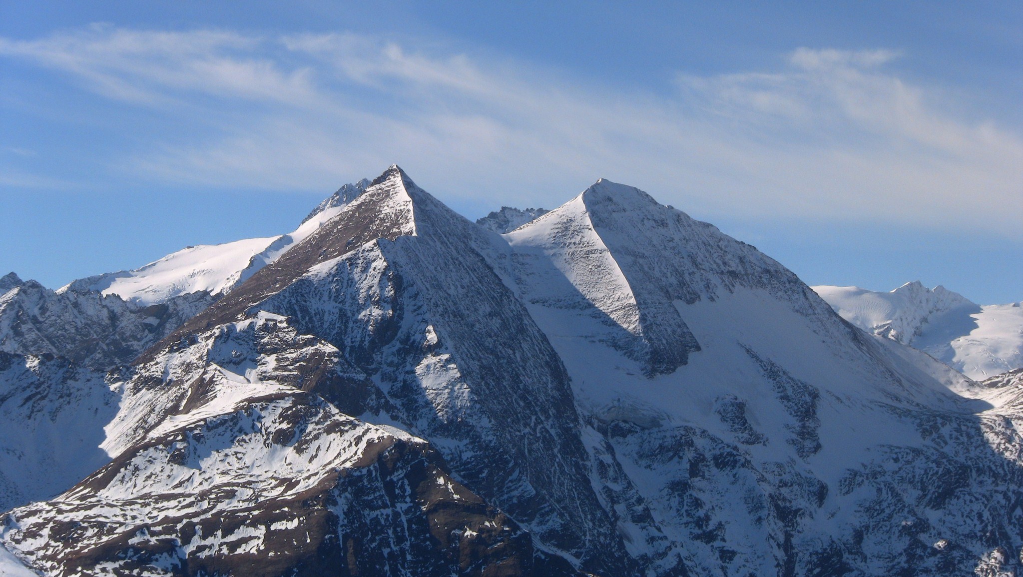
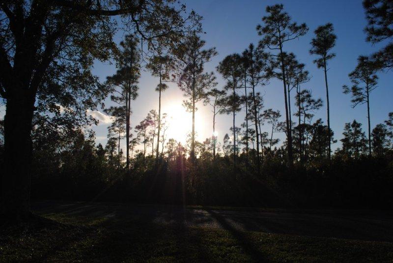
At 12,461 ft (3798m) the Grossglockner stands proudly as Austria’s tallest mountain and the tallest peak in the Alps (east of the Brenner Pass). Though incredibly impressive from afar, those that dare can take a closer look with the Grossglockner High Alpine Road—a winding stretch of mountain road that takes you through 36 bends to a top altitude of 8,215 ft (2,504m). From the Kaiser-Franz-Josefs-Höhe Visitors Center, you can look out on some of the highest peaks in the alps—and log a smiley for Way to Heaven (GCPJDZ).
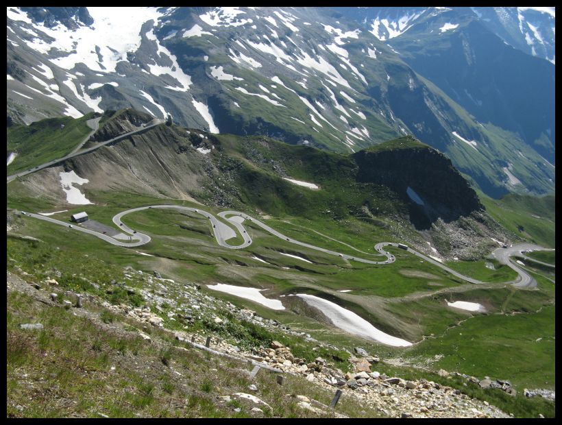
The Grossglockner High Alpine Road. Photo by geocacher Milancer.
The Grossglockner High Alpine Road loosely follows ancient trade routes through the mountains that were used by the Celts and Romans. The idea for the road was first envisioned in 1924 and the first version, a 3-meter-wide gravel road, was completed in 1935.
Now, nearly 900,000 visitors per year make the trek through the mountains. This geocache has a difficulty and terrain rating of 3.5, however, if you want to kick both of those rating up a notch, you can travel up the Grossglockner High Alpine Road by motorcycle or bicycle.
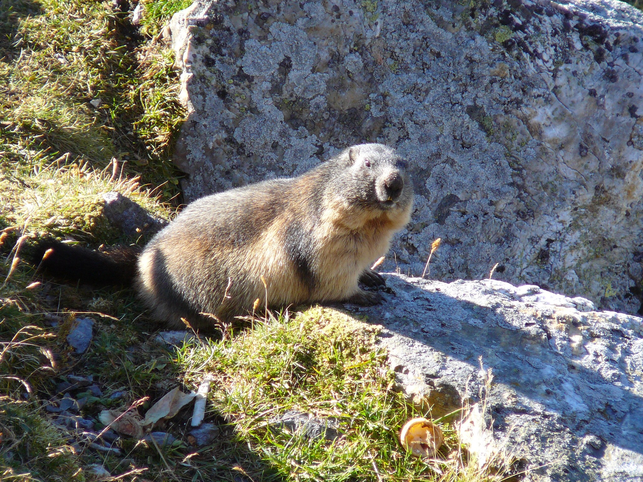
Watch out for marmot muggles! Photo by geocacher parda.
Many of the “found it” logs (and even some of the DNFs) mention one thing: the incredible view. “Took a drive up the Grossglocker on a cold and rainey morning, skipped this area and saved it for the way back after heading to the Glacier. Got lucky as the view opened up on our return a little (before clouding over again quickly)…What a great location, so glad we came here,” wrote geocacher stephia4 in her “found it” log. When asked why he thinks geocachers love this destination so much, the geocache owner, Quaxi, said, “I think the reason for most of the travelers is to pass through a unique world of mountains with blossoming alpine meadows, fragrant mountain forests, massive cliffs and eternal ice to the foot of the Grossglockner, the Kaiser-Franz-Josefs-Höhe.”
The Grossglocker High Alpine Road is closed during the winter, but should be opening next month. If you’re in Austria during the summer, this geocache is a must-find. For more information on the road and to see webcams, visit the official website. As with many geocaches, this hide is all about the amazing views. What’s the most incredible view you’ve ever had while finding a geocache? Tell us in the comments.
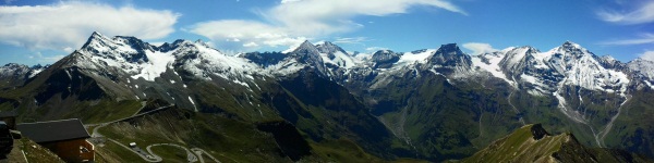
A panorama from GZ. Photo by geocacher js_plasma.
Continue to explore some of the most engaging geocaches around the globe. Check out all the Geocaches of the Week on the Geocaching blog or view the Bookmark List on Geocaching.com.
If you would like to nominate a Geocache of the Week, send an email with your name, comments, the name of the geocache, and the GC code to pr@geocaching.com.
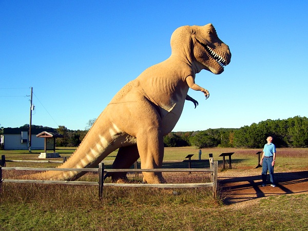
Staring contest, you and me. Go. Photo by geocacher Indigo Parrish.
Millions of years ago, a sea covered a large portion of the land that is now the United States. During this time, dinosaurs called Sauropods and Theropods roamed North Texas. Some experts* say they were geocaching, potentially looking for terrain five geocaches. These giant reptiles left footprints in the soft mud that have been preserved for millions of years. And until this documentary becomes a (terrifying) reality, finding the Dinosaur Valley Earthcache (GCQMHY) might be as close as we can get to living dinosaurs.
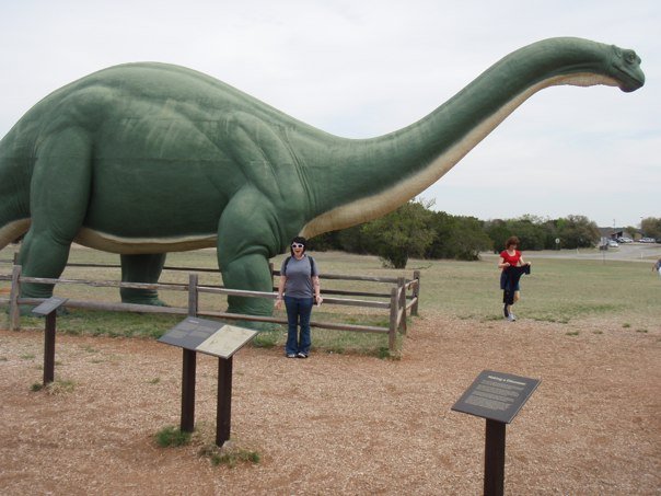
Mrs. Scattermycaches excited to be at the park’s entrance.
The dino footprints that you’ll see while you’re in the park were made about 113 million years ago during the Cretaceous period. The tracks were discovered in the early 1900s, however they did not become famous until 1937 when palentologist R.T. Bird saw them while collecting fossils. Bird continued exploring the Paluxy River looking for more prints and eventually uncovered a large Sauropod and Theropod trackway.
As you follow in the footsteps of these dinosaurs, you might be wondering what these beasts looked like. The three-toed footprints are most likely from Acrocanthosaurus, a smaller relative of T-Rex. These meat-eating, giant lizards were about 20–30 feet long.
Discovering Theropod tracks. Photo by geocacher Silver Fox 62
The round and smaller hoof-like footprints come from Sauropods. This group of dinosaurs are large plant-eaters that walked on all fours. Bones found in 1996 led to the discovery that the tracks belonged to a new species of dinosaur: Paluxysaurus jonesi. At 60–70 feet long and 12 feet tall, these giants became the official dinosaur of Texas in 2009.
To earn your smiley for this Earthcache, you’ll have to answer a few dino-related questions. Although the questions aren’t easy to answer, that hasn’t deterred geocachers from experiencing this amazing place. “We love Earth caches for the education that they provide, and this one was no exception. It was amazing to walk in the same footsteps as the dinosaurs!” said geocacher BANDA in their log.
These amazing tracks were discovered by someone searching in the woods. What’s the most amazing (and appropriate) thing you’ve discovered while searching for a geocache? Tell us in the comments.
Continue to explore some of the most engaging geocaches around the globe. Check out all the Geocaches of the Week on the Geocaching blog or view the Bookmark List on Geocaching.com.
If you would like to nominate a Geocache of the Week, send an email with your name, comments, the name of the geocache, and the GC code to pr@geocaching.com.
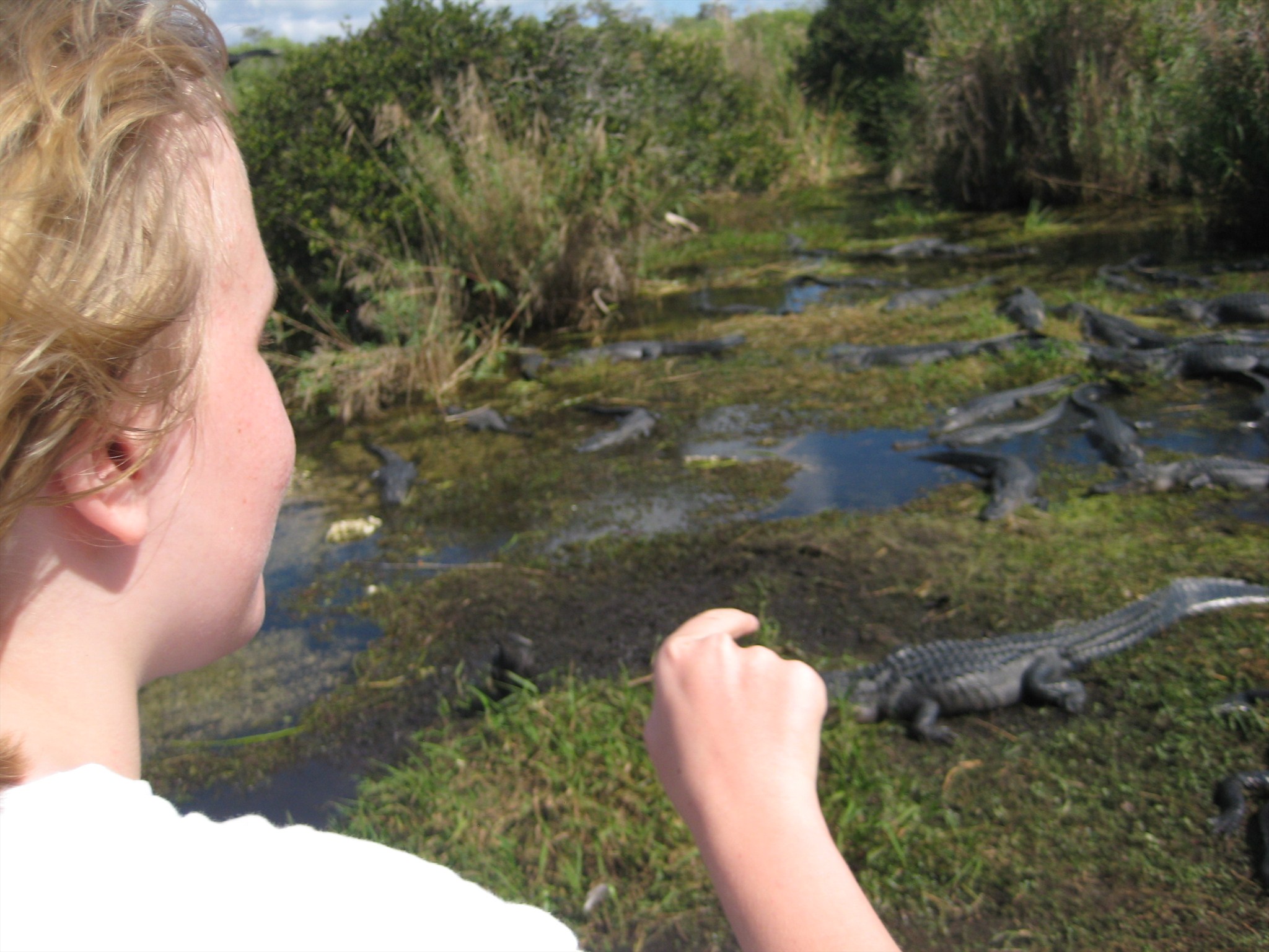
Counting some of the Everglades’ natural residents. Photo by geocacher lilyfly.
Getting plenty of fresh air, enjoying beautiful scenery, exploring wondrous destinations—United States National Park Rangers have a job that many of us dream about. However, it’s not all fun and games. Park rangers work tirelessly to help preserve natural areas, protect endangered species and ensure visitors enjoy their experience. This week’s Geocache of the Week is the Park Employee for a Day Geocache series (beginning with GC42GX2), which put you in the well-worn boots of a Park Ranger in Everglades National Park, Florida, USA.
This geocache series is relatively new and ranges from 1.5–2.5 in difficulty and terrain. Most of the geocaches were placed in January 2013. However, just because these geocaches haven’t had a whole lot of time to rack up Favorite Points, we can tell that this series will be loved by the community. “So far, the caches have been wildly popular with visitors…we’re getting good qualitative feedback from visitors about the real-world issues we’re asking them to consider. Visitors are chiming in on how we should respond to climate change, protect imperiled species, and manage risks from wildlife. This sort of back-and-forth conversation is an exciting new departure from traditional ranger programs found at most national parks,” said Larry Perez, the U.S. Park Ranger in charge of the series.
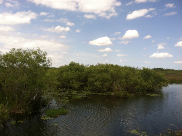
A nice view of the Everglades. Photo by geocacher JunglePete.
The Park Ranger for a Day geocaches are some of the very few geocaches that are placed within a US National Park. Geocachers will be able to experience more than just another find—they’ll be able to see the park through the eyes of a ranger. The series begins with a simple park and grab geocache that contains information about the other geocaches, as well as their coordinates. Each geocache then presents a different, real-world scenario that Park Rangers could face. “The issues we ask our visitors to consider are ongoing, real-world challenges for our park personnel. The series helps expose visitors to the “behind-the-scenes” work–both past and present–that has been undertaken by many of our rangers. These include dealing with invasive exotics, managing large wildfires, and planning for the future in light of sea level rise,” said Larry Perez.
Geocachers share how they would handle the situation in their logs. So far, the geocachers that have made the trip to southern Florida have enjoyed the series. Geocache lilyfly had this to say, “Thanks to the NPS for being willing to take chance on us geocachers. These caches were all placed in excellent locations where minimal impact will be made. The challenges presented really helped give a glimpse to the different issues facing the NPS. We loved it! THANK YOU!”
A beautiful Everglades sunset. Photo by geocacher auyantepuy.
We’re excited about having a series of geocaches in a U.S. National Park. Which U.S. National Park would you like to see geocaches in next? Let us know in the comments.
Continue to explore some of the most engaging geocaches around the globe. Check out all the Geocaches of the Week on the Geocaching blog or view the Bookmark List on Geocaching.com.
If you would like to nominate a Geocache of the Week, send an email with your name, comments, the name of the geocache, and the GC code to pr@geocaching.com.
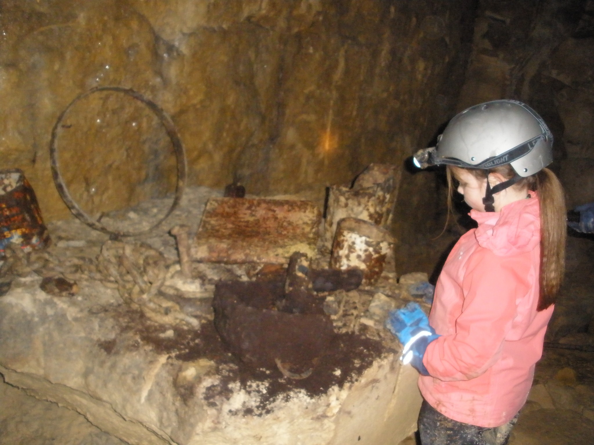
Technically, a geocache can’t be buried—but that doesn’t mean it can’t be underground. The Below Above series, hidden by geocacher BareClawz, takes daring geocachers on a subterranean adventure through abandoned quarries in southwest England, United Kingdom. This week’s Geocache of the Week is Below Above – The Fallen Monarch (GC2GAMT). This difficulty 5, terrain 5 geocache isn’t for the faint of heart—or the claustrophobic.
The Saucepan Man negotiates a tight squeeze while searching for The Fallen Monarch. Photo by geocacher the merry moomins.Wear a helmet. Seriously. Photo by geocacher *geocass*.
The adventure begins with your smartphone or computer—geocachers must figure out clues to find the correct entrance and the correct path to the geocache. From there, it’s time to build up your courage, don your hardhat, check the batteries in your headlamp, pack your geocaching toolkit, and venture into the abandoned (by all except cavers and geocachers, that is) quarries.
As much time and dedication as it takes from geocachers to find these geocaches, creating them is even more difficult. “I have been exploring the quarries for many years and have got to know them quite well, surveys (maps) are also available and using my knowledge combined with the maps I work out a route that I think novice explorers could follow without getting lost, injured or hurting themselves. I then check the route by walking it myself, altering and editing it and then walking it again. When I am finally happy with the route I get a friend, usually a geocacher, to walk the route just following the route I’ve written out. I accompany them and if necessary rewrite parts as needed. Finally it gets fully written up and submitted for publication. This process can take up to two months per cache! I have to consider that people of various levels of underground skills follow these routes to find the caches at the end,” said BareClawz, the geocache creator.
Notes left by miners. Photo by geocacher *geocass*.
During the underground journey, geocachers come across all sorts of artifacts from when the quarries were active. One look at the geocache’s photo logs and you can see everything from boots to old tools to comments written on the walls from the miners that once worked in the caves. And sometimes you come across things you wouldn’t expect, when asked about his best stories while exploring the quarries, BareClawz recalls, “One classic is being in a quarry one evening and finding two lost cavers and guiding them out and to safety. In another quarry I thought I’d found the body of a caver, it turned out to be an old boiler suit on a dummy left years ago by previous cavers as a joke.”
A brave explorer with subterranean artifacts. Photo by geocacher tarmacjohn.
Geocaching takes us on adventures to places we never knew existed. In this case, it’s abandoned quarries. What’s the greatest adventure that geocaching has ever taken you on?
This geocache was submitted by geocacher *geocass*. If you’d like to read more about the whole Below Above series (and see more photos), check out her blog. Also, the Below Above series is extremely popular and highly regarded by the geocachers that have found it. So much so that it has its own Facebook Group.
Continue to explore some of the most engaging geocaches around the globe. Check out all the Geocaches of the Week on the Geocaching blog or view the Bookmark List on Geocaching.com.
If you would like to nominate a Geocache of the Week, send an email with your name, comments, the name of the geocache, and the GC code to pr@geocaching.com.
“The Cathedral” This is located in another one of the Below Above series: Multi 2 (GC2K97V). Photo by *geocass*.
Congratulations on making it down this far! Your prize is a few more Q&As with BareClawz, the creator of the Below Above series:
What inspired you to place these geocaches?
I created the way to set the Below Aboves as a way of combining my two favourite hobbies,geocaching and exploring the old quarries locally with fellow geocachers who some had no idea that these places existed or that there was a way of seeing them. There were a couple of early attempts that led the way to the standard that the current have reached. These were aimed at local cachers and I had no idea that their fame would spread so far and to so many people.
How did you navigate the quarries for the first time?
Initially I got some caving friends to show me the quarries but that was before the first of the Below Aboves and several years ago. I always follow the safety guidelines and tell somebody where I am and how long I intend to be. Then set off with my experience and a map. Initially I did get lost a few times but I can soon work out where I am and don’t panic.
Most of the geocaches in the Below Above series are D5/T5, do you typically like to find similarly difficult geocaches?
I enjoy riddles, puzzles etc and have solved quite a few to find caches but so far no 5/5 caches but I do plan to remedy that soon and find some as soon as I get the chance.
What’s the most interesting artifact you’ve come across while down in the quarries?
There are so many artefacts underground that it’s hard to pick one. Each quarry is different and unique. BA – Mind The Trains I like the railway tracks, but also the water troughs, these appear in Fallen Monarch too, Multi 2 Cathedral is such an awesome sight but the things I like most and spot new ones of in almost every trip are the graffiti comments left by the old workers, some of these date back to the early 19th century. Names of the workers, comic drawings, comments and that sort.
Do you have any crazy stories from when you were placing the caches?
Yes, lots. One classic is being in a quarry one evening and finding two lost cavers and guiding them out and to safety. In another quarry I thought I’d found the body of a caver, it turned out to be an old boiler suit on a dummy left years ago by previous cavers as a joke.
The best memories though are guiding a team of geocachers one year on the day of my birthday and one of the team was a cacher called Ambrel and just after he signed the logbook he presented me with two coins and explained these were what is recognised as Ambrel Top Cache Awards. I now hold 5 of these, one for each of the Below Aboves. Soon I hope that will be 6 as a new Below Above has just been submitted and more are planned over the next few months.
My greatest reward though is the thanks I get mailed by geocachers and reading the logs finders write of their adventures. They say a lot more that TFTC TNLN lol.
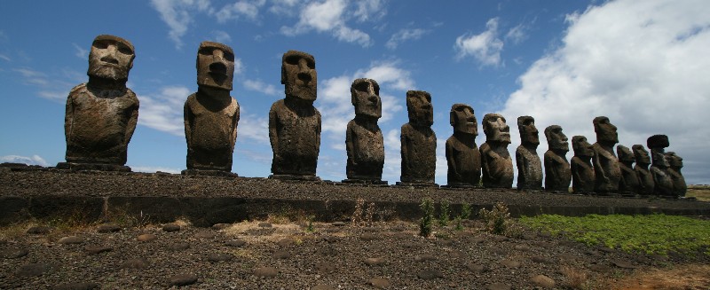
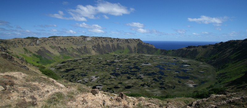
Easter Island was given its name by an early Dutch explorer, who landed on the island on Easter Sunday, 1722. However, the Polynesian locals know it as Rapa Nui. This is one of the most remote inhabited islands on the planet and home to the EarthCache, Rano Kau – Rapa Nui (GC22ZGB), this week’s Geocache of the Week.
Geocacher RachelRoue emphatically earning her smiley.
A visit to this EarthCache is a true escape: the island is located 2,182 miles (3,512 km) off the coast of Chile and the nearest inhabited island is 1,289 miles (2,075 km) to the east. Most visitors know Easter Island for the large Moai statues that represent ancestors of the island’s original inhabitants. These massive statues were carved between the years 1100–1680 out of compressed volcanic ash or basalt.
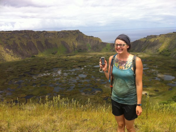
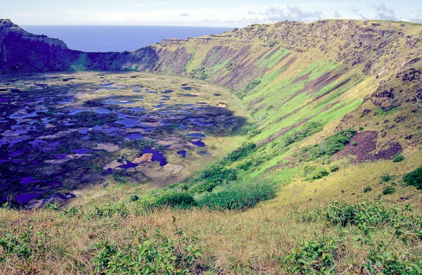
For geocachers that make the journey to Easter Island, finding the Rano Kau EarthCache in Rapa Nui National Park is a must. Rano Kau is an extinct volcano located in the southwestern portion of the island. It was formed at least 150,000 years ago from basaltic lava flows. Now, it stands over a thousand feet tall (over 300m) and contains a crater lake—one of only three natural sources of fresh water on the island. The crater is nearly a mile wide and contains its own micro-climate where figs and vines flourish.
Rano Kau crater on Rapa Nui.
The geocache creator, Dutzig, had this to say about Rano Kau, “The uniform shape of the crater, and the nature and the depth of the crater lake and of course the extraordinary beauty made me hide the cache on the crater of Rano Kau.” When asked about placing an EarthCache versus a traditional geocache, he said, “With my EarthCaches I try to point out unusual features of the world to travelers and give them pleasure. No one has to destroy nature, to look for a geocache. My EarthCaches are partly in very sensitive areas of the world and no one can sabotage the cache or remove [it]. ”
Another view of Rano Kau. Photo by geocacher Kulturmensch
To log a smiley for this EarthCache, you must answer a few questions and you have the option to upload a photo of yourself and your GPS with the crater lake in the background. An uploaded picture to log a smiley is no longer a requirement.
Previous “Found it” logs include plenty of praise for the beautiful location. Geocacher sasktravelbugs had this to say, “We were excited to see another EarthCache from the famed Dutzig, with whom we found another of his caches on Antarctica only a few short weeks ago. What an AMAZING crater! We spent a lot of time just marveling at its size and colours. Thanks so much for creating another great cache that allowed us to learn more about the geography of Rapa Nui.”
Geocaching can take all of us to some pretty remote places, where is the farthest from home that geocaching has taken you?
Continue to explore some of the most engaging geocaches around the globe. Check out all the Geocaches of the Week on the Geocaching blog or view the Bookmark List on Geocaching.com.
If you would like to nominate a Geocache of the Week, send an email with your name, comments, the name of the geocache, and the GC code to pr@geocaching.com.