The mailman recently delivered a nice surprise to me: a beautiful trackable geocoin from the Smithsonian National Museum of Natural History (NMNH) GeoTour. I completed the GeoTour last year, and in the process earned a digital badge for my Geocaching.com profile. Little did I know that the NMNH was working on a geocoin that would eventually take a place of honor in my collection.
National Museum of Natural History Geocoin
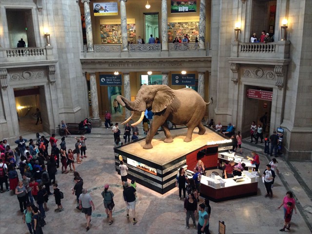
The National Museum of Natural History is a truly spectacular place. Located on the National Mall in Washington, D.C., it’s the most visited natural history museum in the world. The NMNH GeoTour debuted in 2013 with several Mystery caches, a Traditional cache and three EarthCaches.
Inside the National Museum of Natural History
All but one of the caches’ posted coordinates are at the museum, with one outlier located about a two-hour drive north, in Pennsylvania’s Michaux State Forest. (The NMNH also owns a Letterbox Hybrid with posted coords on the museum grounds. It is not an official part of the GeoTour.)
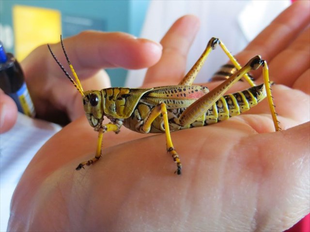
Get up close with nature during the GeoTour
My wife and I started the GeoTour during a trip to D.C. in November 2013, when we were able to stamp our passport for all but two of the caches. I was back in that part of the country for the GeoWoodstock Mega-Event last year, and jumped at the opportunity to complete the tour and earn my digital badge. The NMNH GeoTour is a really fun way to enjoy the museum from a new perspective, and to continue exploring outside the Smithsonian walls. I had visited the NMNH a time or two in the past, but this GeoTour encouraged me to dig into subjects that had escaped my attention on previous trips. Plus, it led me to a few beautiful sites outside of D.C.
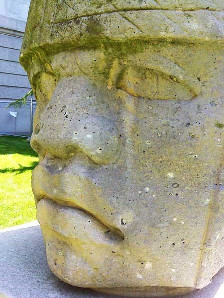
See colossal things while caching!
So how can you qualify for a digital badge and one of these super-cool geocoins? The requirements are listed on all of the NMNH’s GeoTour cache pages. If you’re looking for a way to enhance your next visit to the U.S. capital, I highly recommend making this GeoTour part of your trip!
….and the National Park Service (NPS) was born? That’s right. Since August 25, 2016, the NPS* has preserved America’s special places, “for the enjoyment, education, and inspiration of this and future generations”. To celebrate this impressive milestone, the NPS is sponsoring a Find Your Park GeoTour to engage communities and help people discover nature through geocaching.
The Find Your Park GeoTour launched with 61 geocaches, and now it’s up to 87. Will we get to 100 by the end of this year? We hope so! In the meantime, here are five fantastic geocaches from the GeoTour to peek your interest: Continue reading →
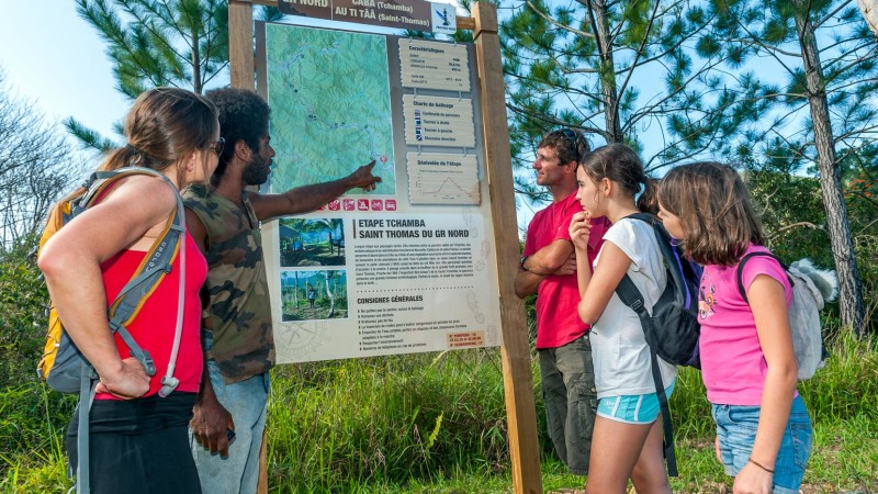
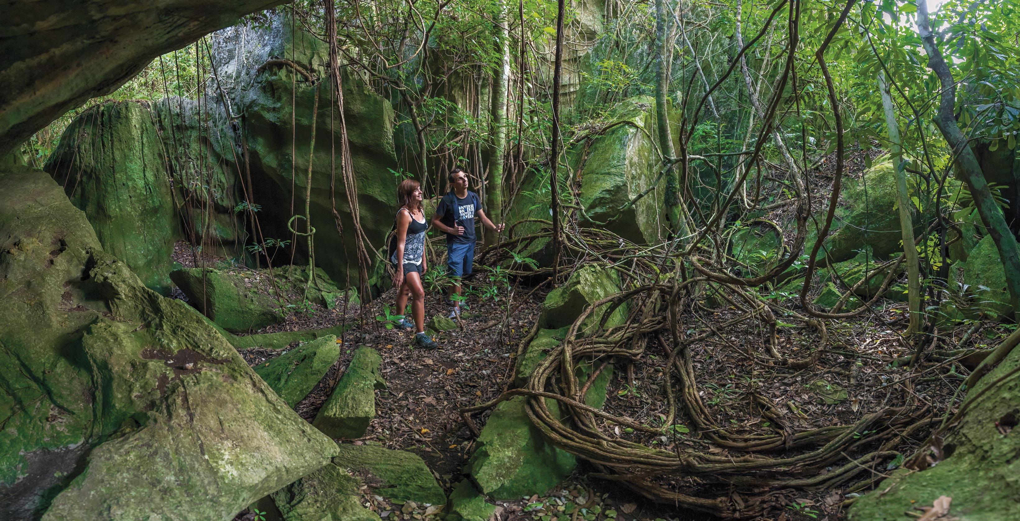
If you are curious about nature, keen on open spaces, and dream of wandering through green forests, then the North New Caledonia area was made for you. This untamed natural land is breathtaking and home to endemic plants & wildlife stemming all the way back to prehistoric time. It’s also an an area with a strong sense of culture, incorporating much of the local Kanak people’s historic traditions and beliefs into modern day life.
They say bad things come in threes. Poison ivy, poison sumac, and poison oak are three of the evilest plants out there. At least 50 percent of people who come into contact with these plants are allergic to them and will develop an itchy rash which can last as long as three weeks.
The best way to prevent a rash is to avoid poisonous plants all together. But if you are determined to get that D5/T5, then you need to know how to protect yourself. Avid geocacher (and dedicated nurse) Kelley Piekarek* put together these safety tips so all outdoor enthusiasts can keep themselves safe during geocaching’s busy season.
Prevention: The best way to avoid the rash is to avoid the plant. The best way to avoid the plant is to know what they look like and where they grow.
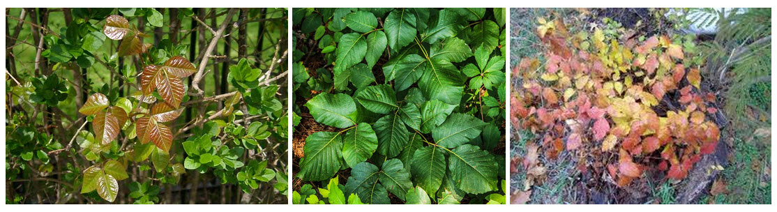
Poison ivy is reddish in spring, green in summer, and yellow/orange/red in autumn
Poison ivy:
Found throughout Canada and the United States except for parts of the West Coast. Can grow as a hairy vine or small shrub trailing along the ground or climbing on low plants, trees, and poles. Each leaf has three glossy leaflets with smooth or toothed edges. Leaves are reddish in spring, green in summer, and yellow, orange, or red in the fall. Found in woody areas, thickets, and moist places.
Poison sumac is orange in spring, green in summer, and yellow/orange/red in autumn. Often, the leaves have spots that look like blotches of black paint.
Poison sumac: Grows as a tall shrub or small tree in bogs or swamps in Northeast, Midwest, and parts of Southeastern North America. Each leaf has clusters of seven to 13 smooth-edged leaflets. Leaves are orange in spring, green in summer, and yellow, orange, or red in the fall. Often, the leaves have spots that look like blotches of black paint. May have yellow-greenish flowers and whitish-green fruits that hang in loose clusters.
Poison oak leaves tend to be glossy, and the plant grows upright. May have yellow-white berries.
Poison oak:
Grows as a low shrub in the eastern and southern North America, and in tall clumps or long vines on the Pacific Coast. Poison oak usually has a cluster of three broad leaves, though it can have up to seven. The leaves tend to be glossy, and the plant grows upright. Western poison oak has lobed leaflets like an oak tree, while eastern poison oak is more like a glossy version of poison ivy. May have yellow-white berries.
Protection:
Keep your skin covered to avoid contact with these plants
Wear a long-sleeved shirt, long pants, gloves, and closed shoes if you’re in an area where these plants may be lurking
Tie the bottoms of your pants legs or tuck them into your boots
Wear gloves when bushwhacking
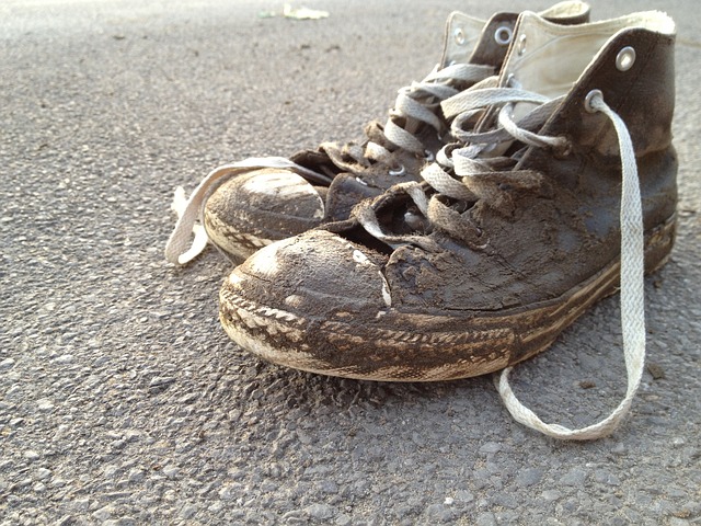
It’s a good idea to keep a pair of shoes dedicated for geocaching that can be kept outdoors
OOPS! I’ve touched it, now what? The chemical that causes the rash is called urushiol and it will stick to your skin when you touch or brush against any part of the plant. It will also contaminate your clothes, ‘caching gear and your geo-dog, too! Remember, you can’t spread the rash to other people, but you can get the rash all over again if you touch contaminated items you haven’t washed.
If you know your skin has come in contact with the plants, wash with soap and water immediately
If water is not available, wipe down the area with rubbing alcohol
Wash your clothes with hot soapy water
Hose down your boots, geocache bag, leash, and anything else you took on your hike
Wash your geo-dog well with soapy water and wear gloves while you do this (she can’t get the rash, but you can get it from her)
Some dogs like baths as much as they like geocaching!
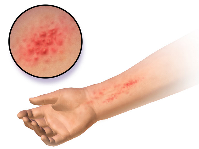
Help! I have the rash! The rash often looks like a straight line because of the way the plant brushes against the skin. But if you come into contact with a piece of clothing or pet fur that has urushiol on it, the rash may spread out. The rash usually develops 12 to 48 hours after exposure and typically lasts two or three weeks. To treat the rash at home:
Do not scratch, as scratching can cause an infection
Leave blisters alone—if blisters open, do not remove the overlying skin since the skin can protect the raw wound underneath and prevent infection
Consider applying calamine lotion or hydrocortisone cream
Consider taking antihistamine pills (with your doctor’s approval)
Rash caused by poison ivy – and this is one of the “nicer’ images
If you have any of the following symptoms, you need to go to the Emergency Room. Like, right now:
You have trouble breathing or swallowing
The rash covers most of your body
You experience swelling, especially if an eyelid swells shut
Much of your skin itches, or nothing seems to ease the itch
You develop a fever greater than 100 F (37.8 C)
The rash doesn’t get better within a few weeks
Stay safe out there my friends, and cache on! How do you stay safe while enjoying your favorite hobby?
*If the name Kelley Piekarek sounds familiar, it may be from this story that made national geocaching news in February of this year. Woof!
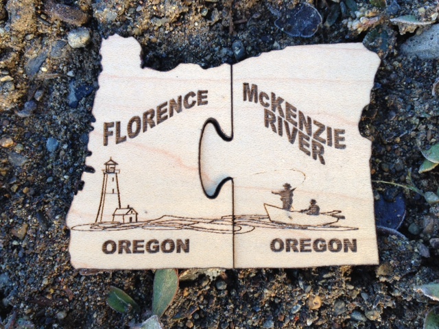
Explore more than 70 new geocaches from Oregon’s Coast to the waterfalls and lava fields of the Cascades on the Eugene Cascades & Coast GeoTour. Geocachers that complete the entire trip will earn two unique, locally made Geocoins that fit together like puzzle pieces.
Launched in October 2012, the McKenzie River Edition of the GeoTour winds along the lush wilderness of the McKenzie River. From old growth forests to secret gardens, this is a geocaching experience you don’t want to miss. Just ask the geocachers.
Kathryn, of Portland, was one of the first finishers. “The cache placements took us to new sights, trails, parks, all the reasons why I love caching so much,” raved Kathryn. “I really feel the tour was very well rounded and had something for everyone.”
The Florence Edition of the GeoTour launches March 9, 2013 at Driftwood Shores. This exciting new addition to the Eugene, Cascades & Coast GeoTour starts on the never ending beaches of the Central Oregon Coast, then takes geocachers to little-known hiking trails and favorite Old Town Florence gems. The more than 30 geocaches are worth every stop.
Book your Eugene, Cascades & Coast GeoTour Adventure today to take advantage of sweet geocaching deals and discounts fromEugene, Cascades & Coast.


 Protection:
 Explore more than 70 new geocaches from Oregon’s Coast to the waterfalls and lava fields of the Cascades on the