L’aiguille du midi—Geocache of the Week

Traditional
GC1Y014
by Vilcanota
Difficulty:
2
Terrain:
2
Location:
Rhône-Alpes, France
N 45° 52.759 E 006° 53.212

Afraid of heights? Then this week’s Geocache of the Week might give you the chills!

To find L’aiguille du midi, you must first visit Chamonix, an adventurer seeker’s heaven! Steep peaks and endless views in the heart of The Alps draw visitors from all over the world to experience this awe-inspiring town and scenery.

At 3,842m (12,605 ft), the Aiguille du Midi and it’s laid-out terraces offer a 360° view of all the French, Swiss, and Italian Alps. A 20-minute ride in the Aiguille du Midi cable car will deliver you to the summit terrace where you will have a clear view of Mont Blanc.

Once you take the cable car to the top, take your time looking for the geocache and be discreet as there may be lots of visitors around. Once you sign the log, take in the panoramic views and walk through an impressive ice cave. You can also walk onto a glass skywalk called “Step into the Void” with a view 1035 meters (3,396 ft) straight down. Yikes! Due to the exposed nature of L’aiguille du midi, make sure to bring some warm clothing since it can be -10°C (14°F) in the middle of summer.

For those who are feeling even more adventurous, there is an option to strap on crampons (those spiky things you attach to your boot to ascend ice)  and climb to the top of Mt. Blanc. In the snowier months, some people also ski down the steep slopes of the Aiguille du Midi. Mountaineers and skiers are able to pass through a tunnel to reach the steep and extremely exposed ice ridge that descends to the glacier below. This activity is only recommended for very experienced climbers and skiers.

Although the scenery may mislead you to think that the cache is a T5, the platforms in place allow for a rating of T2. Thanks to cache owner, Vilcanota, for creating such a fun and thrill-inspiring geocache!


Continue to explore some of the most amazing geocaches around the world.
Check out all of the Geocaches of the Week on the Geocaching blog. If you would like to nominate a Geocache of the Week, fill out this form.
Schlossberg: His(_s)tory! GC1VCKY—Geocache of the Week

Multi-Cache
GC1VCKY
by Team Knofl
Difficulty:
2
Terrain:
2
Location:
Steiermark, Austria
N 47° 04.637′ E 015° 26.227

Graz img2

This 7 stage Multi-Cache in Graz, Austria will give you a historical tour of the prominent hillside of Schlossberg. Along the way you’ll find cafes, restaurants, music venues, and other amenities. This tour will show you a side of the mountain, and will educate you on its history along the way.

It is easy to see why the natural aesthetics and historical and artistic value of Austria would captivate people all over the world to travel to this regal region.  Austria’s second largest city, Graz is located in the province of Styria. Graz offers a strong variety of culture, activities, and places to explore!

kid garz

Located at the center of the city is a prominent mountain by the name of Schlossberg. Coupled by the panoramic view, the famous Uhrturm (which translates to clock tower in German) sits atop Schlossberg and is one of the main sightseeing stops in the city. You may feel beguiled by the foothills off in the distance, the Mur river flowing not too far away below, and the classic red clay rooftops. This cache will take you to several historical monuments along a pathway, with breathtaking views.

Hauptplatz

The cache page tells the legendary story of 900 Graz soldiers defending Schlossberg after the Treaty of Vienna. In 1809, Napoleonic forces attacked the city with 3,000 men, and mostly destroyed the fortress atop the city’s modest mountain. The first stage of this Multi-Cache is in honor of the Major that led the defense, Franz Hackher. There were no known images of him, so the Hackher Lion was constructed in place of a human statue.

OLYMPUS DIGITAL CAMERA

But did you know lions like beer? The Hackher Lion not only likes beer, but has a favorite beer in which he has been sitting on for over 40 years! Now Franz Hackher’s spirit defends his beer. To move on to the next stage the geocacher will need to find out what kind of beer he is protecting.

From here the Multi-Cache brings you to a mid 16th century cistern (a fancy water well),an octagonal bell tower holding “Liesl” the big bell inside, an old canon cottage with more auspicious views out the windows (pictured below), the bishop’s chair, and a turkish well.

OLYMPUS DIGITAL CAMERA

Lastly, the seventh and final stage brings you to the symbol of Graz, the clock tower. The coordinates will bring you the gardens below, clad with colorful flowers and shrubbery. It is a tranquil area where students from the universities might study, or meet a friend.

graz garden


Built in the 13th century, the Uhrturm was designed to be seen from any point in the city. The clock hands were originally designed in the opposite way to what you normally see, in that the hour hand is larger than the minute hand. It was more important to them to see what the hour was from far distances. The people of Graz were forced to pay a ransom to keep the clock as part of the Treaty of Vienna.

Clock face

Not only is Schlossberg rich in history, but its vibrance is felt throughout the city. Each stop of this cache brings you back in history, and authentically tells a story that may not have otherwise been told to anyone just visiting the city. It is easy to see why the cache owner Team Knofl, would take the time to place a historical Multi-Cache here, TFTC!

Hilma Hooker (GC2W056) — Geocache of the Week

Traditional
GC2W056
by Hud4
Difficulty:
2
Terrain:
5
Location:
Bonaire
N 12° 05.974 W 068° 17.213
Geocache Hilma Hooker GC2W056 - photo courtesy of ~M&M~
Geocache Hilma Hooker GC2W056 – photo courtesy of ~M&M~

Ahoy, geocachers! When most geocachers think of T5 geocaches, they usually think of climbing to the top of a steep mountain. But some intrepid geocachers know that diving down, deep down, like, 29 meters (100 feet) down, is what T5s are really all about.

Continue reading →

Arctic Circle Trail (K –> S) — Geocache of the Week

Multi-Cache
GC3QR3J
by TriNitro
Difficulty:
5
Terrain:
5
Location:
Kangerlussuaq, Greenland
N 66° 55.220′ W 051° 21.626

Arctic Multi-Cache Greenland

On a recent trip, I got the opportunity to fly over the Arctic Ocean. As the plane flew 36,000 feet above Greenland, I looked deeply into the ice, trying to spot a polar bear mid-traverse across an ice field. Ever since then I have been dreaming of a Greenland adventure and what amazing scenery and community I might discover there.

unnamed (3)

With a population of just over 57,000 people, Greenland is a vast landscape that has yet to be developed and is slowly increasing in annual visitors (about 40,000 in 2016). For that very reason, I have dreamed of going to Greenland to explore such a uniquely raw place and experience pristine nature. What could make a trip to Greenland even better? Perhaps finding a Multi-Cache along the Arctic Circle Trail!

unnamed (2)

As the most famous hiking trail in Greenland, the Arctic Circle Trail is a 160 km (almost 100 mile) backcountry trail between Kangerlussuaq and Sisimiut. Open until mid-September for hiking, the faint trail leads you through low arctic vegetation and into rocky mountains. Along the way, there are daintily placed huts for you to overnight in or take shelter from the unpredictable arctic weather and also find geocaches along the way. If you do not have 7 or 8 days to make this trek in the summer, or if you are a brave soul, you can embark on the journey via dog sled, snowmobile, or cross country skis. Although completing the trek in the winter sounds magical, you may have some trouble finding the final geocache due to lots of snow.

9801f281-6232-4c82-9845-38568b46de18

Although we are featuring one Multi-Cache on the Geocache of the Week, geocache owner TriNitro was kind enough to place another one going in the opposite direction. So no matter which way you begin your journey, you can find a fun final stage. Check out Arctic Circle Trail (S –> K) if you choose to hike from West to East.

TriNitro hauled 12 days worth of supplies and the caches on his back into the backcountry with him:

In front of us, there were about 160 km of walking, 15 km of canoeing, and twelve days of unforgettable impressions in a widely remote landscape. Again, the weather was incredible and we had so much fun along the trail. And: silence! In my opinion this is one of the most impressive and precious things to experience.

  • Just a few of the gorgeous images from this amazing Multi-Cache

TriNitro was also nice enough to host a geocaching event in Greenland for the very small, but welcoming Greenlandic geocaching community:

Before leaving for our trip to Greenland, I submitted an event in Sisimiut to meet some of the local geocachers. So we found ourselves standing in drenching rain at the old church of Sisimiut waiting for other cachers. As we left directly after the event was published, we did not know how many geocachers might join us, if any at all. Finally, the only local Sisimiut geocacher joined our very private event. Due to the weather conditions he decided to put us in his truck and gave us a sightseeing tour of Sisimiut. Not enough, he invited us to his home where we met his lovely family and joined some tasty meal after we found a geocache in his garden. All the people we met during our trip have been very polite and open minded and we were absolutely overwhelmed by this hospitality.

unnamed

After reading about this geocache and viewing all the breathtaking photos, I am inspired to book a flight to Kangerlussuaq right now! It would truly be a badge of honor to have that guidebook in your home library and that find on your profile.

Thanks to TriNitro for sharing geocaching with the Greenlandic community and for sharing Greenland with all of us geocachers around the world!

c6aae1d8-751e-4cac-b5db-6c63580e789e

Continue to explore some of the most amazing geocaches around the world.
Check out all of the Geocaches of the Week on the Geocaching blog. If you would like to nominate a Geocache of the Week, fill out this form.
Petrified Forest- Route 66—Geocache of the Week

Traditional
GC3EPG9
by PEFO Ranger
Difficulty:
2.5
Terrain:
1
Location:
Petrified Forest National Park, United States
N 35° 03.067 W 109° 48.319

Today is the US National Park Service’s 100th Birthday! In addition to the NPS offering free entry into all National Parks this weekend, Geocaching HQ has created a Find Your Park GeoTour where you can explore geocaches placed by the National Park Service and their partners.

e4695e32-4d97-4faa-bc9c-aa6145c196ea

We want to highlight a fun, car-themed geocache that was hidden by a Ranger in Petrified Forest National Park. Besides, what’s more American than a road trip on Route 66?

Made popular by the Nat King Cole Trio song “(Get Your Kicks on) Route 66” and the 1960’s TV Series, Route 66, the road spans from Santa Monica, California to Chicago, Illinois. Along Route 66, you can visit Petrified Forest National Park, which was established by President Theodore Roosevelt in 1906. Petrified Forest National Park was created to protect large deposits of petrified wood and other fossils from the Triassic Period, which makes this park Dino-Mite! Over 10,000 years of human history can be found in the park, including over 800 archeological and historical sites.

Things to know about the geocache:

  • There is an old car sitting in the roadbed of the previous road.
  • This place is a popular spot to visit, so watch out for muggles taking pictures!
  • This is a “TNLN” geocache, which means “Take Nothing; Leave Nothing”. Bring a pen, sign the log, and save your cool swag and trackables for a different geocaching experience.
  • Please respect the rules and regulations of the park and the resources it was established to protect.

While you’re in Petrified National Forest, check out other caches the PEFO Ranger has hidden:

Thanks PEFO Ranger for hiding some super fun and informative caches and also for serving our National Park Service.

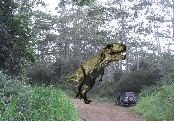
And I’ll leave you with a seemingly relevant dinosaur joke:

What do you call it when a dinosaur has a car accident?

A Tyrannosaurus wreck!

Make sure to share your experience with the community by using the hashtags #FindYourPark and #Geocaching while on your National Parks adventure this weekend.

Continue to explore some of the most amazing geocaches around the world.
Check out all of the Geocaches of the Week on the Geocaching blog. If you would like to nominate a Geocache of the Week, fill out this form.